The Wind Chill Hit Minus 108 at New Hampshire’s Mount Washington
The 6,288-foot summit endured record-breaking conditions brought by an Arctic air mass

As extremely cold temperatures gripped the northeastern United States and southeastern Canada over the weekend, New Hampshire’s Mount Washington endured record-breaking conditions. On Friday, the wind chill at the top of the peak reached minus 108 degrees Fahrenheit, which is likely the lowest wind chill ever recorded in the history of the nation, report CNN’s Ralph Ellis and Aya Elamroussi.
The mountain in north-central New Hampshire stands 6,288 feet tall and often experiences dramatic weather. But meteorologists say this weekend’s powerful winds and chilly temperatures—which dipped to as low as minus 47 degrees—were unparalleled. The previous record-low wind chill at Mount Washington was minus 102.7 degrees in 2004.
Winds of more than 100 miles per hour, with gusts around 128 mph, pummeled the Mount Washington Observatory, a nonprofit weather and climate station located on the summit. Observatory officials warned hikers to stay home, noting that frostbite could take hold in less than one minute.
“On some of my observations, there have been tiny little gaps in my mittens and the spot that was uncovered to the wind felt like a bee stinging my arm continuously,” Francis Tarasiewicz, a weather observer and educator at Mount Washington Observatory, tells WMUR-TV.
INSANE conditions on Mt Washington, NH. 120mph+ winds and -95°F wind chill. It is above the tropopause, meaning that these are stratospheric winds.
— Peter Forister (@forecaster25) February 3, 2023
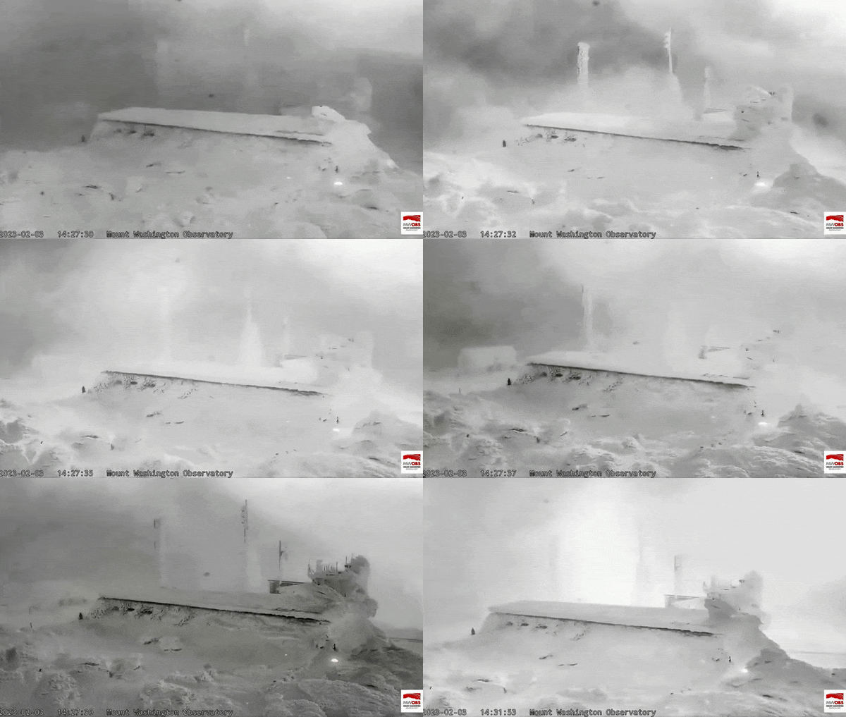
Footage from the summit live stream 2:30-2:40pm. #nhwx pic.twitter.com/OgDakbNn97
The wind was so strong at the summit that it broke a door hinge. Video captured at the site showed gusts battering the frosty observatory, prompting some online observers to note that it looked like it belonged on another planet. And, indeed, the record-breaking wind chill at Mount Washington was slightly lower than the average temperatures NASA’s Curiosity rover experienced on Mars the same week.
Mount Washington’s frigid conditions came from an Arctic air mass moving through the region. On Saturday, nearly 50 million Americans in 15 states were under wind chill alerts, and several cities in the Northeast set records with their low temperatures. Authorities attributed at least one death to the frigid, windy conditions, reports the New York Times’ Jenna Russell.
“This is an epic, generational Arctic outbreak,” per the NWS in Caribou, Maine. “The air mass descending on the area … [is] the coldest air currently in the Northern Hemisphere.”
Mount Washington—and the rest of the Earth’s surface—typically exists in the troposphere, or the lowest layer of the atmosphere. But on Friday, part of the next-lowest atmospheric region—the stratosphere—dipped so low that the mountain’s summit and any surrounding areas above 4,000 feet in elevation were actually in that layer instead. As the atmosphere cools down, it becomes more compressed, causing the boundary between the troposphere and the stratosphere to drop.
The stratosphere is typically 4 to 12 miles above the surface of the Earth, but some of it sank to less than a mile above the surface on Friday, Terry Eliasen, a meteorologist with Boston’s WBZ-TV, wrote in a tweet.
Fortunately, the extreme, cold temperatures lasted only through the weekend, and much of the Northeast began warming up again on Sunday afternoon.
/https://tf-cmsv2-smithsonianmag-media.s3.amazonaws.com/accounts/headshot/SarahKuta.png)
/https://tf-cmsv2-smithsonianmag-media.s3.amazonaws.com/accounts/headshot/SarahKuta.png)