Using Drones to Monitor Tropical Forests in 3 Dimensions
Will forests grow faster, or more efficiently, as atmospheric carbon dioxide increases? Will trees face higher mortality rates as storms and droughts become more common?
Tropical forests are iconic for hosting multiple layers of dense vegetation, including tall trees that support high biodiversity. The large trees of tropical forests are also important for global climatic cycles because tropical forests cycle large quantities of carbon through physiological processes—plants take up carbon through photosynthesis, and carbon is released from plants through respiration and decaying dead wood. However, there is much uncertainty regarding what will happen to tropical forest carbon dynamics as climate change progresses.
Will forests grow faster, or more efficiently, as atmospheric carbon dioxide increases? Will trees face higher mortality rates as storms and droughts become more common?
Cushman measures diameter of a buttressed tree in the ForestGEO plot on Barro Colorado Island, Panama, as an intern with STRI.
Pablo Ramos
I first became involved with tropical forest research as an intern with ForestGEO and STRI in 2012. Through a ForestGEO grant, I measured trunk shape of large, buttressed trees in Panama, Colombia, Thailand, and Singapore in order to better quantify growth in large trees that are particularly important for forest carbon dynamics. ForestGEO plots were a crucial resource in this project and fostered a new appreciation for the difficulty of measuring tree structure—like tree height and crown shape—from the ground. At the same time, my advisor, STRI staff scientist Helene Muller-Landau, was starting a project to use small drones to regularly monitor trees on BCI. Intrigued by the opportunities available through drones, my PhD focused on learning how to use drones to measure trees and forests.
Milton Garcia (L, STRI) and Omar López (R, SENACYT) launch a drone to monitor forests in Panama. Photo: Steve Paton, STRI.
Steve Paton
I returned to STRI as a postdoctoral fellow in February 2020, working with ForestGEO and the Next Generation Ecosystem Experiments—Tropics (NGEE-Tropics) project and used annual drone images collected over all of BCI from 2015-2020. The BCI drone project is a collaborative effort involving many current and former researchers working with Muller-Landau at STRI—former postdoc Jonathan Dandois established much of the initial methodology, engineer Milton Garcia upgraded the drone platform and piloted most of the drone flights, GIS analyst Milton Solano supported data curation, and technicians Pablo Ramos and Paulino Villareal verified the accuracy of drone data by comparing drone measurements to on-the-ground observations. Each drone flight collects multiple kinds of information that can be used for a variety of research goals. Drone images can be used to locate and identify trees, enabling measurement of the shape and size of tree crowns. Changes in color over time can be used to study seasonal changes in leaves. Using a method called photogrammetry, it is even possible to reconstruct 3-dimensonial, colored models of canopy height. Using 3-D data from drones, former STRI/NGEE-Tropics postdoctoral fellow Raquel Araujo studied patterns of tree mortality over time using monthly images of the BCI 50-hectare plot.
Three-dimensional canopy height data from drone images on Barro Colorado Island, Panama. Data are colored from either real image colors (left) or based on canopy height (right), with orange and red showing the tallest trees.
KC Cushman
The goal of this project was to quantify tree mortality across the entire island of BCI from changes in drone-measured canopy height. Quantifying rates of tropical tree mortality is particularly challenging because large trees can live for hundreds of years, as highlighted by previous ForestGEO research. BCI is a great location for this project because it varies in soils and topography, factors that are hypothesized to be important for tree mortality and growth. Soils are important for tree mortality because different soil types vary in physical stability, and in nutrient and water availability to trees. Topography is also important for tree mortality because topography can affect trees’ exposure to wind and light, and access to soil water.
Barro Colorado Island, Panama, contains wide variation in topography and soils types. Here, maps of shaded elevation (left) and soil form (right) highlight the different habitats found on BCI.
KC Cushman
Drone imagery is a promising tool for studying forests, but also presents some analytical challenges. Small drones generally cannot carry a very precise GPS unit, so data must be properly georeferenced before analyzing trends over time. Furthermore, clouds and shadows can obscure drone images, so it is necessary to devise data quality control checks to ensure that results are accurate. Despite working through these methodological challenges, multiple drone flights between 2015 and 2020 were used to create a dataset of canopy height changes during that period. Changes in canopy height can be used to study tree mortality because dead trees create large “holes” in the canopy, where canopy height decreases noticeably.
Drone data from before (a, b) and after (c, d) a group of trees died on Barro Colorado Island, Panama. The disturbances from the treefalls are outlined based on the change in canopy height in 3D drone data (e). Credit: Cushman et al. 2022, Ecology Letters.
KC Cushman
We found that tree mortality is highly variable across BCI. This study shows that multiple factors influence tree mortality—some years had higher mortality than others, some soil types were also associated with increased tree death, older forests had higher mortality than younger forests, and trees were also more likely to die on steep slopes and valleys. These differences in mortality rates are important for how tree communities across BCI store carbon.
This project establishes a new kind of long-term monitoring data for the well-studied BCI site in Panama. The birds-eye-view provided by drone images, which tracks crown growth and damages, complements other long-term data collected in the ForestGEO plot, such as tree species identity and diameter growth. As data collection continues, we will be able to link interannual variation in tree mortality and growth to climatic factors like storms, droughts, and temperature.
These data are not only important for understanding forest dynamics on BCI, but will also be useful for studying forests using satellites. Satellites can measure much larger areas of forest compared to field studies or drones, but a single satellite measurement (e.g. a pixel) is often larger than an individual tree. This makes interpretation of satellite measurements difficult. Detailed, large-scale datasets—like BCI’s drone project—can serve as a bridge between field observations and satellite data. Investing in long-term monitoring on the ground and using tools like drones is crucial for understanding how climate change affects global tropical forests.
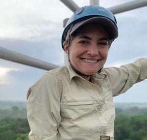
KC Cushman is a forest ecologist broadly interested in understanding variation in forest structure and function across space and time. Her research is motivated by the importance of forests for understanding and predicting global cycles of carbon, water, and nutrients. KC graduated from Swarthmore College in 2012, then spent two years as a research intern at the Smithsonian Tropical Research Institute in Panama. After finishing her PhD at Brown University in 2020, KC returned to STRI as a postdoctoral fellow. KC is currently a postdoctoral fellow at NASA's Jet Propulsion Laboratory.
Get the latest stories in your inbox every weekday.

/https://tf-cmsv2-smithsonianmag-media.s3.amazonaws.com/filer_public/76/d6/76d68b57-d655-4f01-818a-487adec9decf/cushman_image1.jpg)
/https://tf-cmsv2-smithsonianmag-media.s3.amazonaws.com/filer_public/03/83/0383237b-a965-4981-955a-d735e0070d25/cushman_image2.jpeg)
/https://tf-cmsv2-smithsonianmag-media.s3.amazonaws.com/filer_public/ca/17/ca171379-a0fa-40bf-8e69-e45b486db8bd/cushman_image4.jpg)
/https://tf-cmsv2-smithsonianmag-media.s3.amazonaws.com/filer_public/a3/40/a3405a0a-e866-4b36-980b-6e2dbb6e7c6b/cushman_image3.jpeg)
/https://tf-cmsv2-smithsonianmag-media.s3.amazonaws.com/filer_public/4b/4c/4b4c0528-64f2-48c6-800f-521ec470af02/cushman_image51024_1.jpg)