Can’t Make It to the Moon? Head to Arizona Instead
In 1967, the United States Geological Survey turned an old volcano into a lunar training ground for astronauts
On July 20, 1969, the Apollo 11 Lunar Module touched down in the Mare Tranquillitatis, a large basaltic plain formed by ancient volcanoes. Shortly afterward, the crew would take the first human steps on another world—but the feeling wasn't an entirely unfamiliar one for NASA. Years before Neil Armstrong and Buzz Aldrin set foot on the moon, the Astrogeology Research Program—a joint venture between NASA and the United States Geological Survey—had managed to recreate the moon's lunar landscape in northern Arizona.
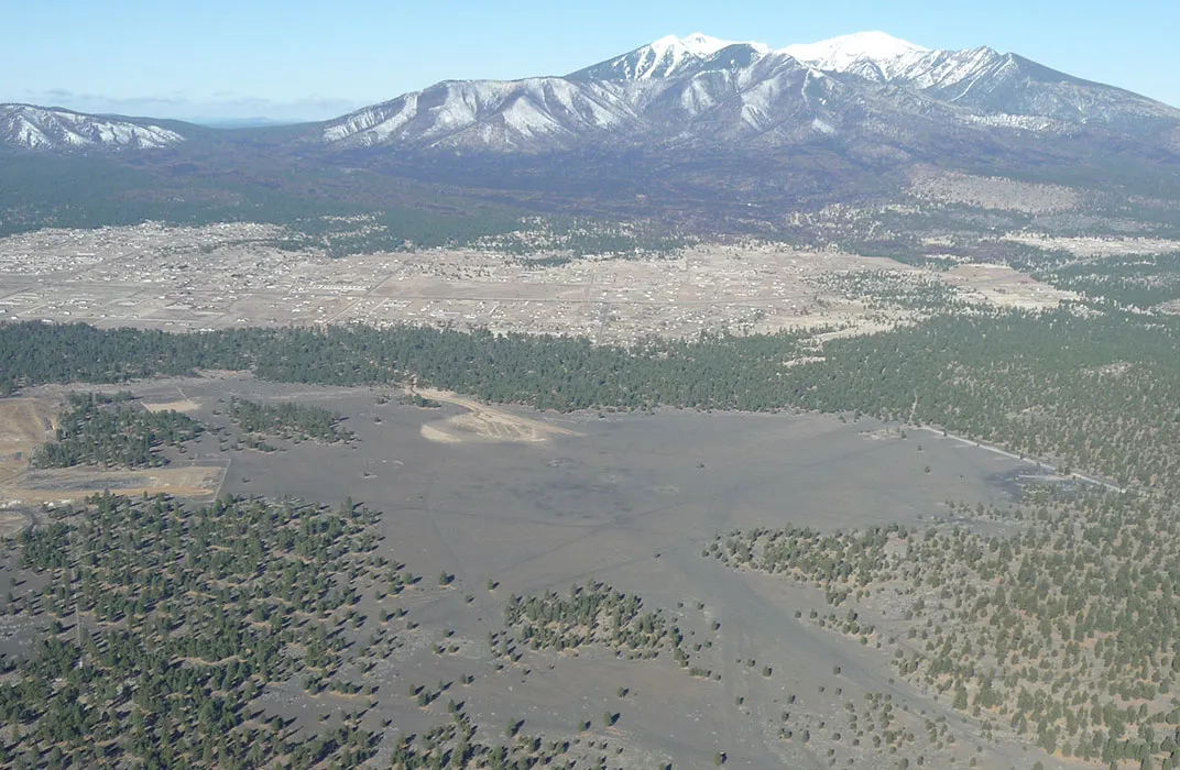
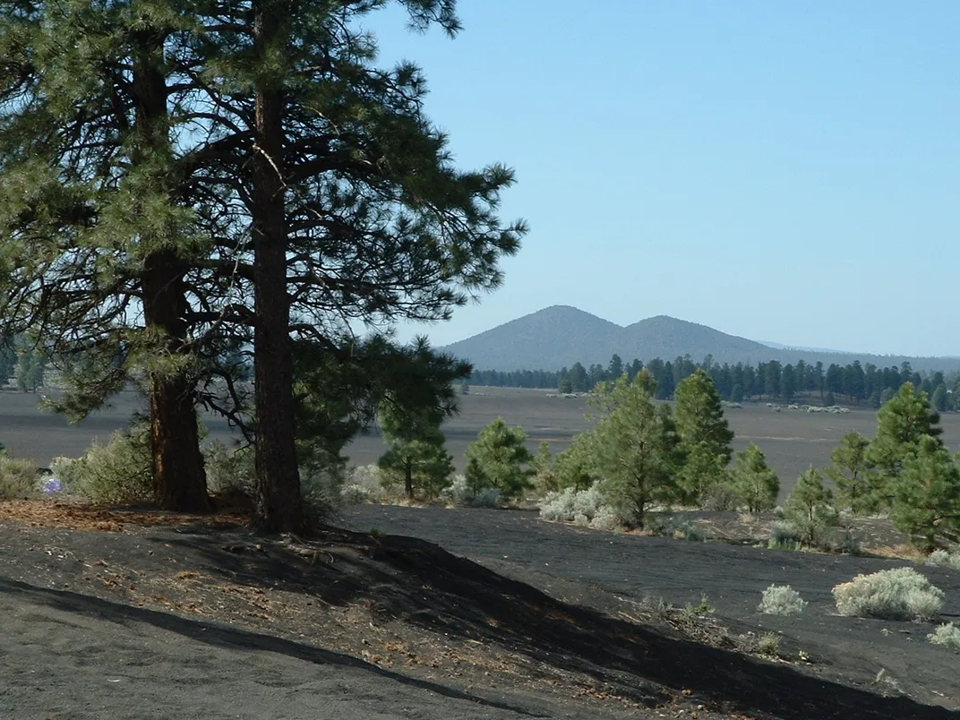
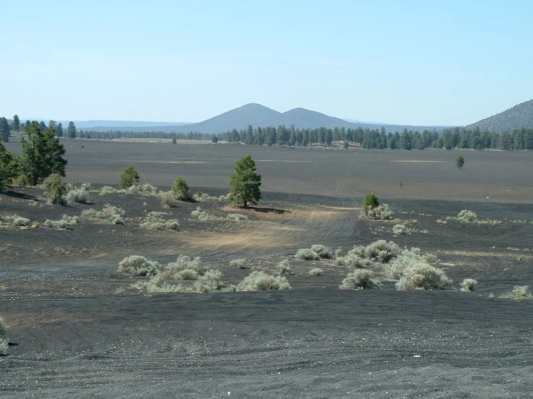
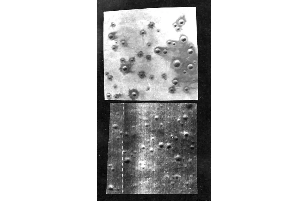
Cinder Lake, located 12 miles from Flagstaff, Arizona, offered the Astrogeology Research Program the perfect location for a lunar analogue, a portion of Earth used to simulate lunar geology and topography. The area is covered in basaltic cinders from a volcanic explosion that took place around 1064—meaning it's covered in much of the same material as the Mare Tranquillitatis, chosen as the landing site for the Apollo 11 mission. Using satellite photographs of the Mare Tranquillitatis, engineers and scientists from the USGS's Astrogeology branch set about recreating lunar craters at Cinder Lake.
"The crater fields were controlled, well-understood environments, which made them useful for early, preliminary astronaut geologic training," says David Portree, manager of the NASA/USGS Astrogeology Regional Planetary Information Facility in Flagstaff.
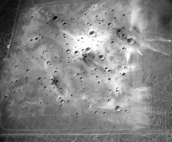
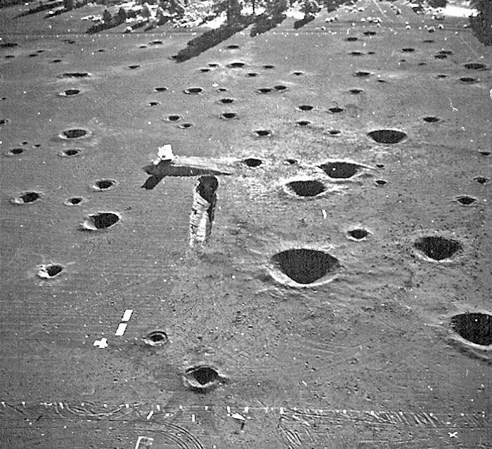
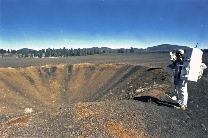
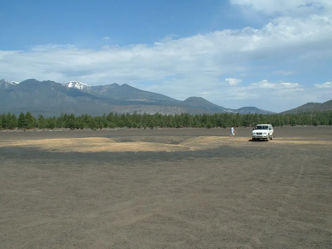
In July of 1967, engineers blasted 47 craters in a 500-square-foot area of Cinder Lake, creating a real-life replica of a particular section of the Mare Tranquillitatis that had been previously singled out as a potential landing field for Apollo 11. In October, they added 96 more craters, bringing the total in Crater Field 1, as it was called, to 143. Later that year, they created another larger crater field, this one made to replicate not only the size but also the specific age of lunar craters. The aim was to allow the astronauts to practice describing the type and age of geological formations they encountered.
To create Crater Field 2, the Astrogeology Research Program began by fencing off about 2,885,000 square feet. After clearing the cinder of underbrush and smoothing the area (in order to create as "new" a landscape as possible), a surveying team marked where each crater would eventually be located, as well as categorizing each one as "old," "intermediate" or "young." The engineers carefully studied the composition of the cinder in the area where each crater was to be made, in order to determine the depth and amount of explosive needed to recreate its lunar analogue.
To begin recreating the lunar craters, engineers dug into the basaltic sediment, revealing distinct layers of cinder and clay indicative of various volcanic episodes. Then, using 1,153 pounds of dynamite and 28,650 pounds of nitro-carbo-nitrate (a blend of agricultural fertilizer and fuel oil), the engineers began laying charges in each of the holes. A total of 354 charges were detonated to create the "oldest" craters, and 61 charges were then detonated to create craters of "intermediate" age. After the intermediate craters were created, scattering their debris over the projectile from the first set of explosions, the 11 remaining charges were detonated to make the "youngest" craters and disperse the final layer of debris. When the astronauts-in-training explored the craters, they could use the layers of sediment to determine the age of the crater—a skill that would come in handy once they were on the moon, relaying information back to USGS geologists via radio.
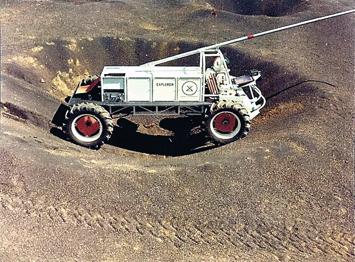
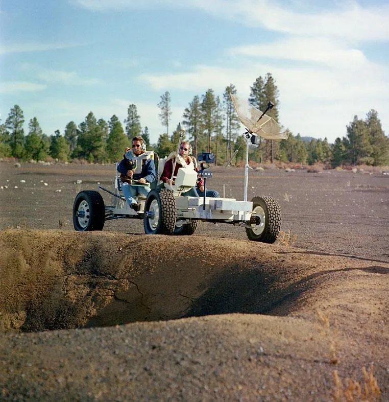
Once Cinder Lake had been transformed from a cinder field to a crater field, Apollo astronauts began testing their equipment, knowledge and skills on the ground. Though the crater fields at Cinder Lake were created before the Apollo 11 landing, the first to train at the site were the crew of Apollo 15, the first mission focused primarily on geology. Astronauts, clad in space suits, wandered around the terrain, practicing using tools and classifying geological formations. In addition to geology training, the crater fields were used to help map potential paths across the lunar landscape. Slopes were built into the field to allow astronauts to test lunar modules, the portion of the spacecraft meant to take astronauts back and forth from lunar orbit to the lunar surface. The crew also tested lunar vehicles, such as Grover the Geologic Rover—a replica of the Apollo Lunar Roving Vehicle made to withstand the forces of Earth's gravity—at the Cinder Lakes crater fields. And Portree notes that USGS Astrogeology also used the site to test equipment and timelines for missions beyond the Apollo.
As the Apollo program came to a close, astronauts and geologists eventually left Cinder Lake to the Arizona wilderness. The last training simulation took place at the site in 1972 with the crew of Apollo 17. And then the location was used for other purposes, notes Portree. "News networks and Disney used the site for filming and photography of simulated moon exploration," he says.
While Cinder Lake is the only lunar analogue meant to replicate the exact area of the Apollo landing, others were created in Arizona, including the Black Canyon field in the Verde Valley, which has since been built over with houses. Other space analogues have been created to replicate various celestial bodies, including the Haughton-Mars Project (HMP), an area of the High Arctic used to replicate conditions on Mars.
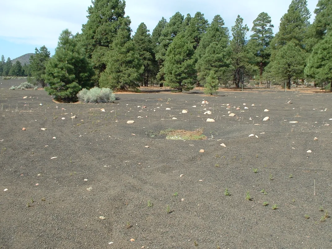
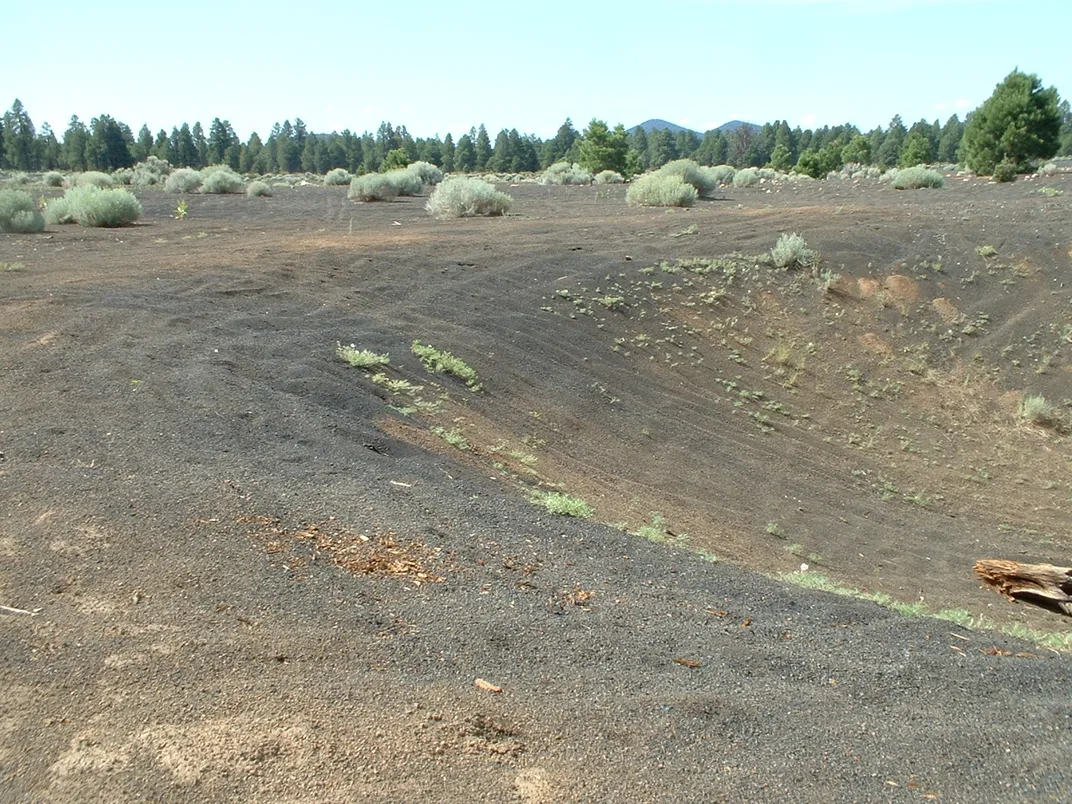
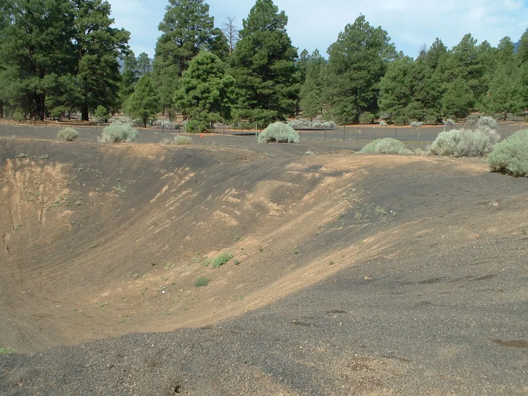
The craters have been seriously degraded by wind and human use, especially at Crater Field 2, now a popular destination for off-roaders and ATVs. Crater Field 1, a little farther removed from the most popular off-road areas, remains better preserved. To experience the area, consider going during the week and avoiding holidays, when visitors with their ATVs and other vehicles flock there in droves. The crater fields can be accessed via many routes, but the easiest is to follow Forest Road 776, marked as the "Cinder Hills ORV area" off of Highway 89, south of the exit marked "Sunset Crater National Park."
/https://tf-cmsv2-smithsonianmag-media.s3.amazonaws.com/accounts/headshot/natasha-geiling-240.jpg)
/https://tf-cmsv2-smithsonianmag-media.s3.amazonaws.com/accounts/headshot/natasha-geiling-240.jpg)