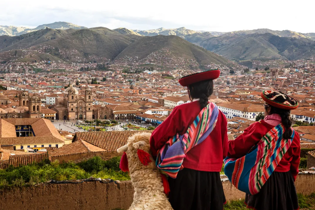
What Endures From the Ancient Civilizations That Once Ruled the Central Andes?
To journey here is to roam through almost six thousand years of civilization, to one of the places where the human enterprise began
/https://tf-cmsv2-smithsonianmag-media.s3.amazonaws.com/accounts/headshot/SQJ_1507_Inca-Contrib_01.jpg)

Huayna Capac had a problem: He didn’t like his hometown, Cusco, in the bracing heights of southern Peru. Unfortunately, Cusco was the center of the Inca Empire, and he was the empire’s supreme ruler. Running the empire obliged him to spend a lot of time in the chilly capital city. Fortunately for Huayna Capac, he was king. With a word he could command thousands of his subjects to build a second capital. Huayna Capac said the word. His new capital was near the Equator, in what is today Quito, Ecuador. The palace was bigger and more luxurious than the first. And the weather was nearly perfect.
The king was pleased with his new digs but now faced a second problem. More than a thousand miles of steep, rugged mountains separate Quito and Cusco. The royal personage required a comfortable passage between them. He ordered hundreds of villages to dispatch all their able-bodied men to build a highway. The finished roadway was lined with guesthouses for travelers and so straight and flat, the chronicler Agustín de Zárate later marveled that you “could roll a cart down it.” Pleased with what he had conjured into existence, the king ordered up a second huge thoroughfare, this one along the coast.
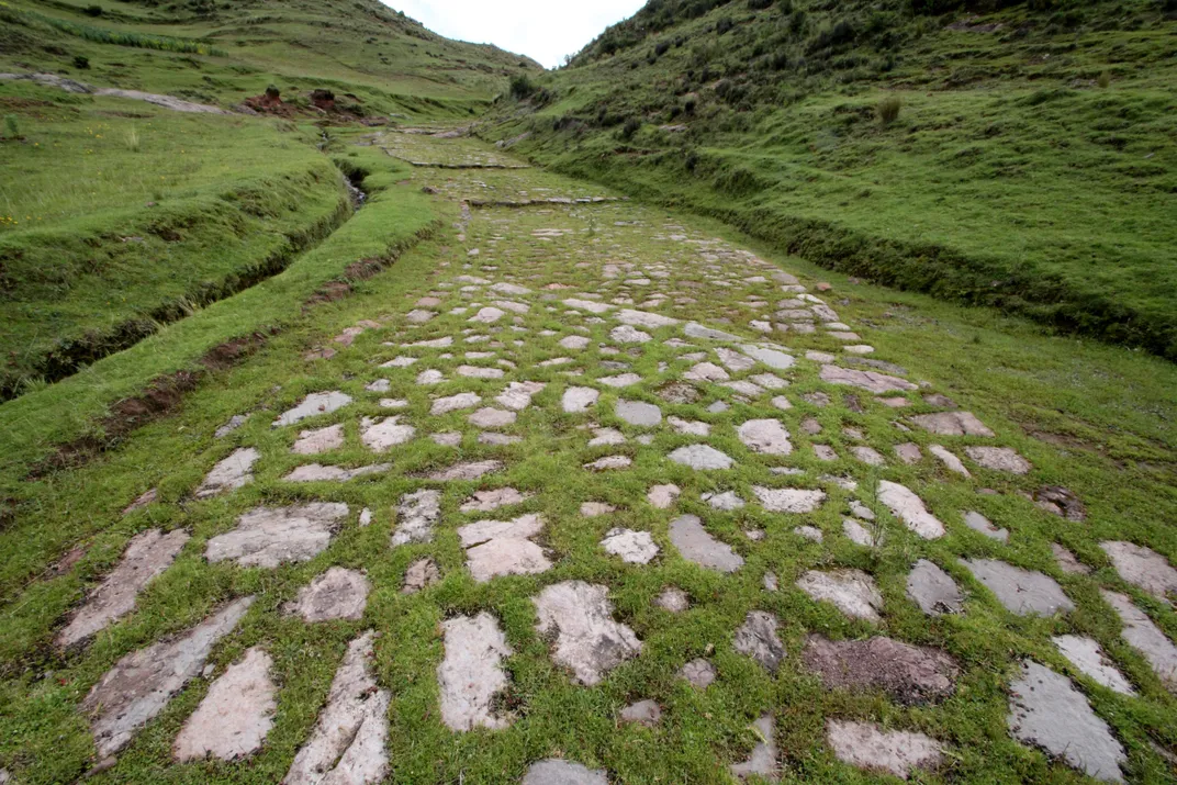
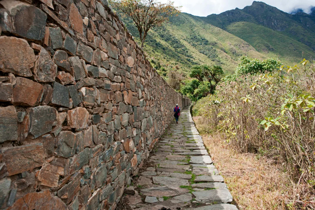
The Inca highway network—the two main arteries and the mass of secondary courses that joined them—was arguably the biggest, most complex construction project ever undertaken. Running for 3,700 miles between Chile and Ecuador, about the distance from New York to Paris, the backbone of the system cut through every imaginable landscape, from icy mountain peaks to tropical lowlands, from the world’s driest desert to one of its wettest forests. It astounded the Spaniards who saw it—the conquistador Pedro de Cieza de León said that the road through the Andes should be more famous than Hannibal’s route through the Alps. “In the memory of people I doubt there is record of another highway comparable to this,” he wrote in the 1540s. It was called the Qhapaq Ñan—which translates from the Quechua as “Road of the Lord.”
Huayna Capac died around 1527, still seeking to incorporate the northernmost parts of the Andes into the empire. His death set off a civil war, fought bloodily along the Qhapaq Ñan. European conquerors arrived in 1532, accompanied by European diseases: smallpox, measles, typhoid, influenza. More than half the population of the Andean realm died. For the next three centuries, Spain tried to wipe out the histories and traditions that remained. But the conquistadors did not succeed. Native peoples tenaciously held on to their beliefs and practices. And archaeologists discovered ever more about the pre-conquest past.
For decades schoolchildren have learned that civilization has four ancient origin places: Mesopotamia, Egypt, the Indus Valley and China’s Yellow River. In the past 20 years researchers have added a fifth member to this select list: the central Andes, which includes southern Ecuador, northwestern Bolivia and most of Peru. Here, we now know, were pyramids and temples as old as or older than those in Egypt, vast irrigation networks that rivaled those in ancient Sumer, and artworks that would endure for centuries, even millennia. Just as in India and China, rulers built walled fortresses, religions flourished and armies clashed. In this realm, the Inca were Johnny-come-latelies—flashy, ruthless newcomers whose empire barely stretched across two centuries.
Left untended, the asphalt paths of the U.S. interstate highway system would disappear in a few decades. But hundreds of miles of the Qhapaq Ñan—paved with heavy stones, linked by suspension bridges that had no equal in Europe or Asia, engineered with astonishing care—remain despite centuries of neglect. You can hike along them for days. People who walk through these extraordinary landscapes are not merely following in the footsteps of the Inca. The Qhapaq Ñan was built atop roadways created by the Inca’s many predecessors. To journey here is to roam through almost 6,000 years of civilization, to one of the places where the human enterprise began.
— ORIGINS STRANGE AND PROFOUND —
Push a throw rug with a foot across a slippery floor until it collides with a second throw rug. The leading edge of the first rug will bunch up into folds, then slide over the second. The first throw rug is the South American plate, an immense slab of rock that includes most of the continent. The second is the Nazca plate, on the floor of the Pacific. The folds are the Andes Mountains, lifted up as the South American plate grinds over the Nazca plate, pushing the latter into the Earth’s mantle. The tremendous strain of the eons-long collision cracks the rock, letting hot magma seep through. The Andes are young, geologically speaking, and have more than a hundred active volcanoes.
The region is a cavalcade of superlatives, a congeries of astonishments. On its western flank, the mountains plunge into the Pacific. All along the coast is a deep trench where the Nazca plate is driven down. Wind blows the surface water north, toward the Equator. That water, driven away, is replaced by cold, nutrient-rich water from the bottom of the trench. The upwelling nutrients feed vast clouds of plankton, which feed vast clouds of everything else. The Andes edge onto one of the world’s greatest fisheries. So many seabirds have feasted on the fish for so long that islands off the coast have mountains of guano 150 feet tall.
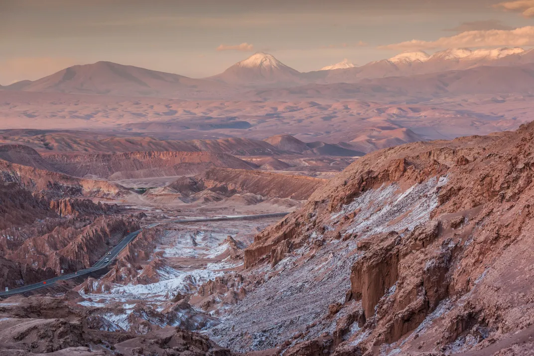
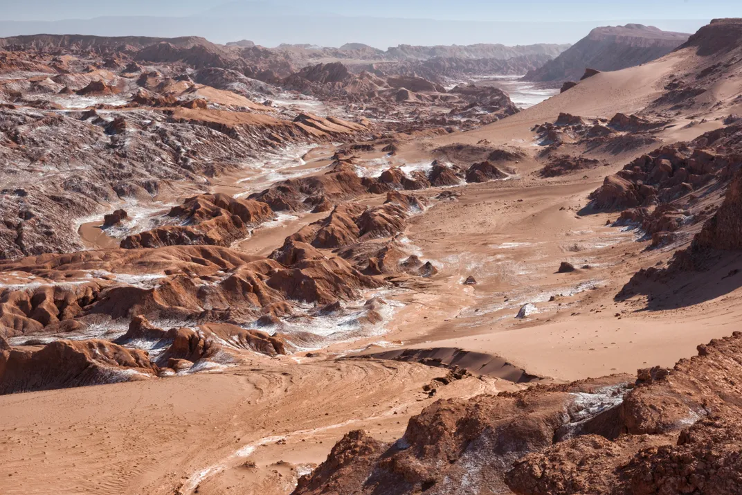
Cold water produces cold air. Moist winds from the Pacific hit the cold air and condense; rain falls into the sea, miles from shore. Blocked by mountains on one side and cold air on the other, the narrow shoreline of Peru and Chile is amazingly dry, a narrow desert that runs for more than a thousand miles. The Atacama Desert, in coastal Chile, is the driest place on Earth—in some places there is no record of rainfall. Scientists and astronauts go there to experience our planet’s closest analogue to conditions on Mars.
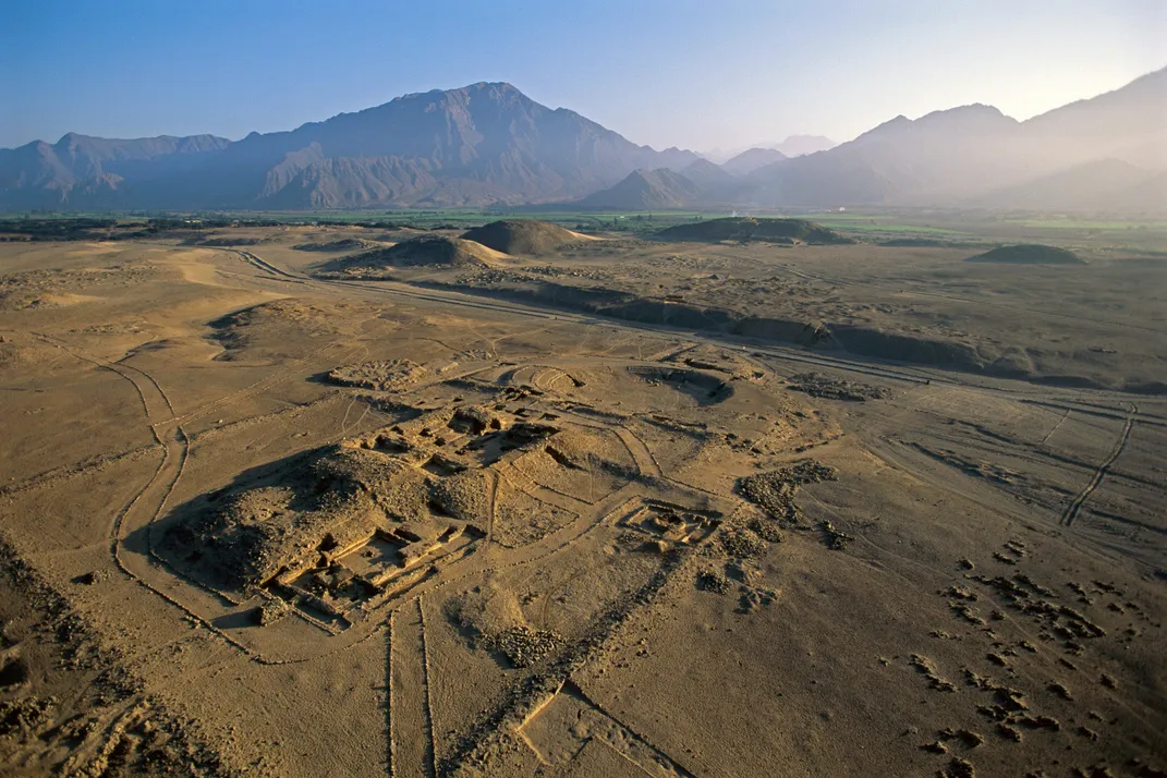
North of the Atacama is Lima, capital of modern Peru, and north of Lima is a 300-mile stretch of coastline with 30 or more ancient monumental centers, as old as those in the Fertile Crescent but much less well known. Depending on how you define the term “city,” these centers could be small cities or remarkable accumulations of rural populations. Urban or rural, they are among the world’s oldest architectural complexes—Sechín Bajo, probably the earliest known, dates to about 3500 B.C., about a thousand years before the Great Pyramid of Giza. Researchers have known of the existence of these sand-buried places since at least 1905. But it was not until the 1990s, when the Peruvian archaeologist Ruth Shady Solis began to excavate Caral, two hours north of Lima, that anyone grasped their age and scale. And it was not until then that researchers fully understood how unusual this place and time were—how flat-out strange.
Nobody is yet sure what to call this stretch of coastline or even if it housed one culture or several. Whatever the name, the region is a puzzle within a puzzle, as fascinating for what it isn’t as for what it is.
In comparison with Mesopotamia, Egypt, China and India (the other cradles of civilization), the Peruvian coast seems absurdly unpromising: chilly, parched, spatially constrained, battered by floods and sandstorms, seismically unstable. The other four arose in the warm, fertile valleys of great rivers (respectively, the Tigris and Euphrates, Nile, Yellow and Indus Rivers), where millennia of regular spring floods had left deep layers of fertile soil. The Peruvian shore, by contrast, is a desert with an unsteady climate. The atmospheric pressure over the Pacific fluctuates chaotically, sometimes causing blasts of warm air to hit the coast, which in turn can lead to years-long bouts of severe rain and floods—the climatic shift now famous as El Niño. Unlike the restoring annual spring floods of the Nile, these unpredictable, violent El Niño floods destroy crops and wash away fields. In what the archaeologist Michael E. Moseley has called “convergent catastrophes,” the flood sediment pours into the small rivers that come down from the Andes, building temporary sandbars at their mouths. Later, when conditions return to normal, ocean winds blow the sand inland; the sandstorms blanket farm fields in new episodes of ruin. Between floods, the region’s frequent earthquakes create expanses of loose debris, setting up conditions for the next round of devastating floods. How could people establish long-lasting societies in such a catastropheprone area? It seems to violate common sense.
Living in this unusual place, Peruvians made do for themselves in unusual ways. Cities in Mesopotamia and Egypt were ringed by thick defensive walls or protected by frontier garrisons, indicating that war was a constant menace. By contrast, these early complexes in Peru show no evidence that their residents ever had to worry about defending themselves. Caral, today the most well-known site, has a sprawling central plaza surrounded by grand pyramids, which are in turn surrounded by residential structures, presumably dwellings for the rich; to the south is a spectacular circular amphitheater. Caral’s buildings date from around 3000 B.C.; the city (if that’s what it was) was inhabited for the next 1,200 years. In all this time, there is no indication of mass violence. Later societies, like the Inca, were violent—but not these. Imagine a millennium of European or Chinese or Mesopotamian history with no war to speak of. That’s how peculiar things look to researchers studying the early coastal Andes.
Cities in other civilizations were surrounded by great expanses of cereal crops: rice in China, wheat and barley in Mesopotamia, Egypt and India. Matters were different on the Andean coast, where cities like Caral had access to huge quantities of fish, and one of the main agricultural products, grown by irrigation from the mountain streams, was the cotton used to make nets and lines. Indeed, Moseley has argued that seafood was the foundation of Andean civilization, rather than agriculture—the only early civilization in the world where this was true.
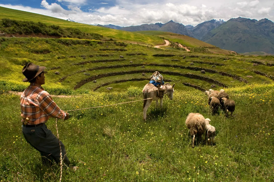
Stranger still, the staple food of the highlands was neither fish nor grain but tubers and tuberlike roots. The most famous of these is the potato, though most people outside South America don’t know that the common spud is only one of the seven potato species domesticated by Andean peoples. Along with the potato are many other local roots and tubers, as delicious as they are unfamiliar, including oca (a tuber that resembles a wrinkled carrot and has a pleasantly sharp taste), ulluco (brightly colored, with skin that does not need to be peeled), yacon (a relative of the sunflower with a sweet, crispy tuber) and achira (a lily-like plant with a mild, starchy “root”). Because tubers and roots grow underground, they can reach almost any size without harming the plant, whereas wheat and rice, growing atop spindly stalks, will topple the plant if the head of grain gets too big. In consequence, roots and tubers are inherently more productive than grains—a lesson initially lost on European farmers, who often had to be ordered by their kings to grow potatoes when they first appeared.
Pottery, the archaeological tracer par excellence, developed later in the central Andes than in other places. From the beginning the region’s peoples seem to have placed greater emphasis on textiles. Not only did they grow cotton to make fishing lines and nets; they literally built their temples from stones stuffed into fiber bags to create, in effect, enormous building blocks. Most important, they used fiber to communicate. In Caral, Shady found what she believes to be an early version of one of the region’s most unusual inventions: the quipu. Consisting of a long horizontal rope with vertical strings dangling from it, the quipu encoded information in the patterns of knots tied into the vertical strings. Quipu scribes “read” the messages by running their hands along the knots, a procedure that so baffled and alarmed Spaniards when they encountered it that in the 1580s they ordered all quipus to be destroyed as “idolatrous objects.” (Only about 750 are known to have survived; although the knots used to indicate numbers have been deciphered, scholars have not yet broken the code for quipu “words.”)
Some aspects of these early societies—the quipu, the architecture of the plazas, perhaps the religious symbols—seem to have survived from the first days of Andean culture right up to the Spanish conquest. Archaeologists have long argued among themselves whether these indicate that some kind of essential Andean culture evolved in these mountains, persevering in different guises for thousands of years. Walking in these places, though, it is clear that the coastal Andes took a path different from any other. Societies here were just as old as but profoundly unlike those that trace their roots to the Middle East or Asia. To be in Peru is to be reminded that the human story, in all its terror and beauty, did not have to turn out the way it has. If we somehow rewound the tape and began again, we too could be running our fingers along knotted strings. And our ancestors too might not have lived fearfully behind defensive walls.
— RETHINKING THE INCA —
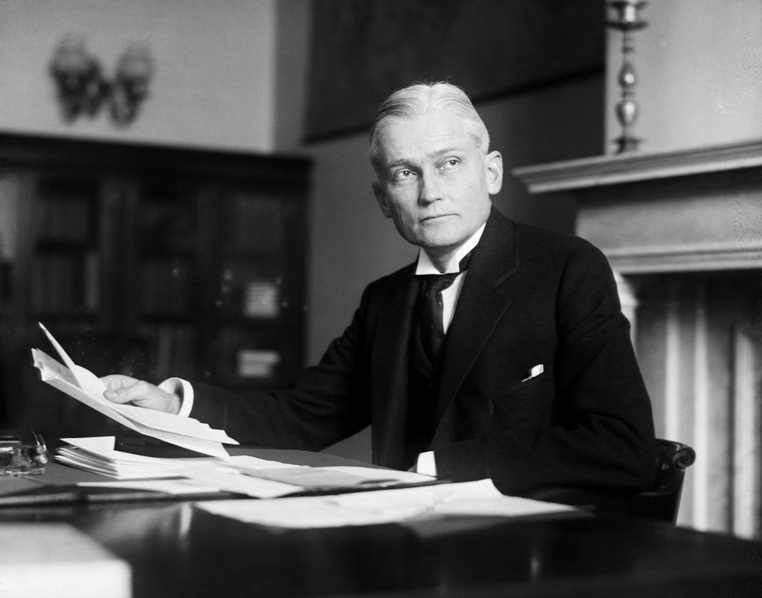
Ephraim George Squier was a 19th-century U.S. newspaperman who became fascinated by the remaining traces of this hemisphere’s original inhabitants. Gradually his interest in antiquity took over his life. He spent ever less time writing and ever more time measuring and photographing ruins, a transition that eventually cost him his wife (a journalist and editor herself, she dumped the obsessed Squier and married his publisher boss). In 1863 President Abraham Lincoln awarded Squier a special appointment to negotiate a treaty with Peru. After working through the issues, Squier spent a year and a half in Peru as a tourist, one of that nation’s first true sightseers. Spaniards like Cieza de León and Francisco de Jerez wrote down their impressions as they conquered. Squier was motivated wholly by curiosity. What he learned would dethrone the Inca.
Conquistador Francisco Pizarro quickly overwhelmed the Inca with only 168 men—so says the standard historical account, still taught in U.S. schools. But Spaniards themselves knew better. Pizarro first landed in South America in 1531; the last Inca holdout wasn’t snuffed out until 1572, four decades later. And the takeover could not have succeeded without the aid of thousands of native people who hated their Inca overlords and thought (correctly) that aiding Spain would overthrow the Inca and (incorrectly) lead to a better life. Preoccupied with war and contemporary politics, the Spaniards only vaguely paid attention to who had lived in the Andes before the Inca. Naturally, the remaining Inca themselves assured the conquistadors that their predecessors all had been “extremely barbarous and savage,” cannibals “spread out in small villages and collections of huts” (as the scholar Bernabe Cobo put it in 1653). In time it became common to assume that all the beautiful ruins in Peru were Inca remains.
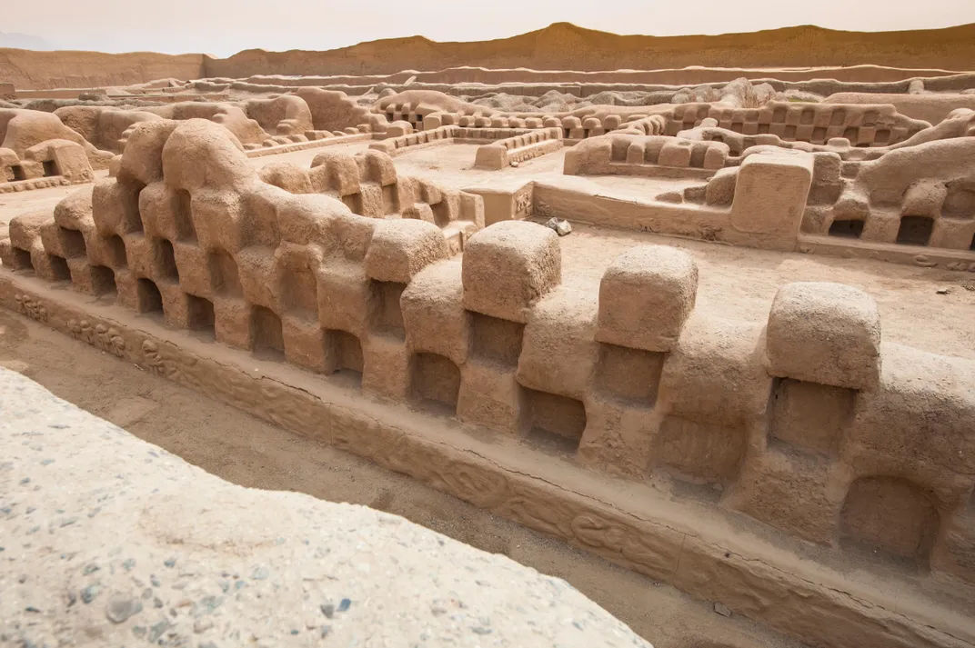
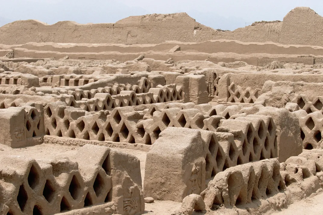
Squier had an itinerary but found it hard to keep. He was repeatedly stunned by what he saw. One of the first places he visited was the pre-Inca, adobe city of Chan Chan, in northern Peru, near the modern city of Trujillo. Chan Chan was huge—its ruins cover more than seven square miles—and covered with dazzlingly intricate designs. Fascinated by the maze of temples, castles and walls, Squier didn’t want to leave. “Constantly the evidences of harmonious design, intelligence, industry, skill and well-directed authority in their construction became more apparent,” he wrote. Having begun to comprehend them, “I was loath to leave my work unfinished.” He reluctantly moved on. To his surprise, ruins seemed to be everywhere he traveled.
Traveling in Peru then “was infinitely more difficult and dangerous than it was in the days of the Incas,” Squier wrote. Neither the colonial government nor its successor had maintained the Qhapaq Ñan; bandits were allowed to run free. Squier summed up his views forcefully: “The influence of Spain in Peru has been in every way deleterious. The civilization of the country was far higher before the Conquest than now.”
Perhaps because the Inca roads had become difficult to travel, Squier wholly bypassed some of the most remarkable examples of Andean civilization. He marveled at the remains of Tiwanaku, the city at the edge of great Lake Titicaca, the world’s highest commercially navigable lake. A religious show capital—the Andean version of the Vatican—Tiwanaku held sway over a region extending from southern Peru to northern Chile from about A.D. 400 to about A.D. 1000. But Squier completely missed Wari, Tiwanaku’s great rival, 500 miles north, the first true empire in the Andean region. He visited the city of Trujillo but didn’t spot the nearby aqueduct of Cumbe Mayo, a five-mile, zigzag trench cut through solid rock three thousand years ago that feeds water from the Atlantic to the Pacific side of the Andes. Most amazing, he failed to come across the valley city of Chavín de Huántar. Known to Europeans since the 16th century, Chavín had a seven-acre ceremonial center so large and beautifully assembled that Cieza de León speculated that it was made by “giants as large as the figures that are carved on the stones.” Beginning in about 1200 B.C., Chavín exercised dominion over much of the central Andes for half a millennium. And so on.
Still, Squier saw so much that his published record of his journey is a tally of astonishments, one after another. And because all these places looked extraordinarily different one from another, Squier concluded that this multitude of styles could not all have belonged to the Inca Empire. And that meant, he realized, that the Inca must be newcomers. They spread their language of Quechua everywhere, yes. They were engineers of genius, yes—Squier, like so many others, was amazed by the Qhapaq Ñan. But the Inca, Squier realized, were colorful icing on a historical cake of many layers. All of their accomplishments, each and every one, were constructed on a cultural base that was “old, very old.”
— GUARDIANS OF THE ANDES —
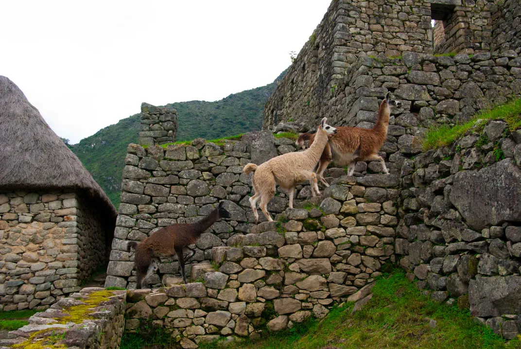
By the main entrance to Machu Picchu, the remarkable Inca palace complex, are half a dozen plaques extolling various aspects of its history and construction. Two of them, arrayed side by side, are particularly notable. One, installed in1961, honors the 50th anniversary of the discovery of Machu Picchu by Hiram Bingham III, a missionary’s son turned Yale professor turned South American explorer. As for the second plaque—we will come to that in a moment.
The Binghams were poor but respectable; Hiram managed to go to Yale and Harvard and then married the granddaughter of Charles Lewis Tiffany, founder of the eponymous company. The couple lived in a 30-room mansion and had seven sons, all of whom would go on to distinguished careers. In 1908 Bingham traveled to Santiago, Chile, as a delegate to the First Pan-American Scientific Congress. Bitten by the adventure bug, he took his time coming home, rambling through much of the Andes and Brazil. A convenient excuse for returning to South America was the search for the last Inca capital, Vilcabamba. Established during the decades that the Inca fought against Spain, it had apparently vanished into the forests of the eastern Andes. Bingham organized the Yale Peruvian Expedition to find it. On July 24, 1911, a month and a day after arriving in Peru, Bingham found himself in Machu Picchu, which he would come to believe was the city he had been searching for. (Incorrectly, as it happens—Machu Picchu is thought to be a private palace for an Inca ruler, not the last capital.)
Bingham, no shrinking violet, believed in the value of publicity. He touted his discovery tirelessly, including a 186-page article that filled an entire issue of National Geographic magazine. Machu Picchu, he claimed, was “the largest and most important ruin discovered in South America since the days of the Spanish Conquest.” As the years went by, his estimation of its—and his—importance only increased. In his last book, Lost City of the Incas, he seems to be the only person present at the discovery—at any rate, the only person who appreciated what it meant.
Which brings up the second plaque. Smaller, less elegantly incised and less prominent than the first, it was emplaced in 1993, three decades later, seemingly as a corrective. Translated from Spanish, it reads, “The National Institute of Culture, Cusco, honors Melchor Arteaga and the Richarte and Alvarez families, who were living in Machu Picchu before Hiran [sic] Bingham arrived.” To most tourists, its meaning must be mysterious. But people who live in the area know what the plaque is saying: The meaning of Machu Picchu isn’t what Hiram Bingham supposed.
After coming to Lima, Bingham quickly proceeded to Cusco. There he met Albert Giesecke, the rector of the University of Cusco. Six months earlier, Giesecke and a friend had taken a four-day trip on horseback down the valley of the Urubamba River, northwest of Cusco. At a bend in the river they encountered a farmer named Melchor Arteaga, who told them about some ruins atop a nearby hill—Machu Pikchu, as they were called in Quechua. Giesecke hadn’t been able to look at Machu Picchu that day because the weather was too rainy, but he told Bingham about what he’d heard. Excited, Bingham led his expedition down the same river trail. He didn’t know it, but he was walking along a branch of the Qhapaq Ñan. On the same bend in the river, he met up with Arteaga, and the next day followed the farmer up the steep hill to the ruins.
Melchor Arteaga leased the property around Machu Picchu to two other families (which are mentioned on the second plaque). The three families had tried to take care of the site, clearing away brush and trees from the most beautiful structures. Bingham could quickly tell what was there. One thing he noted was that people had been visiting Machu Picchu for years—Bingham noticed that one Peruvian academic had scratched his name on a wall with a lump of charcoal. It didn’t matter; Bingham couldn’t really see the people in the places he visited. In the books that boasted of his impressive and important “discovery,” he didn’t mention any of the Peruvians who preceded or helped him.
Bingham may not have been able to see around him, but Cusqueños knew about Arteaga and the other farmers. They knew that all of them spoke Quechua, not Spanish—which is another way of saying they were descended from Peru’s original inhabitants. Bingham, though fluent in Spanish, had to use an interpreter.
Cusqueños will tell you, too, that before Bingham’s journey Arteaga had lived on Machu Picchu for decades, watching over the ruins as best he could. People like him are everywhere in the Andes. And they understand what others are coming to find out: that they live in one of the places where civilizations have flourished for thousands of years, a place with a vast story for those with the eyes to see it.
/https://tf-cmsv2-smithsonianmag-media.s3.amazonaws.com/accounts/headshot/SQJ_1507_Inca-Contrib_01.jpg)