The World’s First Travel Guide Is Set to Go on View in London
The 1486 text features panoramic illustrations of Jerusalem, Venice and other sites across the Mediterranean region
/https://tf-cmsv2-smithsonianmag-media.s3.amazonaws.com/accounts/headshot/meilan_headshot2.png)
/https://tf-cmsv2-smithsonianmag-media.s3.amazonaws.com/filer/da/16/da162bf7-c7cf-43bb-87ae-9faaaf373d94/default.jpg)
In April 1483, a German politician named Bernhard von Breydenbach embarked on a religious pilgrimage to the Holy Land. Breydenbach and his companions—among others, Dutch artist Erhard Reuwich—traveled at a leisurely clip, touring destinations including Venice, Corfu, Modon and Rhodes while en route.
Two years after his pilgrimage, Breydenbach created an illustrated guide detailing the farflung locales he had visited on his trip. The text, titled Peregrinatio in Terram Sanctam, or A Pilgrimage to the Holy Land, was an instant sensation, with eleven editions in six languages published between 1486 and 1505.
Now, one of the few surviving first editions of Breydenbach’s “15th-century bestseller” is set to go on view at the British Museum: As the Guardian’s Robert Hull reports, the book—considered the world’s earliest example of a travel guide—will be featured in the London museum’s “Inspired by the East: How the Islamic World Influenced Western Art” exhibition, which runs from October 10 to January 26, 2020.
Giulia Bartrum, curator of German prints at the British Museum, tells Hull that prior to the text’s publication, “most of the depictions of places such as Jerusalem or Venice were totally made up.”
She adds, “Very few people in Europe had ever visited these places, so they had no realistic idea of what they looked like until this wonderfully detailed guidebook came along.”
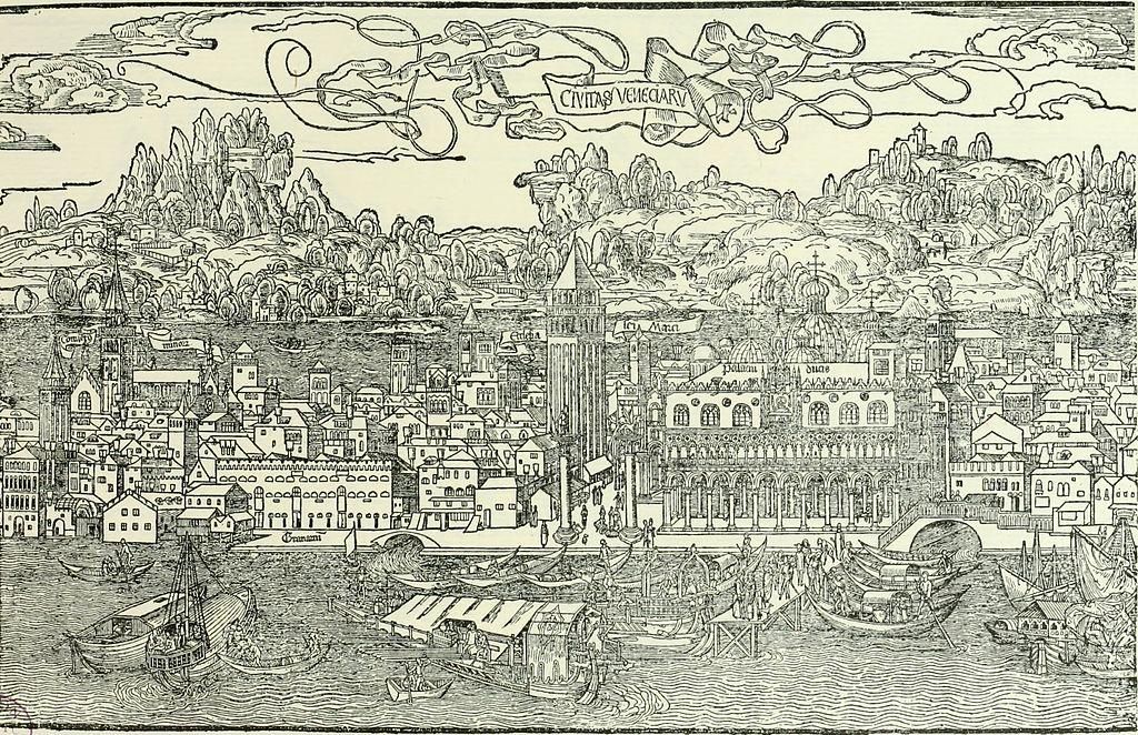
According to CNN’s Julia Buckley, the copy seen in the show is part of the London museum’s permanent collection, but it is rarely displayed due to the aging pages’ light sensitivity. For the duration of the exhibition, the book will be opened to a panoramic pull-out map of Jerusalem created by Dutch artist Erhard Reuwich, who accompanied the German statesman on his trip. The Dome of the Rock stands at the center of the graphic.
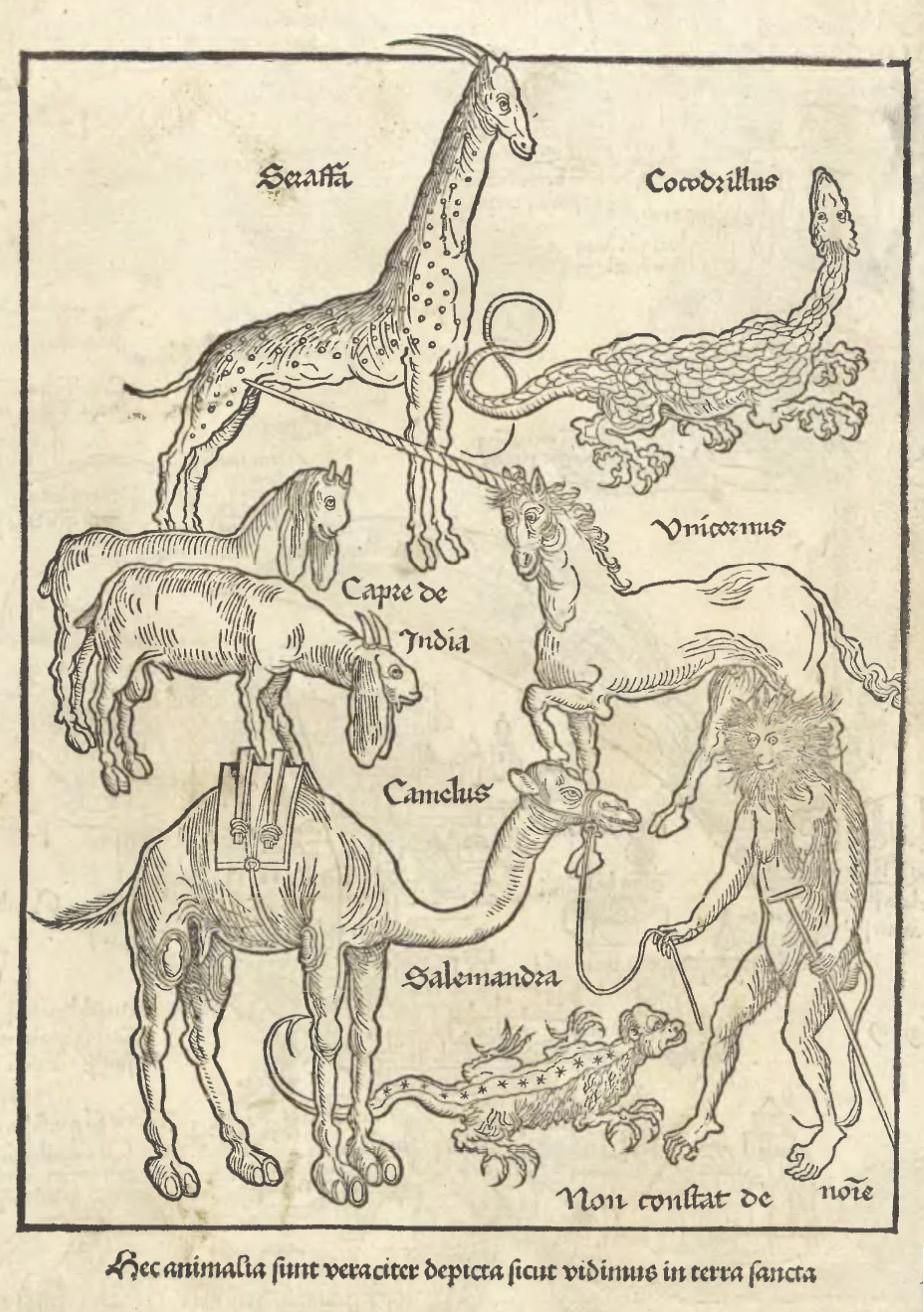
Reuwich contributed multiple illustrations to Peregrinatio in Terram Sanctam: among others, a figurative frontispiece, six panoramic views of Mediterranean towns, and drawings of animals both real and imagined. As historian Hugh Davies wrote in a 1911 commentary discussing the guide, Reuwich’s works “are distinguished from other woodcut views published in the [15th century] by their air of truth as well as their liveliness, being full of groups of figures, some pursuing their everyday occupation.”
Per the British Library’s James Elliot, Breydenbach’s text represents not only the first illustrated travel book, but also the first to contain folding plates. Interestingly, the National Library of Scotland notes, several of Reuwich’s topographic creations were so large they had to be printed from more than one block: Both the Holy Land and Egypt maps, for example, were printed from three blocks.
“In some ways, you can trace all the familiar trappings that tempt us to travel today—Rough Guides or Lonely Planet guidebooks, TripAdvisor and even Instagram—back to this book,” Bartrum says to CNN.
Each of today’s travel guides may be lightyears more sophisticated than what Breydenbach was doing. Still, as Bartrum says, “Peregrinatio in Terram Sanctam did it first.”
“Inspired by the East: How the Islamic World Influenced Western Art” is on view at the British Museum in London from October 10 to January 26, 2020.
/https://tf-cmsv2-smithsonianmag-media.s3.amazonaws.com/accounts/headshot/meilan_headshot2.png)