A Summer Hailstorm Buried the Mexican City of Guadalajara Under Ice
The weekend storm was unusually severe, with drifting caused by a combination of hail and flash flooding
/https://tf-cmsv2-smithsonianmag-media.s3.amazonaws.com/filer/e0/b7/e0b77424-1a9b-4af3-a2d5-60b588ad1050/gettyimages-1153129123.jpg)
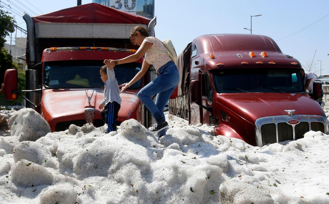
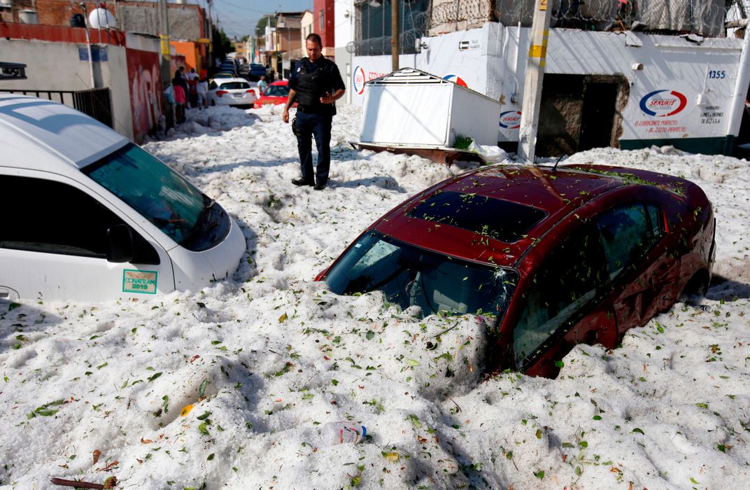
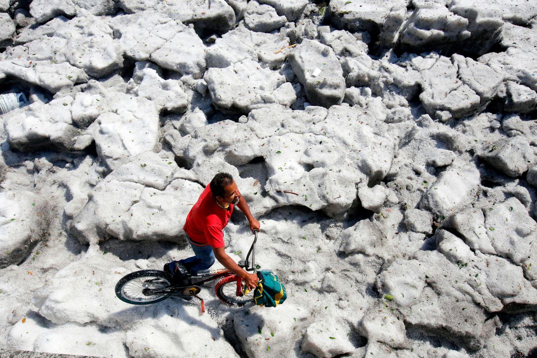
Last week, the average daily temperature in Guadalajara, Mexico, hovered around 88 degrees Fahrenheit—a fairly typical figure for the first few sweltering days of summer. Then, on Sunday, June 30, an unexpected hailstorm hit the area, burying the city under several feet of icy slush.
As BBC News reports, the storm arrived in Guadalajara around 2 a.m. local time, sweeping through the city as air temperatures dropped suddenly from 72 to 57 degrees Fahrenheit. Although the hailstones were relatively small, measuring less than 1 centimeter across, Agence France-Presse notes that the deluge was strong enough to damage some 200 local homes and businesses, as well as at least 50 vehicles. Per the local El Informador newspaper, 10 residents of Guadalajara and its neighboring city, Tlaquepaque, were treated for early signs of hypothermia.
En coordinación con el Ejército Mexicano y autoridades municipales de Guadalajara y Tlaquepaque, el Gobierno de Jalisco trabaja en la limpieza y remoción de granizo en la vía pública, así como en el apoyo a la ciudadanía que sufrió afectaciones en sus viviendas. pic.twitter.com/4q1zgPXys2
— Enrique Alfaro (@EnriqueAlfaroR) June 30, 2019
Guadalajara, capital of the Mexican state of Jalisco, boasts a population of nearly 1.5 million. Situated some 5,000 feet above sea level, the city is no stranger to summer hailstorms. Storms of this magnitude, however, are unusual; state governor Enrique Alfaro told AFP he had “never seen such scenes in Guadalajara,” adding, “Then we ask ourselves if climate change is real.”
Hail is a common seasonal occurrence that forms in thunderstorms with intense zones of rising air. These zones, known as updrafts, carry water vapor into the sky, where it condenses, freezes and transforms into hail. At this point, the hail either rains down or, if the updrafts are strong enough, travels back up into the clouds to start the process all over again, growing in size until the swirling air can no longer support its weight.
Some hail events fall under a category nicknamed “SPLASH,” or “Storms Producing Large Amounts of Small Hail.” In SPLASH storms, hail falls to the ground as a “torrent of small ice grains,” delivering a “‘thump’ not unlike a massive, localized snowfall,” report Jason Samenow and Jeff Halverson for The Washington Post. This is likely what happened in Guadalajara, which is susceptible to hailstorms due to its high elevation. As catalogued in a recent Journal of Applied Meteorology and Climatology study, it remains unclear why certain storm events generate large amounts of small hail, while others produce larger golf ball- or softball-sized hail.
Although photographs of the event’s aftermath testify to tall hail drifts throughout the city, these monoliths were created by urban flash flooding that sent ice flowing into streets and culverts, not purely through accumulated ice dropped during the storm, as climate scientist Daniel Swain of the University of California Los Angeles explains on Twitter. (Similar occurrences have previously been recorded in Mexico City and the Texas Panhandle, among other locations.)
As Marshall Shepherd reports for Forbes, current research details “compelling” links between a warming planet and heatwaves, drought and extreme rainfall, but the data is less convincing when it comes to hail and tornadoes. Writing for the Washington Post earlier this year, meteorologist Paul Douglas notes that while “there isn’t solid evidence that hail has increased due to climate change, … scientists say [that] hail could grow bigger in the future.”
Chris Westbrook, a meteorologist at England’s University of Reading, tells The New York Times’ Iliana Magra that Guadalajara’s mountainous landscape makes it an ideal candidate for extreme hailstorms.
“Fundamentally, hailstorms are not unusual in this part of the world,” Westbrook concludes. “What is unusual is that the conditions were just right to get an awful lot in one go.”
/https://tf-cmsv2-smithsonianmag-media.s3.amazonaws.com/accounts/headshot/mellon.png)


/https://tf-cmsv2-smithsonianmag-media.s3.amazonaws.com/accounts/headshot/mellon.png)