Innovation for Good: Game Changers
A Smithsonian magazine special report
Twenty-Four Ways to Turn Outdoor Passions Into Citizen Science
Heading into the new year, consider collecting scientific data while skiing, hiking, surfing, biking and partaking in other adventures
/https://tf-cmsv2-smithsonianmag-media.s3.amazonaws.com/filer/e3/5a/e35a1321-139b-4c12-9b14-db598acd3671/backcountry_skiing-main.jpg)
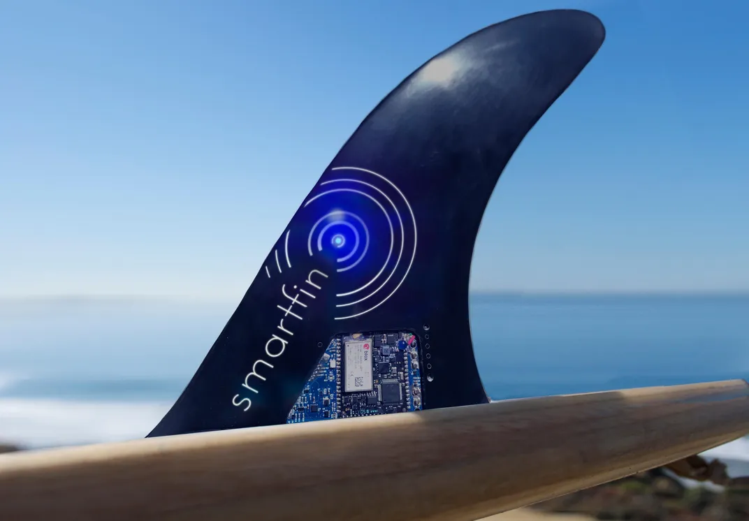
Upon arriving in San Diego five years ago, David Walden bought his own board off Craigslist and taught himself to surf. Today, he is still using that pastime not just for fun—but also to help gather important data on the ocean.
To catch the waves along the Californian coast, Walden rides a board equipped with a device called Smartfin, a surfboard fin that measures sea-surface temperature, salinity, acidity and other ocean parameters while a surfer is in the water. After each session, Walden logs onto the fin’s app and uploads the metrics collected to a public server, where they can be accessed by anyone and downloaded onto an Excel spreadsheet.
He does so because he volunteers for the Smartfin Project, a program housed at Scripps Institution of Oceanography that seeks to leverage recreational surfers to gather data about near-coastal areas—places that conventional instruments like buoys and moorings can’t reach—and help scientists advance the understanding of coastal physics and ecology.
The idea of crowdsourcing data from citizen scientists is far from new. But as more digital tools like drones and smartphones have entered the hands of ordinary people, projects looking to involve the outdoor-recreating public to collect data are getting more ambitious and diverse.
Whether it’s collecting water samples, measuring snowpack or tracking wildlife, plenty of choices are available for people of every background and taste for adventure. As we consider our New Year’s resolutions, here is a roundup of suggestions for how to venture outdoors with a purpose:
Hiking and trekking
The Appalachian Mountain Club enlists hikers to help monitor flowering and fruiting times along mountain trails across the Appalachian region. The program called Mountain Watch asks walkers to use their mobile devices to photograph plant life they observe while hiking and share images through the iNaturalist app. AMC scientists will review submissions and use them to track plant development and gain insight about the effects of climate on local alpine vegetation.
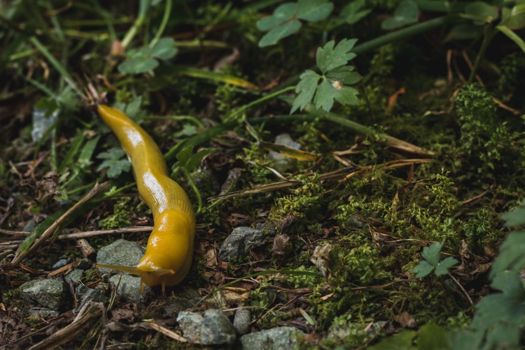
Redwood Watch, a project of the Save the Redwoods League, invites trail-goers in the Bay Area to help researchers better understand how a changing environment affects redwood forests. Trekkers are asked to submit photos and observations of plants and animals they see—California Bay laurels, banana slugs and Pacific giant salamanders, to name a few—as they walk through the woods. Records are then reported in an online database, helping researchers better grasp the extent to which a warmer climate is having on species distribution across the area.
For wannabe biologists, the Citizen Science Program at Glacier National Park recruits hikers to conduct surveys on population size and distribution of resident and migratory animal species within the park, such as eagles, hawks, falcons, mountain goats, bighorn sheep and pikas. The data, which volunteers learn to gather by attending a one-day classroom and field-based education program, assist park managers in learning more about how the animals are responding to warming temperatures, shrinking glaciers, change in habitat and the demise of forage.
Biking
Wildlife Crossing and Wildlife Connectivity are two roadkill-counting projects, the first in California and Maine and the second in Montana, calling on cyclists to help scientists by reporting fauna flattened by automobiles. Bikers interested in participating are asked to scan the road and roadside and report any signs of wildlife (both dead or alive) by entering the data online. These data will be used by transportation planners to design and implement mitigation measures, including fencing, crossing structures and animal detectors placed in runway hotspots, with the goal of reducing wildlife-vehicle collisions.
For riders with a penchant for bird watching, the Cornell Lab of Ornithology’s Global Big Day is a day-long event held around the world during which participants—who are restricted to just bike or foot—traverse woodlands, wetlands, prairies and more scouting for birds. Sightings are submitted to a global database called eBird that researchers and policymakers use to devise bird conservation strategies.
Skiing, snowboarding and mountaineering
The NASA-funded Community Snow Observations project asks skiers, snowboarders, snowshoers and mountaineers to collect snow-depth data in mountainous regions. Participants use a collapsible avalanche probe—a tool most backcountry users are likely to carry in their packs—to take snowpack depth readings and send the geotagged observations via the mobile-sharing platform Mountain Hub to the science team, who use the data to track snow cover and snow’s impact on ecosystem dynamics, hydrological systems and glacier health.

Skiers, mountaineers and others who spend time around the Northern Cascades are sought by the Living Snow Project, a program that studies pink snow, an occurrence that causes the snow in a glacier to take on a reddish-pink hue due to the growth of ice-adapted algae, in the range. They can contribute by either sharing observations of the phenomenon through a dedicated app or collecting pink snow samples to help scientists at Western Washington University characterize each sample’s microbiome and learn more about the dynamics behind this snow-melting process which models aren’t accounting.
The Snowtweets Project, instead, provides a way for backcountry-goers to quickly share their own snow depth measurements with date and location coordinates using Twitter as a broadcasting scheme. These data help cryosphere researchers calibrate the accuracy of instruments on board weather satellites.
Surfing
The Surfrider Foundation's Blue Water Task Force recruits surfers to sample water at ocean and bay beaches through the off-season, when lifeguards leave and agency-run monitoring programs stop collecting water samples. Local chapters then use the data to alert citizens and officials in their communities about water quality problems and to work toward solutions. (Find a chapter near you here.)
The King Tides Project, an effort by the California State University Channel Islands’ Coastography Lab, calls on wave riders in California to log their observations on wave-break patterns and overall wave quality during extreme tide events. The records will help researchers and planners better understand how the state’s coastline might be affected by future sea level rise.
Diving
Grassroots conservation network Reef Check engages amateur divers to expand monitoring of coral and rocky reef ecosystems and kelp forests. Volunteers receive training in surveying a designated habitat annually (or sometimes quarterly) along so-called transect lines. In time, these local observations put together a picture of the reef or the forest. Marine and environment managers then analyze and use the data to better track and care for these ecosystems.
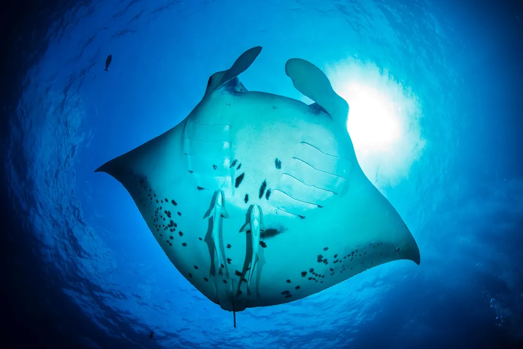
Any diver with a camera can facilitate research on threatened manta rays by uploading belly shots to the global database MantaMatcher, or help marine biologists keep track of shark populations by reporting sightings across both the Atlantic and the Pacific.
Scuba junkies can also assist oceanographers by collecting temperature data in the nearshore ocean for Project Hermes. Freedivers interested in participating are requested to wear a portable sensor that measures water temperature and location coordinates and sends the information autonomously to the project’s database as soon as it reconnects to the internet. Such records assist scientists in investigating the effects of coastal warming.
Kayaking, canoeing and paddle boarding
Nonprofit Rivers for Change is looking for individuals willing to join its source-to-sea paddle experiences around the country. During these events, boaters get to understand the riverine ecosystem and its threats while taking water samples in secluded areas that aren’t normally surveyed by researchers. The data gets used by scientists from different organizations and research centers to assess how waterways are reacting to a range of anthropogenic stresses like climate change and pollution.
Both novice and experienced paddlers are welcome at Paddle the Gulf, an initiative that connects people with the coastal streams and rivers which feed the Gulf of Mexico and collects data about plants and wildlife that live there.
Also in the Gulf, the FWC Fish and Wildlife Research Institute trains volunteers to assist biologists in surveying and re-sighting Florida’s nesting horseshoe crab populations, while the Florida Microplastic Awareness Project engages boaters to keep an eye on the concentration of microplastics in coastal waters.
Sailing
The Secchi Disk study is a scientific experiment that invites seafarers to create a simple piece of scientific equipment called a Secchi Disk and use it to help marine scientists know more about phytoplankton—microalgae underpinning the marine food web that are in rapid decline globally as the oceans warm. The tool measures water clarity, which away from estuaries and coasts indicates the amount of phytoplankton at the sea surface.
Ocean Research Project’s Fish Finder wants to harness the live-aboard community to gather data about fish migrations and essential fish habitats. By lowering special fish detection equipment into the water whenever they anchor or dock in developed and remote locations alike, mariners collect information that would otherwise be lost to science. These resources help researchers broaden the scientific appreciation of species migration and the impact that climate-induced ocean acidification has on it.
Offshore sailors and boaters can help with tracking ocean plastic pollution by submitting debris location coordinates through the Marine Debris Tracker mobile app. This open-source data is used to compile a global dataset on the amount, distribution and type of debris littering the ocean, facilitating research about the threat that plastic debris poses to the marine ecosystem.