The Lost City of Cambodia
Deep in the jungles of southeast Asia, archaeologists have rediscovered the remains of an invisible kingdom that may have been the template for Angkor Wat
:focal(3169x627:3170x628)/https://tf-cmsv2-smithsonianmag-media.s3.amazonaws.com/filer/95/32/9532cbca-e64d-4fed-99de-f481f890af7e/apr2016_l09_cambodia.jpg)
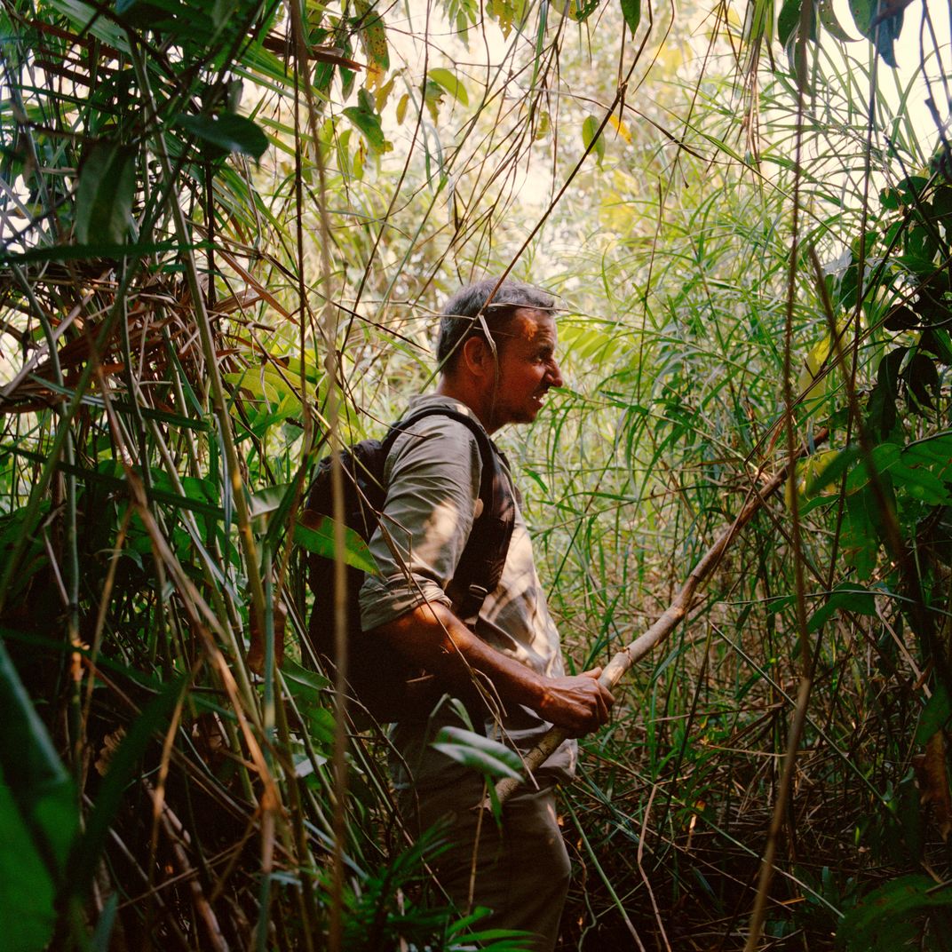
Jean-Baptiste Chevance senses that we’re closing in on our target. Paused in a jungle clearing in northwestern Cambodia, the French archaeologist studies his GPS and mops the sweat from his forehead with a bandanna. The temperature is pushing 95, and the equatorial sun beats down through the forest canopy. For two hours, Chevance, known to everyone as JB, has been leading me, along with a two-man Cambodian research team, on a grueling trek. We’ve ripped our arms and faces on six-foot shrubs studded with thorns, been savaged by red biting ants, and stumbled over vines that stretch at ankle height across the forest floor. Chevance checks the coordinates. “You can see that the vegetation here is very green, and the plants are different from the ones we have seen,” he says. “That’s an indication of a permanent water source.”
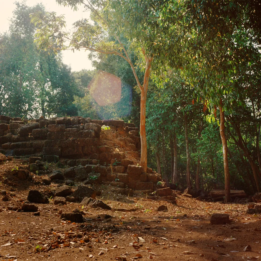
Seconds later, as if on cue, the ground beneath our feet gives way, and we sink into a three-foot-deep muddy pool. Chevance, a lanky 41-year-old dressed in olive drab and toting a black backpack, smiles triumphantly. We are quite possibly the first human beings to set foot in this square-shaped, man-made reservoir in more than 1,000 years. Yet this isn’t merely an overgrown pond we’ve stumbled into. It’s proof of an advanced engineering system that propelled and sustained a vanished civilization.
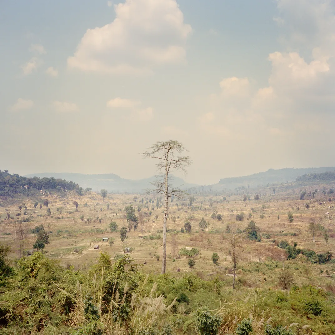
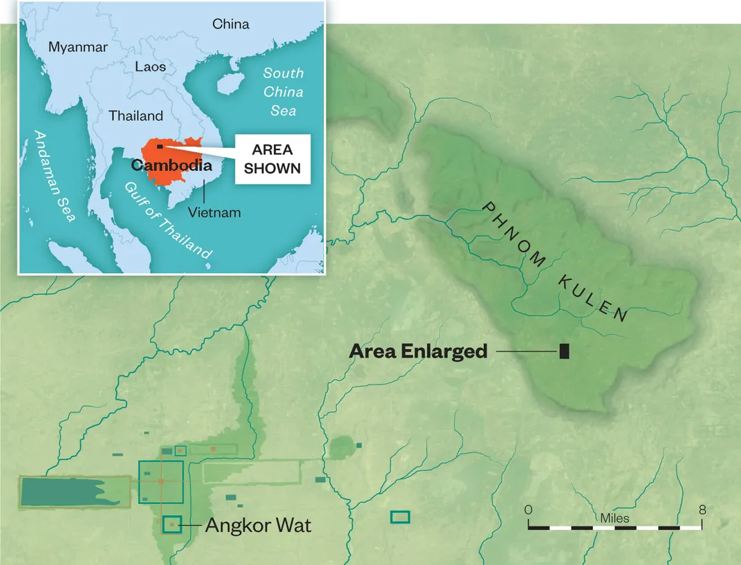
The vast urban center that Chevance is now exploring was first described more than a century ago, but it had been lost to the jungle until researchers led by him and an Australian colleague, Damian Evans, rediscovered it in 2012. It lies on this overgrown 1,300-foot plateau, known as Phnom Kulen (Mountain of the Lychee fruit), northeast of Siem Reap. Numerous excavations as well as high-tech laser surveys conducted from helicopters have revealed that the lost city was far more sophisticated than anyone had ever imagined—a sprawling network of temples, palaces, ordinary dwellings and waterworks infrastructure. “We knew this might be out there,” says Chevance, as we roar back down a jungle trail toward his house in a rural village on the plateau. “But this gave us the evidence we were hoping for.”
Phnom Kulen is only some 25 miles north of a metropolis that reached its zenith three centuries later—the greatest city of the Khmer Empire, and possibly the most glorious religious center in the history of mankind: Angkor, derived from the Sanskrit word nagara, or holy city, site of the famed temple Angkor Wat. But first there arose Phnom Kulen, the birthplace of the great Khmer civilization that dominated most of Southeast Asia from the 9th to the 15th centuries. The Khmer Empire would find its highest expression at Angkor. But the defining elements of Kulen—sacred temples, reflecting the influence of Hinduism, decorated with images of regional deities and the Hindu god Vishnu, and a brilliantly engineered water-supply system to support this early Khmer capital—would later be mirrored and enlarged at Angkor. By the 12th century, at Angkor, adherence to Buddhism would also put its own stamp on the temples there.
**********
Nothing ignites an archaeologist’s imagination like the prospect of a lost city. In the late 19th century, French explorers and scholars, pursuing fragmentary clues about the existence of Phnom Kulen, hacked their way through the jungles of Southeast Asia. Inscriptions found on temple doors and walls made mention of a splendid hilltop capital called Mahendraparvata (the mountain of the great Indra, king of the gods), and its warrior-priest monarch, Jayavarman II, who organized several independent principalities into a single kingdom in the beginning of the ninth century.
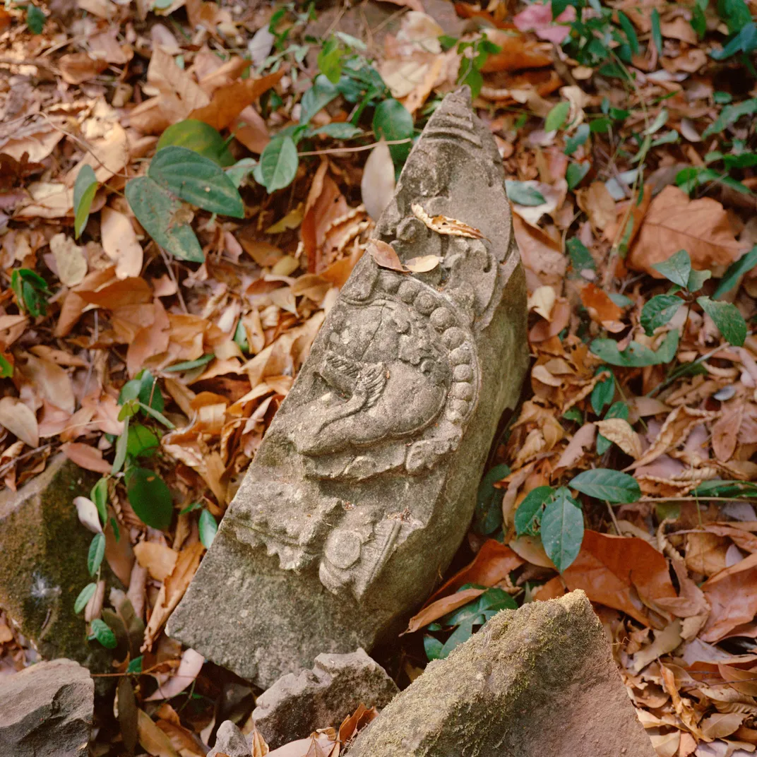
Another French archaeologist, Philippe Stern, trekked to the top of the Phnom Kulen plateau in 1936, and in five weeks of excavations he and his co-workers uncovered the ruins of 17 Hindu temples, fallen carved lintels, statues of the Hindu god Vishnu, and remnants of a great stone pyramid. Stern believed that he had located Mahendraparvata. But the temples of Angkor, built on a more accessible flat plain and visible on a larger scale, were more compelling to archaeologists, and the excavations at Phnom Kulen never advanced much beyond Stern’s initial dig. Then came decades of neglect and horror.
In 1965, at the height of the Vietnam War, Norodom Sihanouk allowed the North Vietnamese to set up bases inside Cambodia to attack the U.S.-backed South Vietnamese Army. Four years later, President Nixon escalated a secret bombing campaign of Cambodia, killing tens of thousands and helping to turn a ragtag group of Communist guerrillas into the fanatical Khmer Rouge. This radicalized army marched into Cambodia’s capital, Phnom Penh, in April 1975, declared the Year Zero, emptied out cities and herded millions into rice-growing communes. About two million people—nearly one-quarter of the population—were executed or died of starvation and disease before the Vietnamese toppled the Khmer Rouge in 1979. Phnom Kulen became the last sanctuary of the Khmer Rouge, and their leader, Pol Pot, known as Brother Number One. The last of the guerrillas didn’t surrender and descend from the plateau until 1998—Pol Pot died that year near the Thai border, not far from Phnom Kulen—leaving behind a traumatized population and a landscape strewn with unexploded ordnance.
Chevance reached Phnom Kulen in 2000, while conducting research for advanced degrees in Khmer archaeology. “There were no bridges, no roads; it was just after the end of the war,” Chevance says as we eat steamed rice and pork with members of his staff, all of us seated on the wood-plank floor of a traditional stilted house, their headquarters in Anlong Thom, a village on the plateau. “I was one of the first Westerners to go back to this village since the war began,” Chevance says. “People were, like, ‘Wow.’ And I had a coup de foudre—the feeling of falling in love—for the people, the landscape, the architecture, the ruins, the forest.”
It wasn’t until 2012, though, that Chevance marshaled high-tech evidence for a lost city, after he teamed up with Evans, who is based in Siem Reap with the French School of Asian Studies. Evans had become fascinated by Lidar (for Light Detection and Ranging), which uses lasers to probe a landscape, including concealed structures. Mounted on a helicopter, the laser continually aims pulses toward the ground below, so many that a large number streak through the spaces between the leaves and branches, and are reflected back to the aircraft and registered by a GPS unit. By calculating the precise distances between the airborne laser and myriad points on the earth’s surface, computer software can generate a three-dimensional digital image of what lies below. Lidar had recently revealed details of the Mayan ruins of Caracol in Belize’s rainforest, and exposed La Ciudad Blanca, or The White City, a legendary settlement in the Honduran jungle that had eluded ground searches for centuries.
The jungles of Kulen presented a problem, however: Rampant illegal logging of valuable hardwoods had stripped away much of the primary forest, allowing dense new undergrowth to fill in the gaps. It was unclear whether the lasers could locate enough holes in the canopy to penetrate to the forest floor. Despite skepticism, Evans, with help from Chevance, raised enough money to survey more than 90,000 acres in both Phnom Kulen and Angkor. “The whole thing was pulled together with chewing gum and duct tape,” Evans says.
In April 2012, Evans joined Lidar technicians as they flew in a helicopter at 2,600 feet in a crosshatch pattern over Phnom Kulen. About two months after the overflights, Evans, awaiting the processing of visual data they had collected, switched on his desktop. He stared “in astonishment,” he says, as the ghostly legendary kingdom resolved before his eyes into an intricate cityscape: remnants of boulevards, reservoirs, ponds, dams, dikes, irrigation canals, agricultural plots, low-density settlement complexes and orderly rows of temples. They were all clustered around what the archaeologists realized must be a royal palace, a vast structure surrounded by a network of earthen dikes—the ninth-century fortress of King Jayavarman II. “To suspect that a city is there, somewhere underneath the forest, and then to see the entire structure revealed with such clarity and precision was extraordinary,” Evans told me. “It was amazing.”
Now the two archaeologists are using the Lidar images to understand how Mahendraparvata developed as a royal capital. The early water-management system they now saw in detail demonstrates how water was diverted to areas on the plateau that lacked a steady flow, and how various structures controlled supplies during rainless periods. “They employed a complex series of diversions, dikes and dams. Those dams are huge, and they required huge manpower,” Chevance says. At the dawn of the Khmer Empire, he goes on, “They were already showing an engineering capacity that translated into wealth and stability and political power.”
The Lidar imagery also has revealed the presence of dozens of ten-foot-high, 30-foot-wide mounds in symmetrical rows on the jungle floor. Chevance and Evans at first speculated that they were burial sites—but, in succeeding excavations, they found no bones, ashes, urns, sarcophagi or other artifacts to support that hypothesis. “They were archaeologically sterile,” says Evans. “They are a mystery, and they may remain a mystery. We may never know what those things are.” Lidar surveys of Angkor also detected several mounds that are virtually identical to those at Phnom Kulen—just one of many startling similarities of the two cities. Indeed, as the archaeologists studied the images of Mahendraparvata, they realized with a flash of insight that they were looking at the template for Angkor.
**********
Chevance and I set out on dirt bikes, bouncing over rickety wooden bridges that cross silt-laden streams, groaning up steep hills and plunging down switchback trails hemmed in by dense stands of cashew trees (grown illegally in this reserve). In one large clearing we come across the discarded remnants of huge mahogany trees that have been felled with a chain saw, cut into pieces and dragged out in ox carts. Chevance suspects the culprit is an affluent resident in the village of Anlong Thom, but says that fingering him will be pointless. “We will send a report to a government minister, but nothing will change,” he says. “The rangers are on the take.”
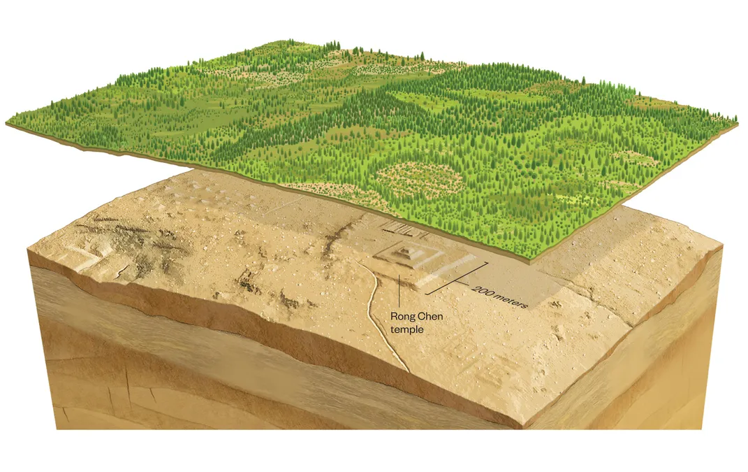
At the highest point on the plateau, Chevance leads me on foot up a slope to a monumental five-tiered platform made of sandstone and laterite (a rusty-red rock): the mountaintop pyramid of Rong Chen. The name translates as Garden of the Chinese, and refers to a local myth in which Chinese seafarers smashed their ship against the mountaintop at a time when an ocean supposedly surrounded the peak. It was here, in A.D. 802, according to an inscription in Sanskrit and ancient Khmer found in an 11th-century temple in eastern Thailand, that Jayavarman II had himself consecrated king of the Khmer Empire, at that time a dominion probably a bit smaller than contemporary Cambodia. And it was here, too, that the king created a cult of divinely ordained royal authority. More than 1,200 years later, in 2008, Chevance had arrived at the mountaintop with a team of 120 locally hired laborers. Government experts demined the area; then the team began digging. The excavation suggested that it was the centerpiece of a royal metropolis—a conviction later confirmed by the Lidar overflights. “You don’t build a pyramid temple in the middle of nowhere,” Chevance tells me. “It’s an archaeological type that belongs to a capital city.”
Today Rong Chen is a darkly numinous place, where the glories of an ancient Khmer civilization collide with the terrors of a modern one. Unexploded mines still lie buried here—the result of Khmer Rouge efforts to protect their mountain redoubt from assault. “We saw a few mines at the last moment when we were doing the excavations,” Chevance tells me, warning me not to venture too far from the pyramid. “Most of the villages on Phnom Kulen were mined. The road between the villages was mined.”
The hilltop camp afforded the Communist fighters a sanctuary near the strategic city of Siem Reap, then in government hands, and served as the base from which the Khmer Rouge carried out acts of sabotage—including blocking a spillway that carried water from Phnom Kulen into the city. “They prevented water from reaching Siem Reap, and the Cambodian Army knew that.” The result, Chevance says, was that the mountain was bombed. “You can still find B-52 bomb craters here.”
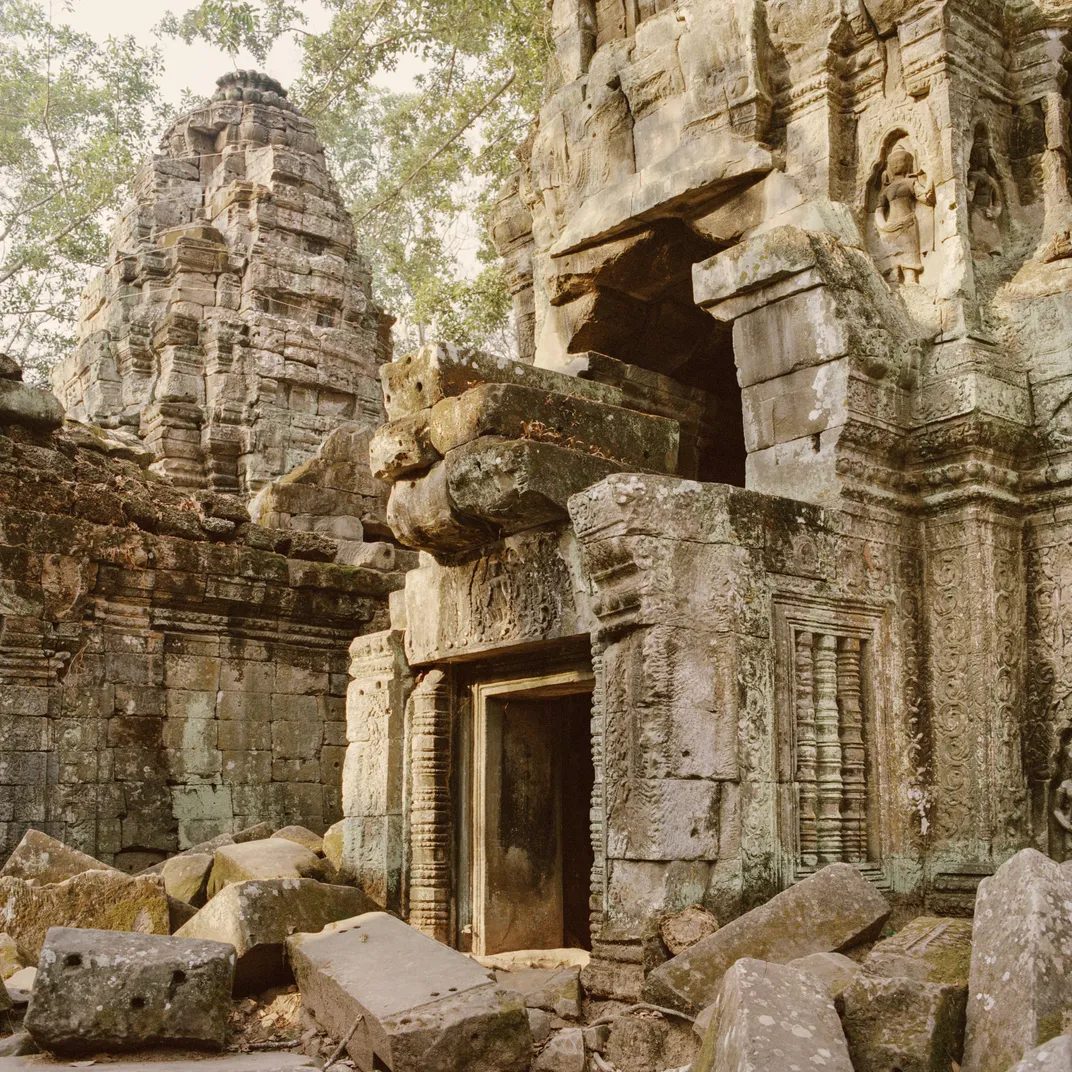
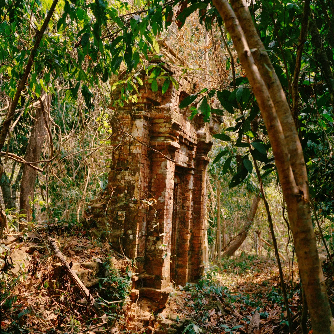
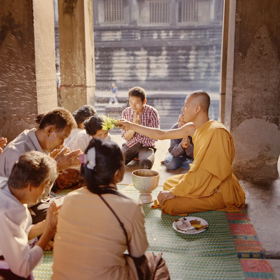
Chevance and I get back on our dirt bikes and bounce down a path to the best-preserved remnant of Jayavarman II’s capital: an 80-foot-high tower, Prasat O Paong (Temple of the Tree of the Small River), standing alone in a jungle clearing. The facade of the Hindu temple glows a burnished red in the setting sun, and intricate brickwork reaches to the apex of the tapered column. Ceramics inside this and other temples excavated on Phnom Kulen prove that they remained pilgrimage sites as late as the 11th century—an indicator that the structures continued to influence the rest of the Khmer Empire long after Jayavarman II moved his capital from Phnom Kulen to the Angkor plain and the city’s original population had disappeared.
**********
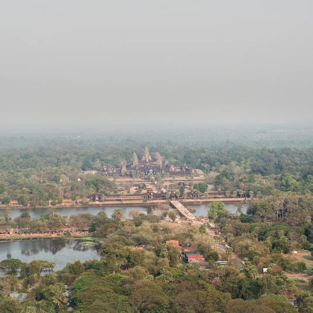
Angkor—which Chevance and Evans describe as “an engineered landscape on a scale perhaps without parallel in the preindustrial world”—is a place that inspires superlatives. Achieving its apogee in the late 12th and early 13th centuries, the site, at its peak, was an urban center extending over nearly 400 square miles. Chevance leads me up the near-vertical stone steps of Pre Rup, a soaring tenth-century structure with a platform made of laterite and sandstone. It represents a transition point, a synthesis of the two extraordinary temples we explored on the plateau, Prasat O Paong and Rong Chen. “It is a pyramid with three levels,” Chevance tells me, as we clamber among the deserted ruins in the heat. “On top you also have five towers similar to the ones we saw on the mountain. It is a combination of two architectural styles.”
As has now become clear, thanks to Lidar, Phnom Kulen, faintly visible on the horizon 25 miles away, influenced far more than the later city’s sacred architecture. To support Angkor’s expanding population, which may have reached one million, engineers developed a water-distribution system that mirrored the one used on the plateau. They collected water from the Siem Reap River, a tributary of the Mekong, that flows from the plateau, in two enormous reservoirs, then built an intricate series of irrigation channels, dams and dikes that distributed water evenly across the plain. Although Angkor’s soil is sandy and not highly fertile, the masterful engineering allowed farmers to produce several rice crops annually, among the highest yields in Asia. “The secret to their success was their ability to even out the peaks and troughs seasonally and annually, to stabilize water and therefore maximize food production,” Damian Evans tells me.
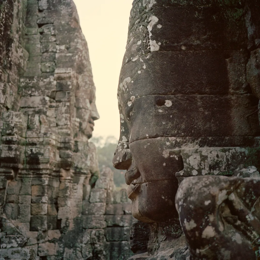
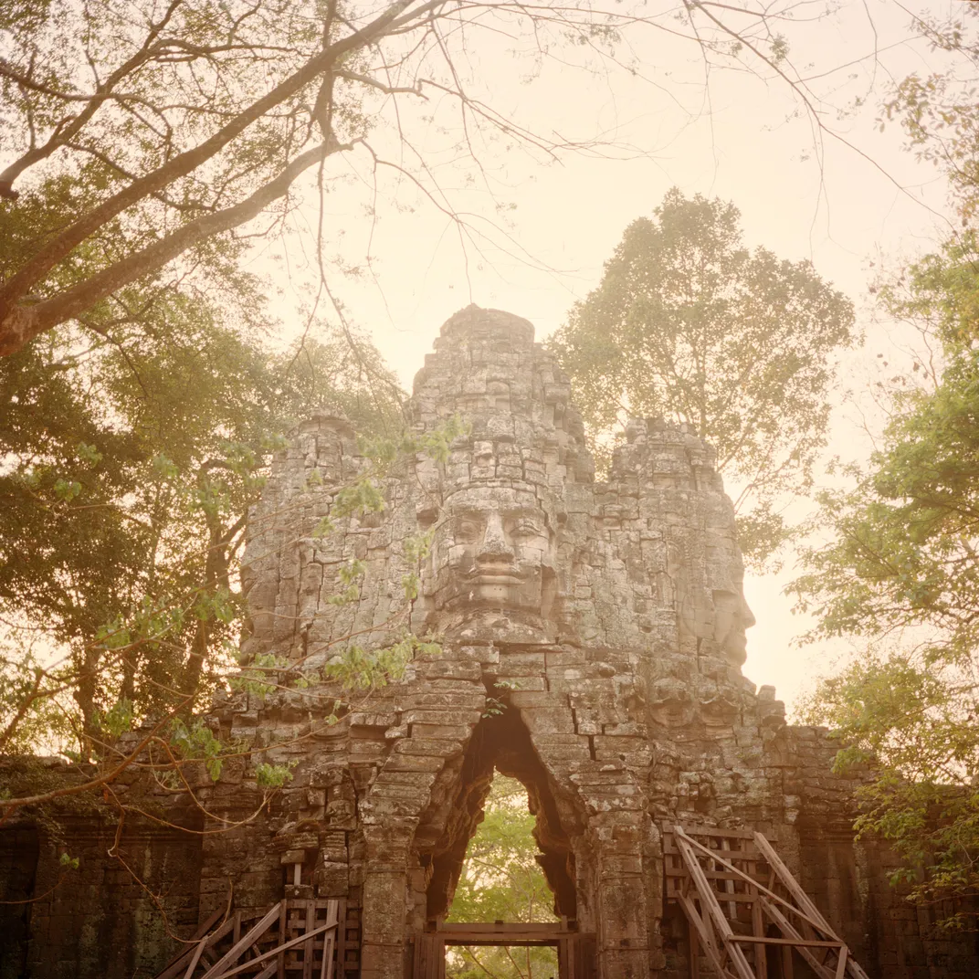
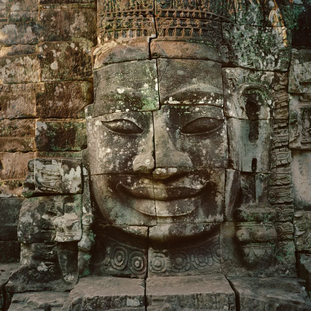
Angkor was at its height during the reign of Jayavarman VII (circa 1181-1220), regarded by scholars as the greatest king of the Khmer Empire. Two days after my arrival in Angkor, I’m standing with Evans on the highest platform of the king’s masterpiece, the temple known as the Bayon. Evans gestures across a stunning tableau of sandstone terraces, pillars and towers, as well as galleries carved with bas-reliefs depicting warriors marching into battle. “No king who came afterward ever built on this scale again,” says Evans. Jayavarman VII, who made Mahayana Buddhism the Khmer Empire’s state religion, grafted what are commonly believed to be his own features onto a serenely smiling Buddhist divinity. Its massive stone face beams in dozens of iterations throughout this complex, radiating compassion and kindness across the four corners of the empire.
It is here, in the heart of Jayavarman VII’s capital, that the histories of Angkor and Mahendraparvata converge most powerfully. “You are looking at cities that are widely separated in space and time,” Evans tells me. “But each has an urban core defined by a grid of streets and a central state temple—the Bayon here, Rong Chen there—at the center.”
Yet the Lidar data show that the cities followed divergent paths. While Mahendraparvata was a masterpiece of urban planning, with temples and dwellings carefully laid out by Jayavarman II around wide boulevards—a Khmer version of Haussmann’s Paris—Angkor developed haphazardly. Densely populated neighborhoods of wooden houses squeezed against the edges of the Bayon. Evans describes Angkor as a “messy aggregation of centuries of development, with features superimposed one on top of another.”
Beneath the jungle canopy south of the city, Evans’ Lidar surveys have detected huge spirals inscribed into the landscape, covering one square mile, reminiscent of the ancient geoglyphs discovered in the Nazca Desert of southern Peru. Like the mystery mounds, the spirals contained no artifacts, no clues about their function. “They could have a meaning encoded in them that may never be known,” Evans says.
**********
The sheer ambition of the Khmer kings, their re-engineering of a jungled landscape into an urban one, sowed the seeds of destruction. New research has provided a clearer picture of the sequence of events that may have doomed Mahendraparvata. The Lidar data revealed that its population didn’t engage in terraced rice farming in their mountain metropolis—which meant that they almost certainly relied on slash-and-burn agriculture. That would have depleted the soil rapidly, and probably contributed to the decline and fall of the city. The evidence backs up research conducted by Chevance and a colleague, who analyzed soil samples taken from a reservoir on Phnom Kulen. Evidence showed that vast amounts of soil and sand “got washed down the valley, indicating deforestation,” says Chevance. Soil from a later date contained a high concentration of jungle vegetation, which suggests that the land had been abandoned and taken over again by the tropical forest.
In the case of Mahendraparvata, this process likely occurred more rapidly than at Angkor—a major population center for about 600 years—where decline came more slowly. Over time, the artificially engineered landscape almost certainly led to topsoil degradation, deforestation and other changes that drastically reduced the capacity to feed the population and made Angkor increasingly difficult to manage.
Leaders of the rival kingdom of Ayutthaya, in what is now Thailand, sacked Angkor in 1431. It was abandoned and left to decay, doomed to the same fate as its predecessor, Mahendraparvata. “There are in the kingdom of Cambodia the ruins of an ancient city, which some say was constructed by Romans or by Alexander the Great,” the Spanish explorer Marcelo de Ribadeneyra wrote when he chanced upon Angkor nearly two centuries later. “It is a marvelous fact that none of the natives can live in these ruins, which are the resorts of wild beasts.”
“There are still many questions to answer,” Chevance tells me. “We know more about temples and kings than everyday life.” When it comes to the inhabitants of Mahendraparvata, Chevance adds, a fundamental question underlies his work: “How did they live?”
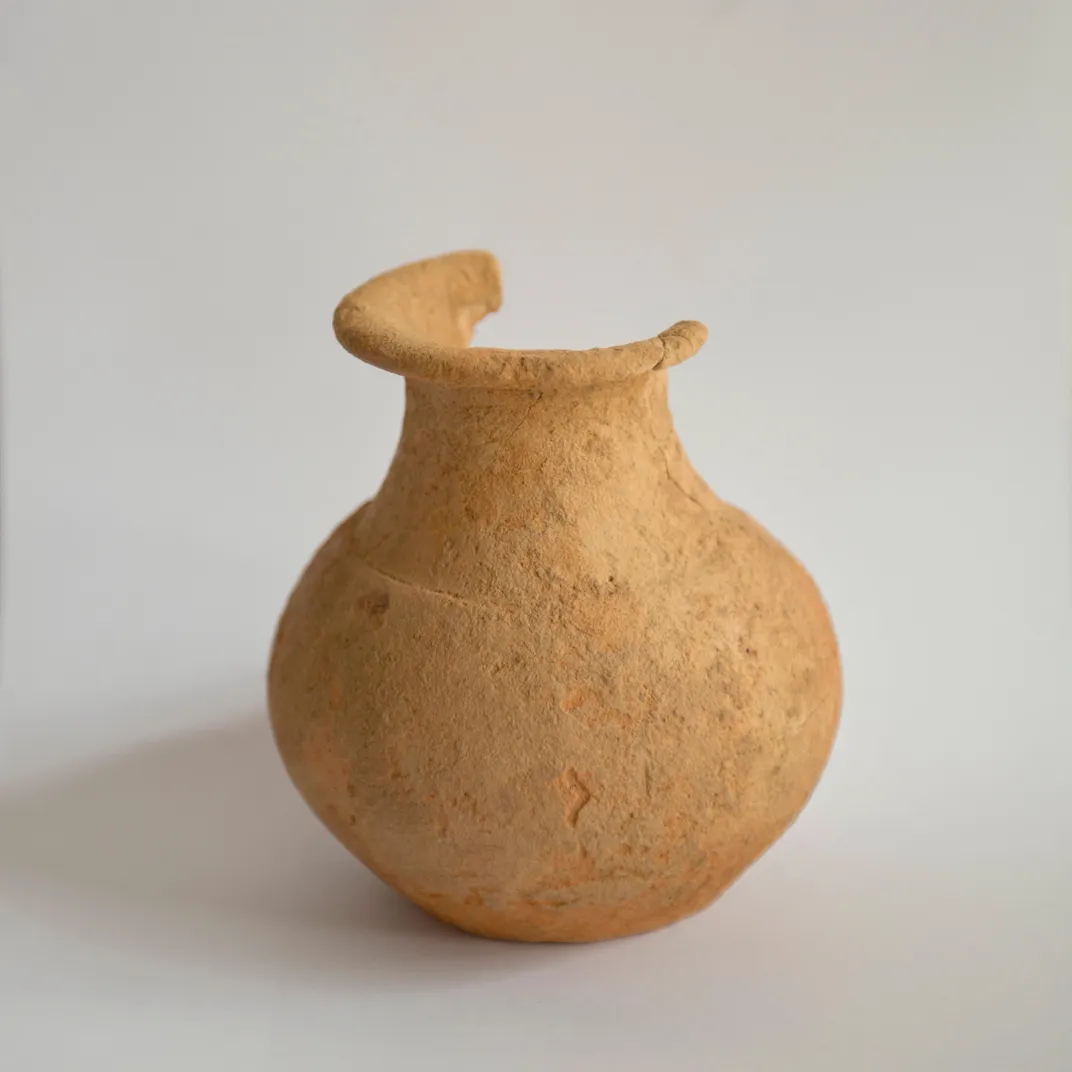
Answering that query will be difficult, because few traces of ordinary Khmer life remain: While temples —built for the ages—endure, Mahendraparvata’s population constructed their dwelling places out of wood, which rotted away long ago. Even the royal palace, which probably employed thousands of people, has been reduced to a few crumbling platforms, pavements, gutters, dikes and roof tiles.
Last year, as part of the Cambodian Archaeological Lidar Initiative, Evans and Chevance conducted a new series of helicopter surveys of Phnom Kulen to take in “the entire mountain range,” says Evans—more than 100 square miles encompassing archaeological sites, rock quarries and traces of ancient cities. The CALI project also included overflights to investigate ancient provincial centers of military and industrial significance, as well as the Khmer capital of Sambor Prei Kuk, 100 miles south of Angkor. The city endured from the seventh to the ninth centuries, declining just as Angkor was on the rise. In total, the CALI campaign covered more than 700 square miles.
Ten ground teams worked alongside the aerial survey teams in remote areas, and in extreme heat, refueling choppers, conferring with local authorities, collecting precision GPS data at ground stations, and persuading local people to stop burning off forest, so that flights relying on aerial sensors would not have the ground obscured by smoke.
The result of this ambitious effort, funded by the European Research Council, was a “unique archive,” says Evans, of the ways that human beings transformed the natural environment and shaped Khmer history over 2,000 years. The results will be published in a peer-reviewed journal later this year. Further surveys are planned using drones and satellites. Evans’ teams are currently on the ground across Cambodia, investigating surface remains shown by Lidar. This ambitious effort, he believes, eventually will reveal the entire mosaic of Southeast Asia’s greatest civilization, only now beginning to come into focus. Ultimately, he believes, what will emerge is a dazzling, nuanced understanding of a “complex hierarchy with an unmatched scale.”
Related Reads

Temple of a Thousand Faces
/https://tf-cmsv2-smithsonianmag-media.s3.amazonaws.com/accounts/headshot/Screen_Shot_2021-09-15_at_12.44.05_PM.png)
/https://tf-cmsv2-smithsonianmag-media.s3.amazonaws.com/accounts/headshot/SQJ_1510_Venice_Contrib_04.jpg)