John Smith Coined the Term New England on This 1616 Map
After Jamestown, Smith pushed the English to settle the northeast, identifying Plymouth as a suitable harbor four years before the Pilgrims landed there
/https://tf-cmsv2-smithsonianmag-media.s3.amazonaws.com/filer/2b/a7/2ba76be8-bf29-4e95-863f-d7945595db85/map-of-new-england.jpg)
On March 3, 1614, Captain John Smith set sail for Monhegan Island, a rocky outcrop ten miles off the coast of Maine. The spot was popular for fishing, and the funders of Smith’s voyage expected fresh whale on his return.
When Smith and the crew of his two whaling ships landed in what was then called Northern Virginia that April, however, they found rorqual and finback whales to be painfully difficult to catch. To make the trip worthwhile, most of the men fished and traded furs, while Smith and eight other shipmates explored the shore.
“I have a gut feeling that what Smith really wanted to do was the surveying anyway,” says Peter Firstbrook. “He wasn’t a fisherman. That was just an excuse to get him over there.”
Smith quickly discerned that the half-dozen maps of the region he had in his possession were useless, saying that they were “so unlike each to other; and most so differing from any true proportion, or resemblance of the Countrey, as they did mee no more good, then so much waste paper, though they cost me more.”
He and his foolhardy band of sailors, nonetheless, covered 350 miles, from the Bay of Fundy down to Cape Cod, in an open boat probably no more than 30 feet long. And, with a humble set of surveying tools—a crude compass, astrolabe, sextant, a lead line to measure depth, a quill pen and paper—they gathered notes for their very own map of what Smith named “New England.” The official map was published alongside Smith’s book, A Description of New England, in 1616.
“I have actually positioned modern maps against the 1616 map. When you get into detail, it varies—sometimes the islands aren’t in quite the right place or maybe they are bigger or smaller than they are. But, overall, within a 10 mile margin of error, it is remarkably accurate,” says Firstbrook, a former BBC filmmaker and a biographer of Smith. “It really was a fine achievement and much better than anything else that existed at the time.”
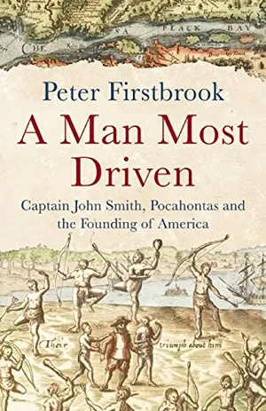
In his new book, A Man Most Driven: Captain John Smith, Pocahontas and the Founding of America, Firstbrook argues that historians have largely underestimated Smith’s contribution to New England. While scholars focus on his saving Jamestown in its first two harsh winters and being saved by Pocahontas, they perhaps haven’t given him the credit he deserves for passionately promoting the settlement of the northeast. After establishing and leading the Virginia Colony from 1607 to 1609, Smith returned to London, where he gathered notes from his exploration of the Chesapeake Bay and published his 1612 map of Virginia. He yearned for another adventure in America and finally returned in 1614.
When Smith was mapping New England, the English, French, Spanish and Dutch had settled in North America. Each of these European powers could have expanded, ultimately making the continent a conglomerate of similarly sized colonies. But, by the 1630s, after Plymouth and the Massachusetts Bay Colony were established, the English dominated the East Coast—in large part, Firstbrook claims, because of Smith’s map, book and his ardent endorsement of New England back in Britain.
“Were it not for his authentic representation of what the region was like, I don’t think it would be anywhere near as popular,” says Firstbrook. “He was the most important person in terms of making North America part of the English speaking world.”
Wary of Smith’s reputed temper, the Pilgrims passed him up in 1620 and instead recruited Myles Standish as sailing master for their journey to a new life. But in a nod to Smith’s charting skills, the religious separatists did purchase his map and notes of New England. It is hard to know if they actually had the map with them on their voyage. “They could well have left it behind and regretted it,” says Firstbrook. They were, after all, headed to the Hudson River, but storms altered their course, causing them to land 200 miles to the north in Plymouth.
Many believe that Plymouth was named after the Pilgrims’ port of departure in Plymouth, England, but Smith was actually the first to call the site “New Plimouth” on his map four years earlier. In fact, in A Description of New England, Smith astutely noted that Plymouth was “an excellent good harbor, good land; and now want of any thing, but industrious people.”
/https://tf-cmsv2-smithsonianmag-media.s3.amazonaws.com/accounts/headshot/megan.png)

/https://tf-cmsv2-smithsonianmag-media.s3.amazonaws.com/accounts/headshot/megan.png)