Smithsonian scientists help put endangered Myanmar species on the map
The Smithsonian Conservation Biology Institute (SCBI) is developing animal distribution maps as part of the Smithsonian Conservation Commons’ Working Landscapes initiative in Myanmar, helping stakeholders and decision makers make better choices regarding landscape management.
/https://tf-cmsv2-smithsonianmag-media.s3.amazonaws.com/blogging/featured/IMG_20181103_141129.jpg)
As long ago as the 1950’s, Smithsonian scientists were captivated by the vast biodiversity of Myanmar, the kite-shaped, northernmost country in Southeast Asia. In the past few decades, they have been involved in over 50 projects and discovered more than 70 new species of plants and animals.
Three years ago, Grant Connette, a postdoctoral fellow at the Smithsonian Conservation Biology Institute (SCBI), decided to figure out where Myanmar’s many unique and threatened species live. By developing animal distribution maps as part of the Smithsonian Conservation Commons’ Working Landscapes initiative, he helps stakeholders and decision makers make better choices regarding landscape management.
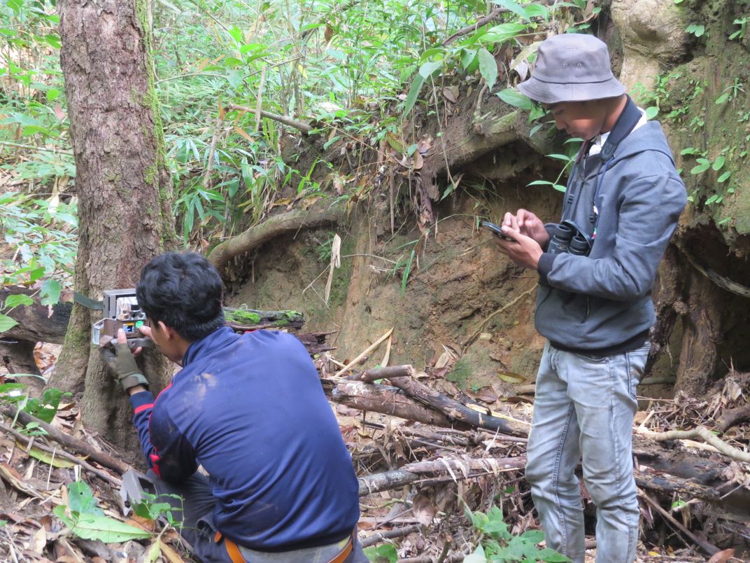
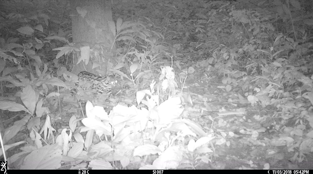
A fundamental aspect of his work is to collaborate with local conservation groups collecting camera trap photos of animals in different locations across the country and also to encourage data sharing. With the aggregated information, Connette can do larger analyses of the distribution of 50 mammals, almost half of which are threatened or endangered, including tigers, the Asian elephant, the dhole —a type of coyote—, the Malayan tapir and the banteng, a species of wild cattle.
“Each individual organization has done surveys in a small portion of these landscapes. Based on that, you can say very little about where these species occur and how they respond to different human impacts across the landscape, but when you put data together from 12 or 15 different sites, you have a really good picture of what’s driving the distribution of these species,” said Connette.
The mammal surveys have not only produced the best available maps detailing where species occur in Myanmar, but by showing what landscape factors drive their distributions, Connette’s data allows predictions of how animals respond to roads, villages and forest degradation. This helps people design better landscape management options.
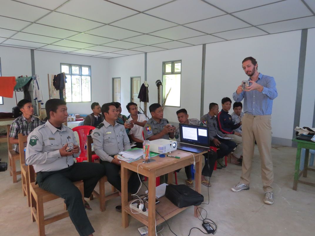
Birds are also getting a map. Grant, alongside Katie LaJeunesse Connette, SCBI international program manager for Myanmar, recently conducted a bird mapping workshop with 33 Burmese birdwatchers. A group including researchers, university professors and bird guides gathered around computers for five days to locate threatened and endangered bird species of Myanmar on a map.
They not only indicated where they had seen birds before, but where they believe birds could be found. All these inputs help feed a model that produces predictive maps for different birds, including species with little data available. The next step in the project would be to check the accuracy of the maps and the model through field work.
“We brought together this group of experts with great bird knowledge to do something bigger with that information. It will be useful both for the conservation of the species and for the bird watching community,” explained LaJeunesse Connette.
Complementing the bird and mammal mapping work, Grant published a land cover map for the southernmost state of Tanintharyi, where the last fragments of lowland evergreen forest remain in Southeast Asia; a type of forest known for having an overwhelming percentage of Myanmar’s biodiversity, yet it risks being cleared out for growing palm oil.
“It’s been a lot of work to just get to the point where we have the information we need to apply it to decision making about conservation and development in this region. Some of it is very practical and geared towards immediate landscape management and some other is setting the baseline for future work around landscape planning,” concluded Connette.
The Conservation Commons is an action network within the Smithsonian Institution (SI), highlighting the relevance of science and innovative interdisciplinary approaches across science and culture to on-the-ground conservation worldwide.