A Smithsonian magazine special report
Science and Tradition Are Resurrecting the Lost Art of Wave Piloting
Can Marshall Islanders’ unique heritage help them navigate a rising ocean?
/https://tf-cmsv2-smithsonianmag-media.s3.amazonaws.com/filer/98/aa/98aa0af5-7844-421b-959a-ccda00fd8300/pa011074.jpg)
The Republic of the Marshall Islands lies more than 2,000 miles from the nearest continent, a smattering of coral atolls engulfed by the vastness of the central Pacific Ocean. The islands are tiny, together encompassing just 70 square miles, and they’re remote, spread over 750,000 square miles of ocean. They’re also gorgeous—white sand beaches, tropical foliage, and lagoons so turquoise they seem to glow. Traveling through in the 19th century, Robert Louis Stevenson called the area the “pearl of the Pacific.”
But the 50,000 or so Marshallese who call these islands home live in one of the most challenging environments on Earth. With so little land surrounded by so much water, most activities—from trading to gathering food—require dangerous trips across the sea. Because most of the islands rise just seven feet above the waves, they’re impossible to spot from a distance. If you were on a boat scanning the horizon, you wouldn’t see an island until you were nearly on top of it.
That’s why it’s so astounding that seafarers from Southeast Asia discovered and colonized these island chains some 2,000 years ago—and even more so that they stayed, eking out a life defined more by water than earth. Before European colonization, Marshallese navigators routinely sailed dugout canoes across vast stretches of open water, landing precisely on the only atoll for hundreds or even thousands of miles. They did so through a system that anthropologists call wave piloting. Instead of relying on the stars to find their way, wave pilots steer by the feeling of the ocean itself.
Over the last 150 years, wave piloting was nearly lost. But today, Western scientists and the last of the Marshall Islands’ expert navigators are attempting to explain the physics that underlie this ancient art for the first time. As they translate it into scientific terms, they’re helping preserve an integral part of Marshallese identity—even as rising sea levels threaten to push more Marshallese away from their homes and their seafaring heritage.

When Alson Kelen was young, he used to lie at night against his father’s arm, on an island where there were no lights and no cars. The only sounds were waves slapping against wet sand, the breeze rustling through palm fronds, the delicate crackling of a coconut-shell fire. As the purple-blue evening gave way to night, Alson’s father would tell his son to close his eyes. And then he would tell stories about sailing, about flying on the wind, about surviving long and difficult journeys.
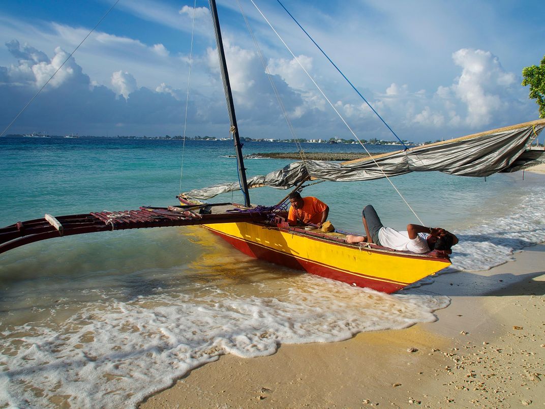
The island where Alson lived, Bikini, was a hub of traditional Marshallese navigation. In the old days, young men and women learning wave piloting would spend hours floating in the ocean blindfolded, memorizing the minute sensations of waves, currents and swells beneath them. Then they’d study stick charts—maps made of curved sticks that show the locations of islands and predominant swells—to place those waves in a larger mental geography. Later, if they became disoriented at sea, they could close their eyes and use the reflections and refractions of waves to determine the direction of land.
For generations, these skills were guarded like a family heirloom. But in the first half of the 20th century, under German, Japanese and eventually American occupation, they began to decline. Bikini, once a stronghold of sailing culture, became the center of nuclear testing by the United States. Between 1946 and 1958, the United States detonated 67 atomic bombs in the area. Communities like Alson’s were permanently displaced. The knowledge passed down for millennia “was fading away,” Alson says.
Across the world, equally sophisticated navigational systems have been pushed out by technology or lost through cultural oppression. But Alson had spent his whole life dreaming of canoes. In 1989, he launched a six-month program called Waan Aelõñ in Majel (Canoes of the Marshall Islands) that teaches life and job skills to local kids through building and sailing outrigger canoes. Roughly 400 teenagers and young adults have graduated from the program and canoes, once on the brink of disappearing, are now part of life in dozens of outer islands.
Alson’s passion also caught the attention of John Huth. The Harvard experimental particle physicist works at the Large Hadron Collider and helped discover the Higgs boson, and he has long been fascinated by indigenous navigation. How could Marshallese stick charts, for instance—made without GPS or compasses or even sextants—show the location of far-flung islands with almost precise latitudinal accuracy?
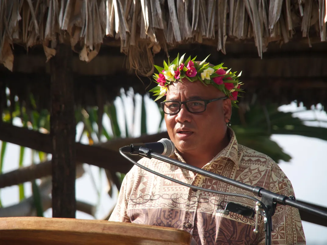
In 2015, Huth was invited to the Marshall Islands to join a 120-mile outrigger canoe voyage with Alson, Dutch oceanographer Gerbrant van Vledder, University of Hawaii anthropologist Joe Genz and one of the Marshall Islands’ last navigators, an elder who calls himself Captain Korent Joel.
"My attempt,” Huth later explained at a lecture, “was to unravel what seems to be a rather mysterious and somewhat fragmented tradition. … In a sense what I’m trying to do is help some of the last of the Marshall Islands’ navigators try to piece together some of their traditions by employing what science can bring to the topic.”
Huth and the other Western scientists are trying to understand the oceanography, wave dynamics, climatology and physics of wave piloting. It’s not a straightforward task. Captain Korent’s understanding of wave patterns, finely tuned from generations of keen observation, doesn’t always mesh with Western scientific concepts. Korent describes four main ocean swells, for example, while most sailors in the region can only sense one or two. Even computerized buoys dropped in the ocean fail to pick up the minute sensations Korent uses to navigate.
But the biggest mystery is a technique that allows a navigator to sail between any two islands in the Marshalls by identifying a ridge of waves, called a dilep, that seems to connect neighboring islands.
Korent’s explanation of dilep (or at least the translation of it) seemed to contradict basic wave dynamics. But as Huth lay awake in the hull of the chaser boat on the return leg of his journey last year, frantically scribbling wind speed and GPS coordinates into a yellow Rite-in-the-Rain notebook, he began to develop an idea that could explain dilep in scientific language for the first time. He’s reluctant to give too many details—it’s still unpublished—but he says that he thinks “it has more to do with the motion of the vessel and less to do with what’s happening with the swells.”
Huth hopes to return to the Marshalls to test this and other theories and eventually publish his hypotheses in a scientific journal. But his ultimate goal is to turn that academic paper into a layperson’s manual—a sort of "Introduction to Wave Piloting" that could be taught in Marshallese schools in the future.
As it stand today, generations of Marshallese may never get the chance to practice wave piloting. As sea levels rise, life in the Marshall Islands is becoming increasingly precarious. Several times a year the rising ocean floods peoples’ homes, washes out roads and destroys staple crops. More than a third of the population—some 25,000 Marshallese—have already emigrated to the United States, and the number is likely to grow.
Most climate experts predict that global sea-level rise will render the Marshall Islands uninhabitable by the end of this century. The government of Bikini is already petitioning the U.S. Congress to allow the island’s former residents to use a nuclear testing trust fund to buy land in the U.S. for relocation.
By giving wave piloting new life, Huth, Alson and others are helping displaced Marshallese maintain a link to their place in the world no matter where they wind up. Even though the specifics of Marshallese wave piloting are unique to the waters around the Marshall Islands, any form of cultural revival—from wave piloting to weaving—is also a form of climate adaptation, a way of surviving.
If the skills their ancestors clung to for so long are validated by some of the world’s greatest scientists, perhaps climate change won’t mean cultural genocide. Perhaps the Marshallese are voyagers, not victims, with the skills to push off into the unknown and thrive.