Here’s A Map of All the Trees in California
Every meter covered by trees shows up
/https://tf-cmsv2-smithsonianmag-media.s3.amazonaws.com/filer/86/f7/86f7300c-f4c8-4fd0-a0a1-c9586dc5f579/3498180845_b87e482153_o.jpg)
While towering redwood trees and their sequoia cousins may make up the most famous forests in California, the entire state has vast swaths of arboreal growth. There are the California sycamores, the evergreen live oaks, quaking aspens and more. In a new map from EarthDefine, a sensor data company, all those trees are included, at a 1-meter scale resolution.
Here is an overview image:
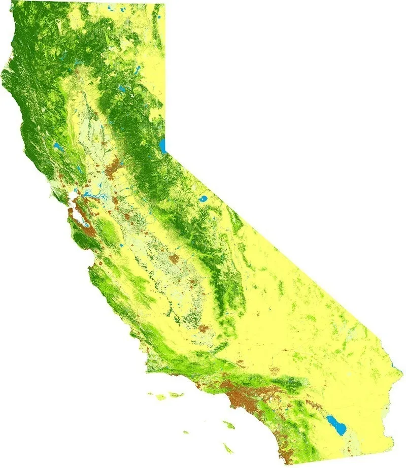
The map was built from aerial imagery from the National Agriculture Imagery Program, collected between May and October 2014 and run through EarthDefine’s data analysis and processing software. They are able to distinguish between trees, bare land, water, shrubs and more grassy areas as well as identifying impervious surfaces where rainfall runs off, including urban development. According to the company’s press release, the mapping effort is 30 times more detailed that current state-level datasets for California.
With that rich dataset, EarthDefine can show extremely detailed findings — such as this map of Sacramento’s urban forest, which covers 16.5 percent of the city’s area.
Gathering such detailed images and data about land cover is important for understanding how ecosystems function, where resources might be located and how that distribution changes over time. Already, the ongoing drought is killing trees in California’s national forests. In May, Veronica Rocha and Hailey Branson-Potts reported for The Los Angeles Times that at least 12 million acres in the state have already succumbed to drought. Maps and surveys are the only way that researchers can understand the scope of the problem.
This map in a snapshot in time of California’s trees that can be compared to the past and to the future.