Ecuador, Land of Malaria, Iguanas, Mangoes and Mountains
The author leaves Peru behind and crosses into Ecuador, where he encounters his first sign of a mosquito
/https://tf-cmsv2-smithsonianmag-media.s3.amazonaws.com/filer/20130123081111PeruMalariaSignSMALL.jpg)
We Enter Malaria Country The desert gave way to the muggy climes of the tropics, at last, in the northernmost 50-mile stretch of Peruvian coastline south of Ecuador. We had been pedaling past cacti in the morning and hadn’t seen a sign of a mosquito in Peru—until that afternoon, when we passed a billboard reminding travelers to defend themselves against malaria. We noted the warning—but anyone who has toured on a bicycle knows that stopping to dig through panniers is a chore best deferred until a later time. “We’ll take our malaria pills tonight,” I shouted to Andrew. Thirty feet ahead of me, he answered with a thumbs up.
Near dusk, we turned toward the coast to stay the night at Puerto Pizarro. We headed down the side road and noted signs for mangrove swamp tours. We realized that malaria country had sneaked up on us—bad news when preventative pills are to be taken daily beginning 24 hours before arrival in the malaria region. Entering town, we encountered a pair of cops who waved us to the side of the road and warned us to get inside quickly, before it got dark. “Ah, yes—mosquitoes,” I said. “No—people here will see the gringos and try to rob you,” one of the men answered. They directed us to a hotel. After paying, we hurried across the courtyard to our room—a separated cabin with three beds and a bathroom for $20. Andrew fumbled with the key. “Quick, there are mosquitoes,” I said. He dropped the keys as he slapped one on his arm. “Bug spray!” he yelped and unzipped his pannier. I went into my own saddlebag for my malaria pills. I shook out two of the shiny red tablets and handed one to Andrew along with some bubbly water. He said, ”I don’t think this is textbook malaria prevention,” but took the medicine anyway. We opened the door, shoved in and slammed it behind us.
We were in the tropics. A brief warm rain fell that night, and in our bungalow beds, sweating in the humidity, we studied our map. We had just 20 kilometers to the border. We would be in Ecuador by noon.

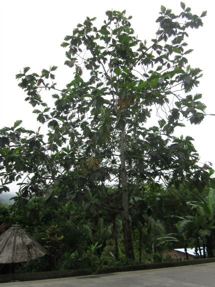
We Enter Ecuador The next day, after passport control, the landscape transformed dramatically and rapidly. Large trees with splayed out trunks like buttresses stood grandly in fields, outliers of the rainforest. Other trees, with huge and voluminous canopies, grew on one side of the Pan-American Highway while their long, graceful branches dropped fruit pods on the other side. Banana orchards began, and continued for miles. Scattered among them were cacao trees, with large football-shaped red pods hanging from the branches, and vast sugar cane fields. Breadfruits dangled from elegant but wildly prehistoric-looking trees 70 feet tall with leaves like fan palms. Large green iguanas skittered across the road. Road-killed animals the size of sea otters with shiny black tails lay on the shoulder—some sort of jungle beast we couldn’t recognize. And while plant life fought for elbow room on almost every square foot of soil, that supreme conquistador of invasive species grew in groves—the eucalyptus tree. The people looked and behaved differently than in Peru, too. There was an obvious African origin in many of the locals we greeted as we rode. They honked their horns less—much less—as well. We also encountered more and more men and women carrying machetes, pocketknives of the jungle. Several miles to the east, across the banana plantations, the Andes began as an abrupt bluff blanketed with forest and disappearing into the rain clouds. Roadside households offered direct sales of fruits grown in the backyard. Avocados, watermelons, mangoes and pineapples lay in piles outside front doors, as did Pepsi bottles full of sugar cane juice. We needed money, and in a town called Pasaje we approached an ATM by the main square. I entered and removed my card, typed in my pin and waited for what riches would emerge. The machine sputtered and rumbled and emitted a smashing surprise—American dollars.

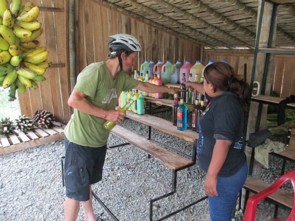
We found beautiful bunches of bananas for sale at roadside fruit shacks—and they were hilariously cheap. A cluster of 25 red bananas—the specialty sort that fancy groceries in the States sell for $1.80 per pound—cost us 50 cents. The same shack was also offering traga, cane sugar-based alcohol infused with different fruits, like grape, apple, watermelon and cacao. We bought a bottle of banana traga and moved onward. We stopped for lunch under a bus shelter, and a local man named Antonio came out of a home with his two kids to meet us. We asked him about local fauna—especially bears and jaguars. Long ago these animals occurred here, he said, but people have shot them all. “But up there, jaguars and bears still live,” Antonio said, pointing toward the mountains.

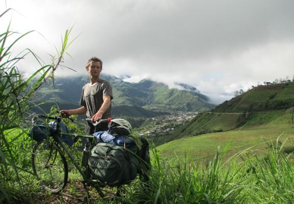
We Enter the Andes Our destination was Quito in five days, and after 200 miles of pedaling through Ecuador’s muggy, hot lowlands, our road led into the Andes. Our spirits rose with the altitude, and we realized we’d been sorely missing the mountains for two weeks. But cycling in the Andes is not quite like cycling in other ranges. In the Pyrenees, the Alps, the Rockies, the Sierras, the Toros—in nearly any range of large mountains in the world, a cyclist can say with certainty after several hours of hard climbing that the top of the pass is near. Not so in the Andes, where even the lower of the many mountain passes are higher than the highest summits of other ranges. Climbing from La Troncal over the mountains and eventually into the so-called Avenue of the Volcanoes, we saw an amazing transformation of the land. Whereas the lowlands teemed with bananas, iguanas, mangoes and malaria, two miles above we saw country with a strong resemblance to Mediterranean Europe. Cows grazed on green mountainsides among scattered pines. Trout streams flowed out of the canyons. Plum and apple trees grew in yards. The clouds broke occasionally, offering staggering views of the land’s vertical relief. Vast chasms plummeted into V-shaped stream valleys, towns and shacks clinging to the slopes, while the peaks vanished above into the fog. At several points we were able to see what lay ahead—miles and miles more of steady ascent, with no switchbacks in sight.
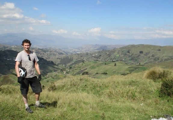
Descending trucks spewed the smell of burning brake pads. Motorcyclists dropping out of the high country were bundled up like Ernest Shackleton. The summit, obviously, was still hours away. But the monotony, the gasping for air, the slow, slow pedaling, our aching necks—it all finally ended as we crested out on the top of the pass. Trucks, buses and cars honked their congratulations. We believe the elevation there was about 12,700 feet. On the north side were checkerboard farms and villages scattered over rolling hills and looking like Ireland. Beyond, the titans of the Andes loomed, snow-covered volcanoes three miles high and more. The summit of Chimborazo, the highest mountain in Ecuador at 20,500-something feet (sources give varying heights), hid behind a veil of clouds. Due to the shape of the Earth and its equatorial bulge, Chimborazo’s peak is the Earth’s closest point to the sun.

Speaking of the sun, it does amazing things in Ecuador’s highlands. Its path leads it high overhead every day of the year, coaxing plant life into bloom that could never live at such altitudes elsewhere. We saw fig and avocado trees sagging with fruit at almost 10,000 feet—an elevation at which even pine trees struggle to grow in the middle latitudes. And whereas grapevines go dormant each winter in most places, farmers in Ecuador—and winemakers—may harvest two crops per year. The sun is so powerful here that it even burned us through our T-shirts.
Up Next: We Enter the City of Quito
Planning Your Next Trip?
Explore great travel deals
Smithsonian magazine participates in affiliate link advertising programs. If you purchase an item through these links, we receive a commission.
/https://tf-cmsv2-smithsonianmag-media.s3.amazonaws.com/accounts/headshot/Off-Road-alastair-bland-240.jpg)
/https://tf-cmsv2-smithsonianmag-media.s3.amazonaws.com/accounts/headshot/Off-Road-alastair-bland-240.jpg)