These Are All the Places in the United States Where Nobody Lives
There are still plenty of empty census blocks out West
:focal(642x336:643x337)/https://tf-cmsv2-smithsonianmag-media.s3.amazonaws.com/filer/59/7f/597f5cff-dd2c-40ba-9145-a2c3c8fbb6bc/census0pop-mapsbynik-rev140420a.jpg)
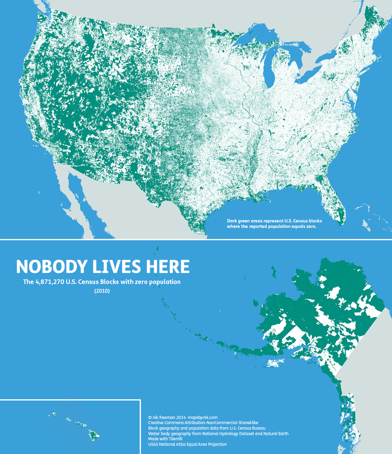
Usually on maps, we see the places where people live. But mapmaker Nik Freeman decided it would be interesting to see where people don’t live. By taking data from the U.S. census blocks, the smallest designation available, Freeman mapped out the entire country. You can see the result above: anywhere that is green is a place where people don’t live.
But just because a square is green, that doesn’t mean that there aren’t any people there. Freeman explains on his blog:
Commercial and industrial areas are also likely to be green on this map. The local shopping mall, an office park, a warehouse district or a factory may have their own Census Blocks. But if people don’t live there, they will be considered “uninhabited”. So it should be noted that just because a block is unoccupied, that does not mean it is undeveloped.
Perhaps the two most notable anomalies on the map occur in Maine and the Dakotas. Northern Maine is conspicuously uninhabited. Despite being one of the earliest regions in North America to be settled by Europeans, the population there remains so low that large portions of the state’s interior have yet to be politically organized.
Freeman also noted the line that divides the Dakotas as being strangely stark, though he later updated his blog with a possible reason for the stark line. It appears that while North Dakota has small census blocks, South Dakota’s are much larger, so South Dakota might appear more populated by default. But, compared to parts of Canada, even North Dakota can seem positively populated.