Going the Distance on the Pacific Crest Trail
One of America’s great long-distance hiking trails, the PCT meanders 2,650 miles through three states
/https://tf-cmsv2-smithsonianmag-media.s3.amazonaws.com/accounts/headshot/Off-Road-alastair-bland-240.jpg)
/https://tf-cmsv2-smithsonianmag-media.s3.amazonaws.com/filer/20130408124115PCT_Sign2.jpg)
The concept is alluringly simple: Leave your home, your television, your laptop, your job, put on a backpack and walk from Mexico to Canada.
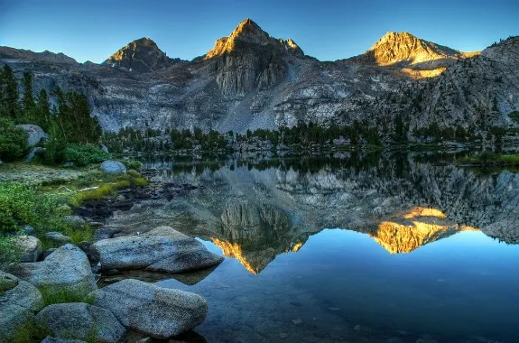
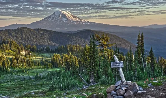
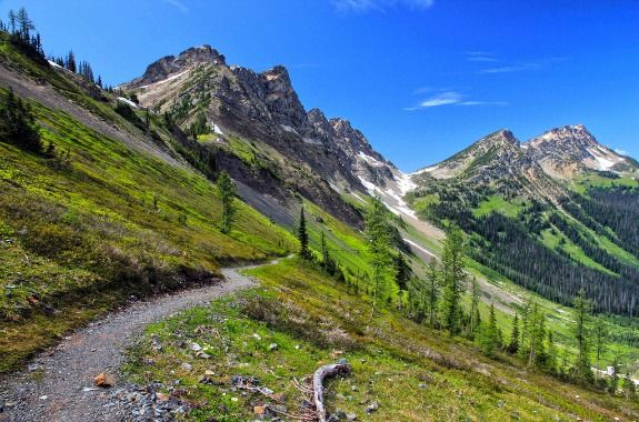
That, in a sentence, describes the experience of walking the Pacific Crest Trail. Usually called the PCT, this epic foot trail meanders 2,650 miles through three states, from Campo, California, to E.C. Manning Provincial Park, in British Columbia. Many thousands of people walk some portion of the trail each year, whether in California, Oregon or Washington, while several hundred attempt to go the full distance. Hikers intending to do so must be fit, brave, ambitious and—at least for a while—unemployed. They must also undertake some serious planning as they begin what will likely be the greatest outdoors adventure of their lives. The PCT is one of America’s three great long-distance north-south hiking trails, along with the Continental Divide and the Appalachian trails. The PCT passes among the world’s largest trees, some of the most fantastic rock formations and one of the driest deserts. It crosses one of North America’s largest rivers, and traverses a wide range of climates and landscapes, from low-lying to deserts to craggy high country to well-watered, mossy forests.
Most people who hike the PCT walk south to north, and for them, the adventure is about to start. Most will depart before May. This allows them to begin when the desert temperatures are still mild and progress northward rather in sync with the warming weather. The April-May start time also works out especially nicely by putting northbounders at the south end of the Sierra Nevada just as the high country snowpack really begins to melt, and if they stay on schedule they should pass through the Pacific Northwest before the first autumn snows.
Jack Haskel, a staff member with the Pacific Crest Trail Association, told Off the Road that several thru-hikers are already a few hundred miles into their walk.
“It’s been a low-snow year, which makes it a decent year to get an early start,” he said.
Hikers must handle some paperwork before they begin—but, happily, bureaucratic obstacles are quite minimal. The PCT Association will grant a PCT Long Distance Permit to anyone planning to walk at least 500 miles of the trail. This document is free, takes two to three weeks to process and paves the way for a hiker to walk every inch of the PCT.
Logistically speaking, now comes the fun stuff—bears, food supplies, dangerous terrain and running out of water. Haskel says there are, in particular, two waterless distances of about 30 miles in the Southern California desert where hikers must tote gallons at a time.
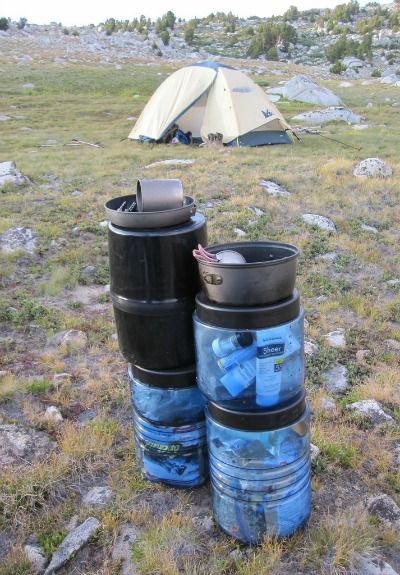
Once hikers reach the Sierra Nevada, a simple water filtering pump can be used at any of hundreds of lakes and streams along the way—but rations now become the biggest priority. North of Kennedy Meadows, hikers cross not a single road for about 200 miles and, unless they trek off-trail to a town, may need to carry with them some 60,000 calories of food a person. Such deliciously laden hikers are gold mines of goodies for black bears, which don’t pose much of a physical threat to people but may easily rob hikers of their supplies if they leave them unguarded—even for just a few moments, whether day or night. Bears, Haskel warns, can be especially problematic near the Rae Lakes in Kings Canyon National Park and in Yosemite National Park’s Lyell Canyon. In places, a plastic bear canister is required—and hikers would be wise to carry one of these bear-proof food containers throughout their journey.
About 1,000 people apply for thru-permits each year. Between 500 and 800 individuals attempt the journey. Fewer than half of them finish each year. The average thru-hiker will take about five months to walk the entire trail, averaging 20-plus miles a day after factoring in rest days. Haskel says many hikers begin at a pace of 16 or 17 miles per day but, by the time they reach Oregon, “are basically doing a marathon every day.” He says the PCT is “an amazing workout” and that thru-hikers can expect to arrive at the finish line “skinny” and, perhaps, fitter than they’ve ever been. Thru-hikers, by virtue of their lifestyle, become voracious eaters, burning 5,000 calories or more per day and, when they’re able, regaining this energy through glorious, face-stuffing feasts. Fortunately, hikers will encounter towns with quality stores and restaurants every few days for most of the PCT’s length. The PCT Association’s website offers guidelines and strategy suggestions for resupplying along the trail.
One need not be starving—just bored of couscous and curry—to stop and eat one of the most famous meals along the entire PCT, the Pancake Challenge at Seiad Valley Store and Cafe, on the Klamath River in Northern California. The Challenge consists of putting down five one-pound pancakes—a feat that perhaps only a thru-hiker (or a black bear) could ever manage. Walking Man Brewing Company, in Stevenson, Washington, is a popular watering hole for PCT hikers. Haskel also recommends Paradise Valley Cafe, near the San Jacinto Mountains in Southern California, popular among hikers for its burgers.
A small fraction of PCT hikers—perhaps just several dozen people—hike the trail north to south, starting at the Canadian border and walking to Mexico. Such southbounders often opt for this route plan due to their calendar schedule; if they cannot break away from school or work until June, they simply can’t begin the journey in the desert, where June temperatures can be crushing. They will also have a poor chance of reaching the Canadian border before winter if they depart from Campo in late June. But hiking in this direction introduces some unique challenges. Most southbounders start after June 15—but even then, much of the trail will still be covered with snow. Southbound hikers can expect not to see the trail itself for snowy sections as long as one mile or more. Thus, getting lost is likely, and many southbounders carry GPS devices for this reason. By July and August, the high country snows will have mostly melted—but October will be just around the corner, and the highest passes of the entire journey lie very much toward the end of the trail, in the Sierra Nevada. Forester Pass—at 13,153 feet—is the giant of them all. It stands 780 miles from the finish line, and southbounders generally aim to cross this beautiful but potentially perilous obstacle before October.
From here, much of the remaining country is desert, which by autumn is mild, dry and beautiful. Many southbounders slow to an easy pace here, Haskel says, as the race against winter is over. Fifteen to 20 miles a day—child’s play for hikers who have come all the way from Canada—brings them in a month or two to the Mexican border at Campo, where a taco—plus a dozen more and a few beers—may never taste so good.
The trail runs 2,650 miles.
The trail leads through 26 national forests, seven national parks, five state parks and three national monuments.
The trail’s midpoint is at Chester, California, near Mount Lassen.
The highest point along the way is Forester Pass in the Sierra Nevada, at 13,153 feet.
Fewer than 200 hikers finish the PCT each year.
About 5 percent of thru hikers walk north to south, considered the more challenging direction.
The first person to thru-hike the entire trail was Richard Watson, in 1972.
The fastest time was set in 2011 by Scott Williamson, who hiked north to south in 64 days 11 hours, averaging 41 miles per day.
A few speed hikers have finished so-called “yo yo” hikes, reaching the end, then turning around and walking the entire PCT again in the opposite direction.
Cyclists may attempt a bike-friendly, 2,500-mile parallel route called the Pacific Crest Bicycle Trail.
/https://tf-cmsv2-smithsonianmag-media.s3.amazonaws.com/accounts/headshot/Off-Road-alastair-bland-240.jpg)