Twitter May Be Faster Than FEMA Models for Tracking Disaster Damage
Real-time online activity could provide speedier assessments as disaster unfolds than tools currently used by the government agency
/https://tf-cmsv2-smithsonianmag-media.s3.amazonaws.com/accounts/headshot/Rachel-Nuwer-240.jpg)
/https://tf-cmsv2-smithsonianmag-media.s3.amazonaws.com/filer/1e/9c/1e9c86b4-7471-461b-8b9e-2d8973969393/42-50927749.jpg)
Social media is useful for more than just connecting with old high school friends and sharing cat videos. Twitter has become the go-to platform for breaking news on everything from the Boston Marathon bombing to the flyby of Pluto.
Now, research reveals that Twitter can also be used for rapid damage tracking after natural disasters—possibly even more quickly and expansively than similar assessments carried out by FEMA.
“It turns out the relationship between actual physical damage and the response online is quite strong,” says Yury Kryvasheyeu, a computational social scientist at Data61, an Australian digital and data innovation group. “You can get a quick, free signal that reliably maps the damage.”
This isn’t the first time Kryvasheyeu and his colleagues have used social media to gain real-world insights. They previously examined unemployment, epidemics and social mobilization through the lens of Twitter and other platforms. But this is the first time they’ve carried out an analysis on such an intensive timescale.
Rapid response in areas hardest hit by hurricanes, floods, earthquakes and other natural disasters can save lives and help first responders best allocate limited resources to places that are most in need. But traditional means used to identify high priority locales are surprisingly clumsy and expensive, often requiring personal visits to sites or aerial surveys.
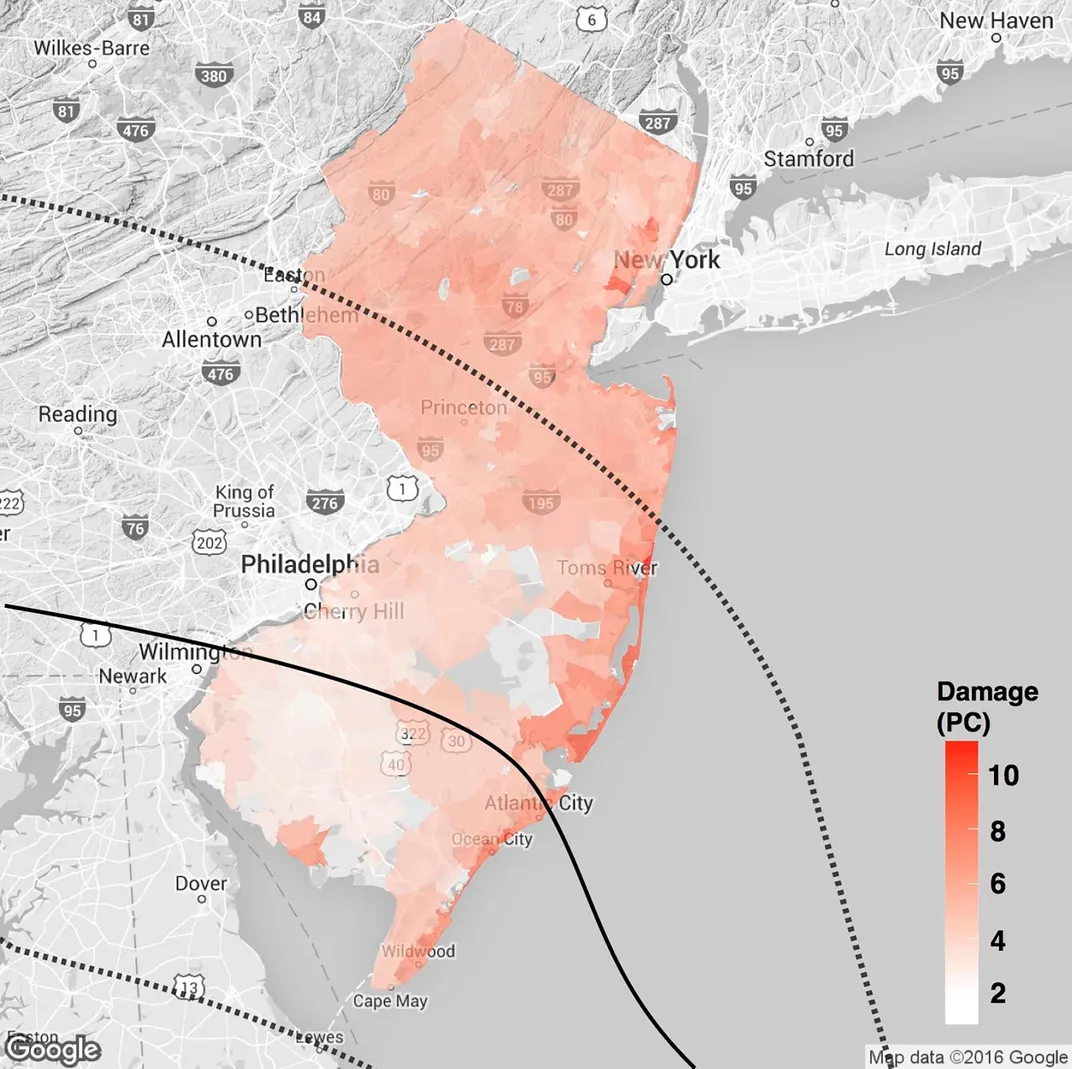
Suspecting that social media could do a better job, Kryvasheyeu and his colleagues homed in on 2012's Hurricane Sandy as a case study. They accumulated more than 55 million geo-tagged tweets posted one week preceding and three weeks following the storm. The tweets included keywords such as "sandy", "frankenstorm", "flooding" and "damage".
The team standardized the data using demographic figures of neighborhood populations, which allowed them to directly compare the number of tweets from places that are heavily populated, like Manhattan, with places that are less densely packed. Finally, they consulted as many sources as possible on actual damage caused by the storm, including insurance claims and FEMA data.
As the researchers report today in Science Advances, combining the social media findings and the damage assessments on a map revealed significant overlap, with hardest hit areas also producing the most chatter on Twitter.
“For me, the biggest surprise was that this actually works so well, and that the signal is so strong,” Kryvasheyeu says.
The researchers further verified their findings by performing the same exercise on all major disasters declared by FEMA in 2013 and 2014, including floods, tornadoes, a mudslide and an earthquake. They found that the method worked for 11 of the 12 events; the outlier—flooding in Alaska—was likely in an area too sparsely populated to produce a strong signal on Twitter.
The study exemplifies the use of “social media as a mirror reflecting society,” says Kristina Lerman, a computer scientist at the University of Southern California who was not involved in the research. Although that reflection is sometimes more akin to “a funhouse mirror, distorting some segments of society,” it is still clear enough in many cases to derive accurate measurements on important topics, she says.
First responders can begin using the method—using Twitter to identify hotspots during a disaster—immediately, Kryvasheyeu says, as implementing it requires nothing more than Twitter, openly available Census Bureau demographic data and some basic computer programming skills. More than that, though, Kryvasheyeu and his colleagues hope that Twitter itself may take up the effort in-house, as Google has done to help UNICEF map the spread of Zika virus.
“There’s a trend now of big technology companies helping NGOs, because they have better engineers, computers and data,” says study co-author Manuel Cebrian, also a computational social scientist at Data61. “Our hope is that this is something Twitter can do in collaboration with emergency managers.”
/https://tf-cmsv2-smithsonianmag-media.s3.amazonaws.com/accounts/headshot/Rachel-Nuwer-240.jpg)