NATIONAL MUSEUM OF NATURAL HISTORY
How the Pandemic Changed Scientific Exploration
How seven Smithsonian scientists continued to discover the secrets of the natural world safely during the pandemic
/https://tf-cmsv2-smithsonianmag-media.s3.amazonaws.com/blogging/featured/A_person_kneeling_in_dirt_with_a_clipboard..jpg)
When the World Health Organization declared COVID-19 a pandemic one year ago, it brought much of the world to a halt. Countries closed their borders, international flights stopped and people worldwide were told to stay home as much as possible. But not even a global pandemic could stop scientific advancement. Scientists near and far quickly adapted their research and fieldwork projects to follow the new health guidelines and keep everyone involved safe. Here is how seven of the National Museum of Natural History’s scientists continued to discover the secrets of the natural world safely during the pandemic.
Tuning in to past volcanic eruptions
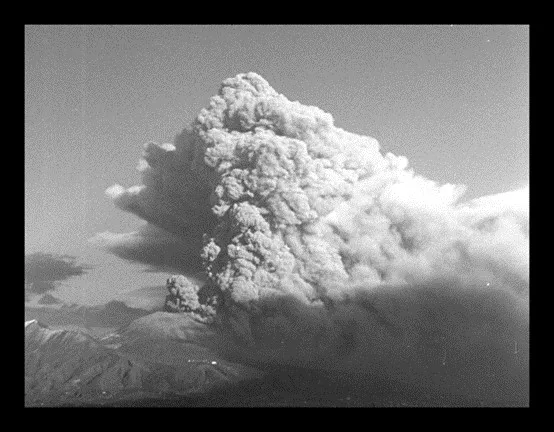
In the early afternoon of March 22, 1944, Italy’s Mount Vesuvius erupted. Ash blanketed the surrounding area and lava flows decimated several nearby villages.
Ben Andrews, a geologist and director of the Global Volcanism Program, has been studying past ash plumes to improve forecasting and mitigation efforts for future volcanic eruptions. Unable to conduct fieldwork in person, Andrews and Allie Coonin, an intern at the museum and a student at Brown University, used digitized 35mm film footage collected by the U.S. Navy to study Mt. Vesuvius’ 1944 ash plume instead. The footage helped them make some of the first ever measurements of 3D air entrainment into a volcanic ash plume. These measurements will help Andrews determine whether future ash plumes will rise into the atmosphere, where they can disrupt air traffic and cause planes to crash, or collapse into flows of hot gas and volcanic matter that destroy everything in their path.
Phone a fossil excavation
Rick Potts, a paleoanthropologist and the director of the Smithsonian’s Human Origins Program, has been leading expeditions to Kenya for 36 years in hopes of further unraveling the story of how humans evolved. But when the pandemic hit, traveling to Kenya became impossible.
The travel ban was problematic because two of his excavation sites were in danger of being damaged by heavy rains. So, in August of 2020, Potts lead a virtual field project to collect fossils and stone artifacts that were at risk. Luckily, the team found that the fossil sites were in good condition. For seven days, Potts helped guide his Kenyan colleagues from afar through phone and video as they collected fossils that will help him and other scientists better understand our origins story.
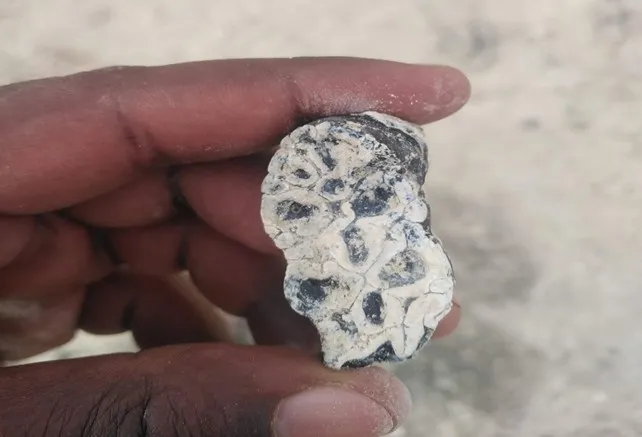
This week’s Zoom guests are 2,000-year-old birds
Last year, when Helen James — a research zoologist and curator of birds at the museum — clicked into a Zoom call with her collaborators at the Bishop Museum in Hawaii, she wasn’t looking to chat about the events of the day or listen to a presentation. She was looking for bird bones.
James has been excavating fossilized birds in Hawaii to better understand the evolution of island avian biodiversity. The pandemic meant that James could not travel to Hawaii herself but the fossils still needed to be collected. The site where she collects fossils is being eroded by wind, rain and the sea. As the site erodes, bones are exposed and could be damaged by the elements if left in place. Luckily, her collaborators in Hawaii were able to make trips to the site for the fossils. They would then hold up every bone they had found over Zoom for James to look at. She preliminarily identified all of the collected fossils and will wait to further investigate the bones until it is safe to travel again.
A cherry for your thoughts on internet DNA
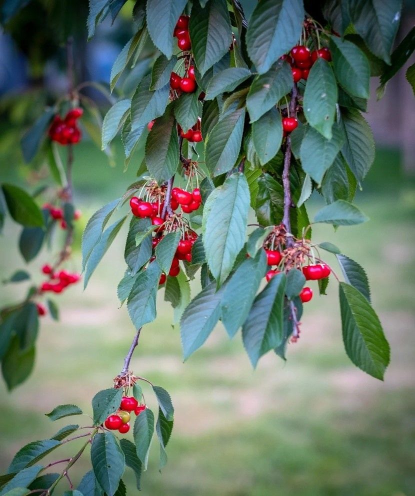
There are hundreds of millions of DNA samples stored in online repositories. And yet, in experiments, DNA stored online is usually considered secondary to samples collected in the field — until now.
Richard Hodel, a Peter Buck Fellow in the museum’s botany department, was planning to collect tissue samples from plants in the genus Prunus — which includes cherries, peaches, apricots and almonds — when his plans were curtailed by COVID-19. Needing an alternative way to study the evolutionary relationships between Prunus species, Hodel turned to online DNA repositories. Leveraging hundreds of millions of digital DNA sequences, Hodel made an evolutionary tree showing how major groups within Prunus are related. While DNA samples collected directly from the source will always be important, the pandemic reinforced the value of online repositories.
Finding fossils with Google Earth
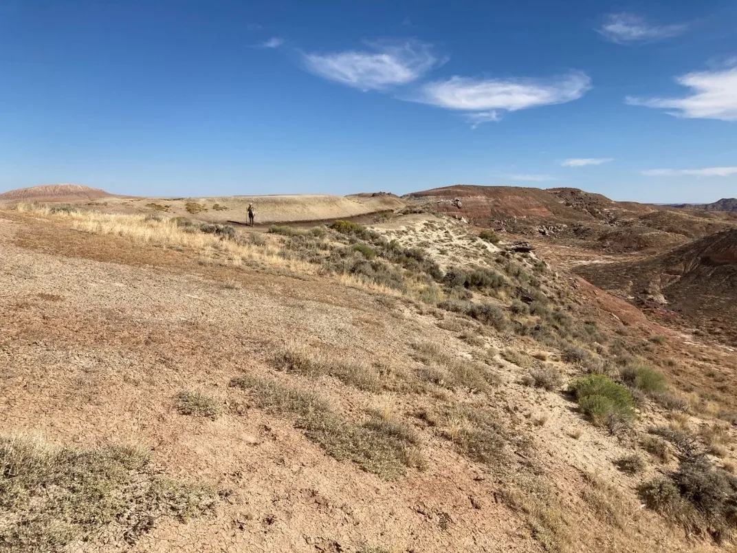
When COVID-19 shut down most of the country in March of 2020, Scott Wing, a paleobotanist with the museum, turned to Google Earth to keep himself sane while being stuck at home. For weeks, Wing scoured satellite images of Wyoming’s Bighorn Basin looking for places that might have plant fossils. Finding scores of possible spots and wondering if he was right, Wing got approval from the Smithsonian’s COVID Safety Team to make the 35-hour drive from Washington D.C. to Wyoming and see for himself. After a month camped out in the badlands, Wing realized that more than half of the sites he’d identified with satellite images had fossils. Because of this, he is using Google Earth to plan his next field season.
Sharing coral larvae is caring
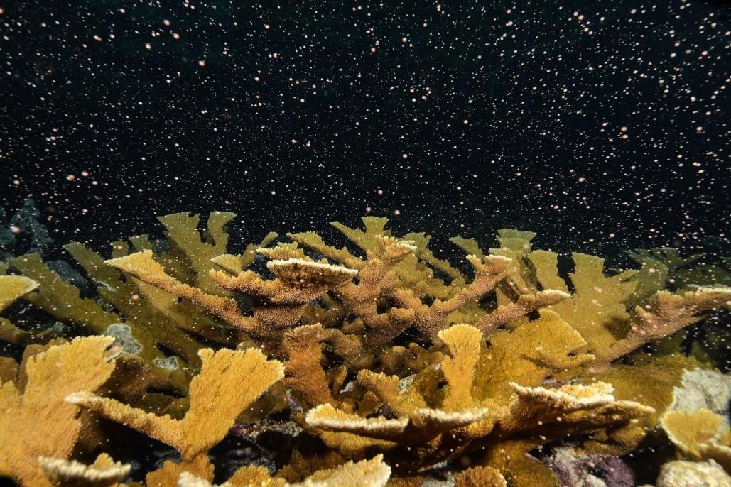
Coral larvae spend their first days to weeks swimming near the surface of the water trying not to be eaten. They then sink to the bottom of the ocean where they settle onto a surface to develop into an adult coral. Understanding the process of how coral larvae settle down is important for learning how the larvae become reef-building colonies.
Typically, Smithsonian Marine Station (SMS) scientists travel to Carrie Bow Cay Research Station in Belize to collect coral larvae for experiments aimed at understanding coral settlement. But when COVID-19 struck, it looked like they wouldn’t be able to continue with their experiments. Luckily, the Florida Aquarium, Biscayne National Park, SECORE International and the University of Miami pitched in and gave SMS larvae that they had collected. Their generosity allowed SMS to continue learning why coral larvae decide to settle where they do, an important step in developing more effective coral reef restoration projects.
Gardeners lend a helping hand
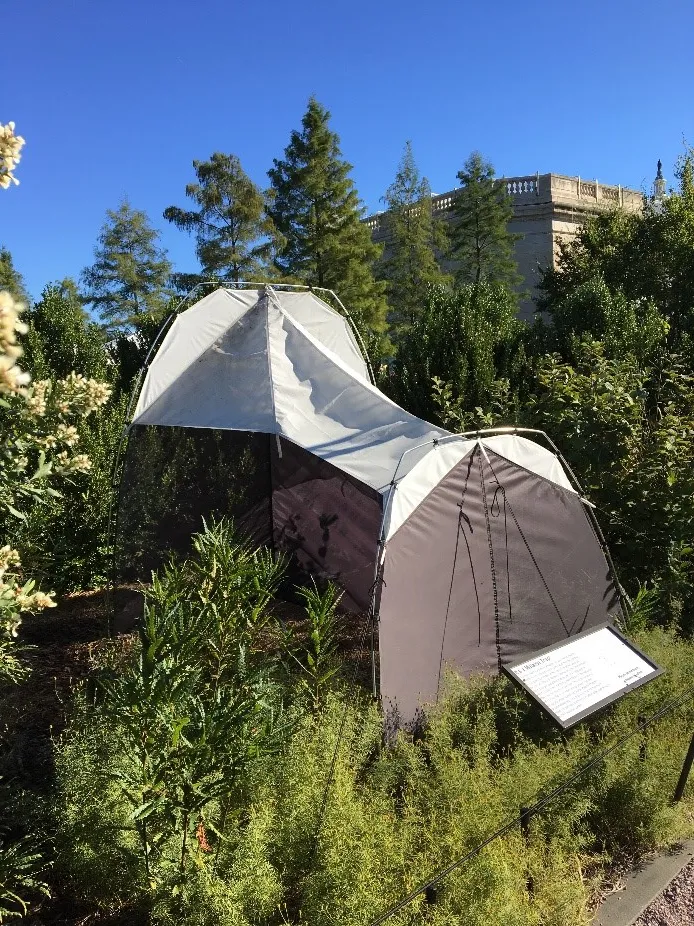
Before the pandemic, Nicholas Silverson, a museum specialist in the museum’s entomology department, would collect weekly samples from their malaise trap, a structure which passively collects insects moving though the Regional Garden at the United States Botanic Garden at the base of Capitol Hill.
Silverson says that field ecologists have been calling 2020 the year of missing data because of COVID-19’s impact on projects, like the trap, that rely on the in-person collection of data. Due to staff restrictions, Silverson and his team — Scott Miller and colleagues at the Barcode of Life Database — could not access the museum and Garden, but were able to rely on the Garden’s skeleton crew to maintain the trap and successfully collect weekly samples.
The data collected contributes to ongoing regional and urban biodiversity surveys that will help scientists around the world learn how insect populations move and live in those environments. With the help of the gardeners, this year’s data will be complete and able to show a more comprehensive picture of insect biodiversity in Washington, D.C. and the region.
Related Stories:
Six Videos that Put the Pandemic in Context
‘One Health’ Could Prevent the Next Coronavirus Outbreak
Get to Know the Scientist Studying Ancient Pathogens at the Smithsonian