Hunting Lost Worlds in Wyoming’s Bighorn Basin
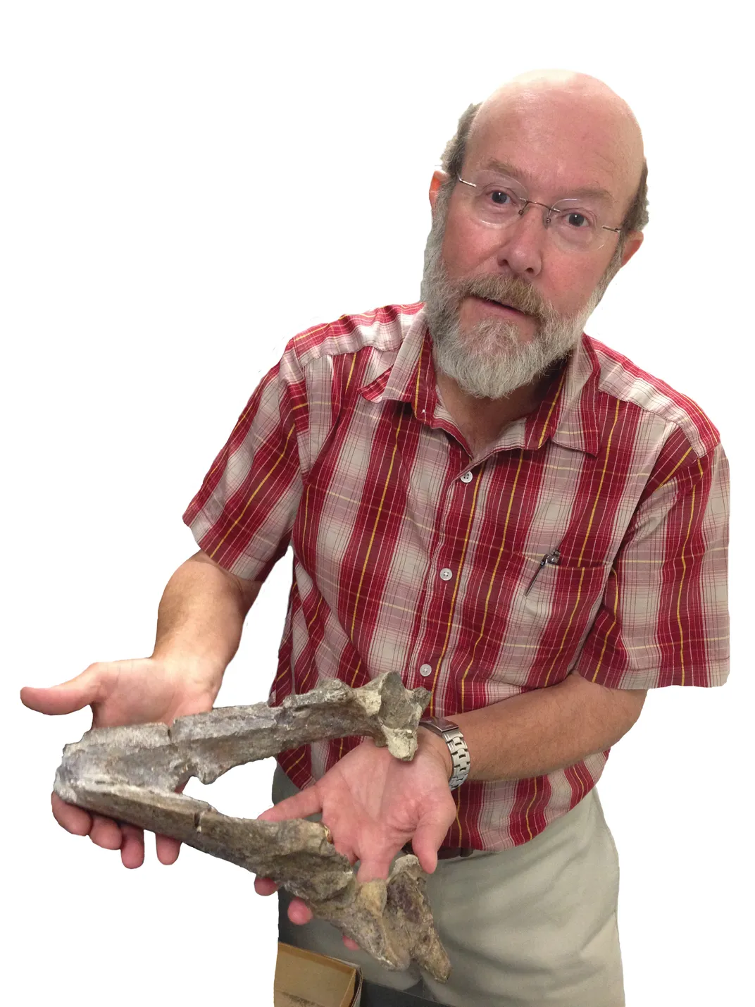
A geology tour with Kirk Johnson, Director of the Smithsonian Natural History Museum, and Will Clyde, a geology professor at University of New Hampshire
/https://tf-cmsv2-smithsonianmag-media.s3.amazonaws.com/filer/70/7f/707ff79b-0346-4f41-ad66-5194dd1798c5/intro_walking-kj-9-wr.jpg)
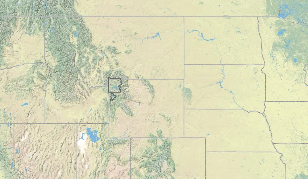
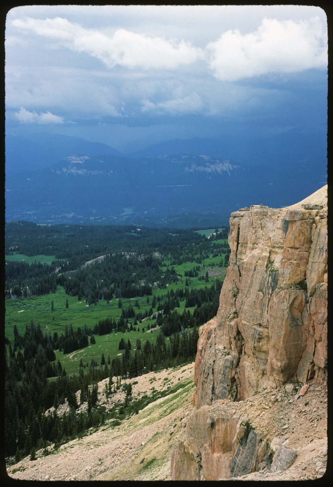
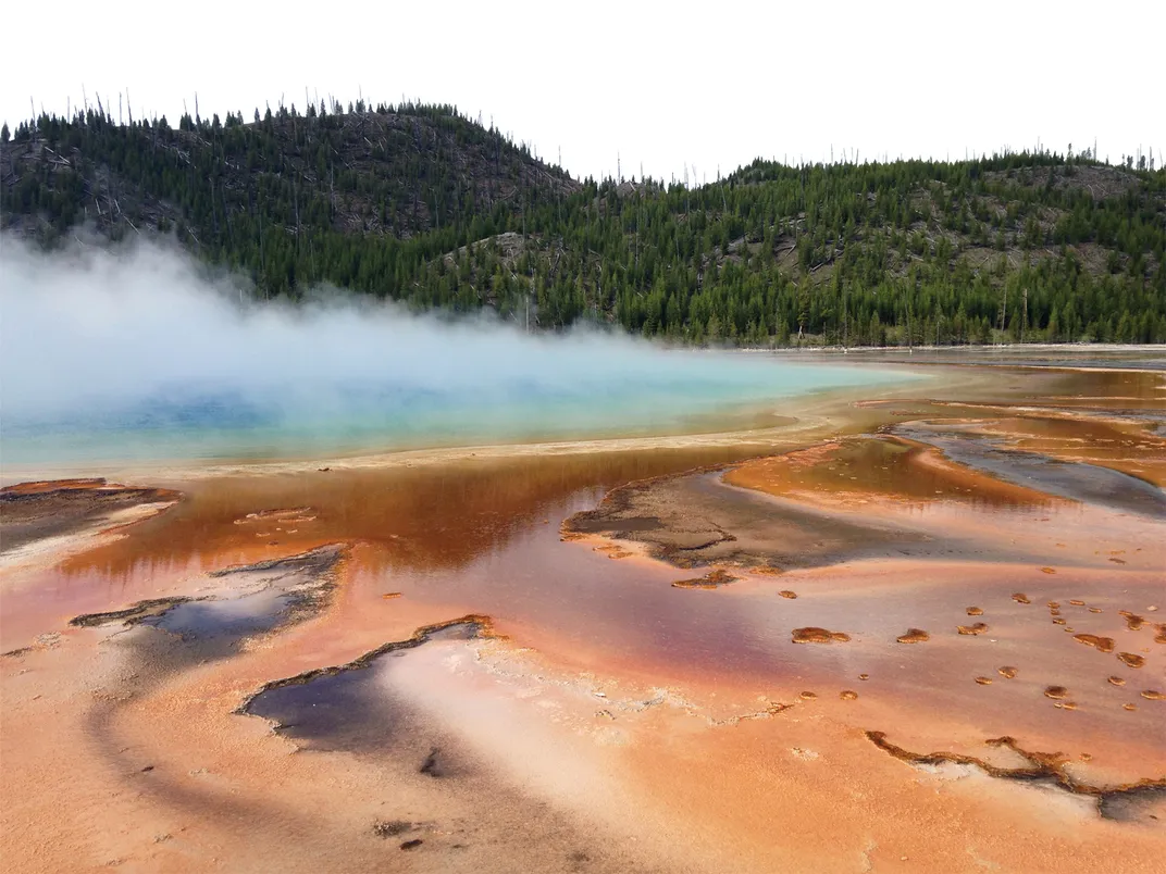
The northwestern corner of Wyoming is home to two of the nation’s most famous national parks: Yellowstone and Grand Teton. Each year, these parks see more than 3 million visitors who arrive from all directions, and those who come to Yellowstone from the east by way of Cody must pass through a vast, dry depression known as the Bighorn Basin. The basin’s main towns are Thermopolis, Cody, Powell, Lovell, Greybull, and Worland, but we’d be remiss if we didn’t mention Shell, Ten Sleep, Meeteetse, Basin, Otto, and Bridger.
This story is an excerpt from 'Ancient Wyoming: A Dozen Lost Worlds Based on the Geology of the Bighorn Basin' by Kirk Johnson and Will Clyde
Merging paleontology, geology, and artistry, Ancient Wyoming illustrates scenes from the distant past and provides fascinating details on the flora and fauna of the past 300 million years.
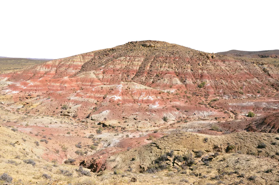
From outer space or on the Wyoming Highway Map, the basin appears as a giant oval hole about 150 miles long by 80 miles wide. The high points of the surrounding mountains reach more than 11,000 feet, while the low point of the basin is only 3,500 feet. The Bighorn Basin is a curious bit of topography, and it has one of the best geological stories on the planet.
In fact, the Bighorn Basin may be the best place on Earth to tell the story of our planet. Because of its geology, the Bighorn Basin contains layers of rock older than 2.5 billion years, as well as many, many younger rock layers. What makes this place so amazing is that it has layers of rock from almost every single geologic time period. If you had to pick one place in the world to tell the story of Earth’s history, you would pick this place. So we picked this place.
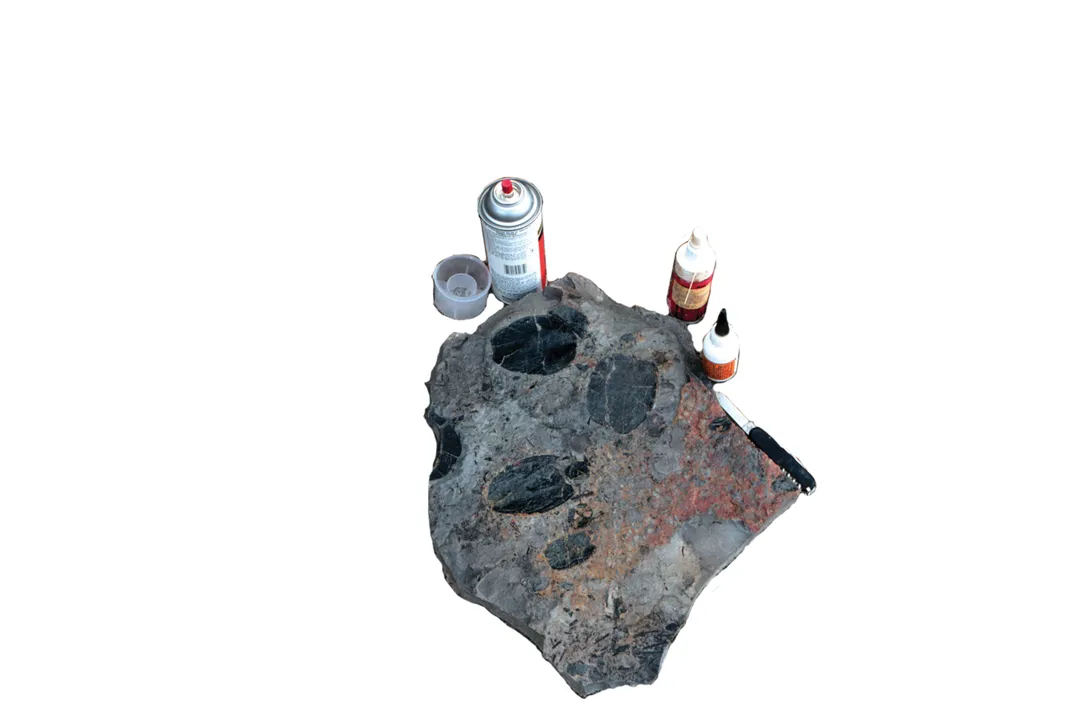
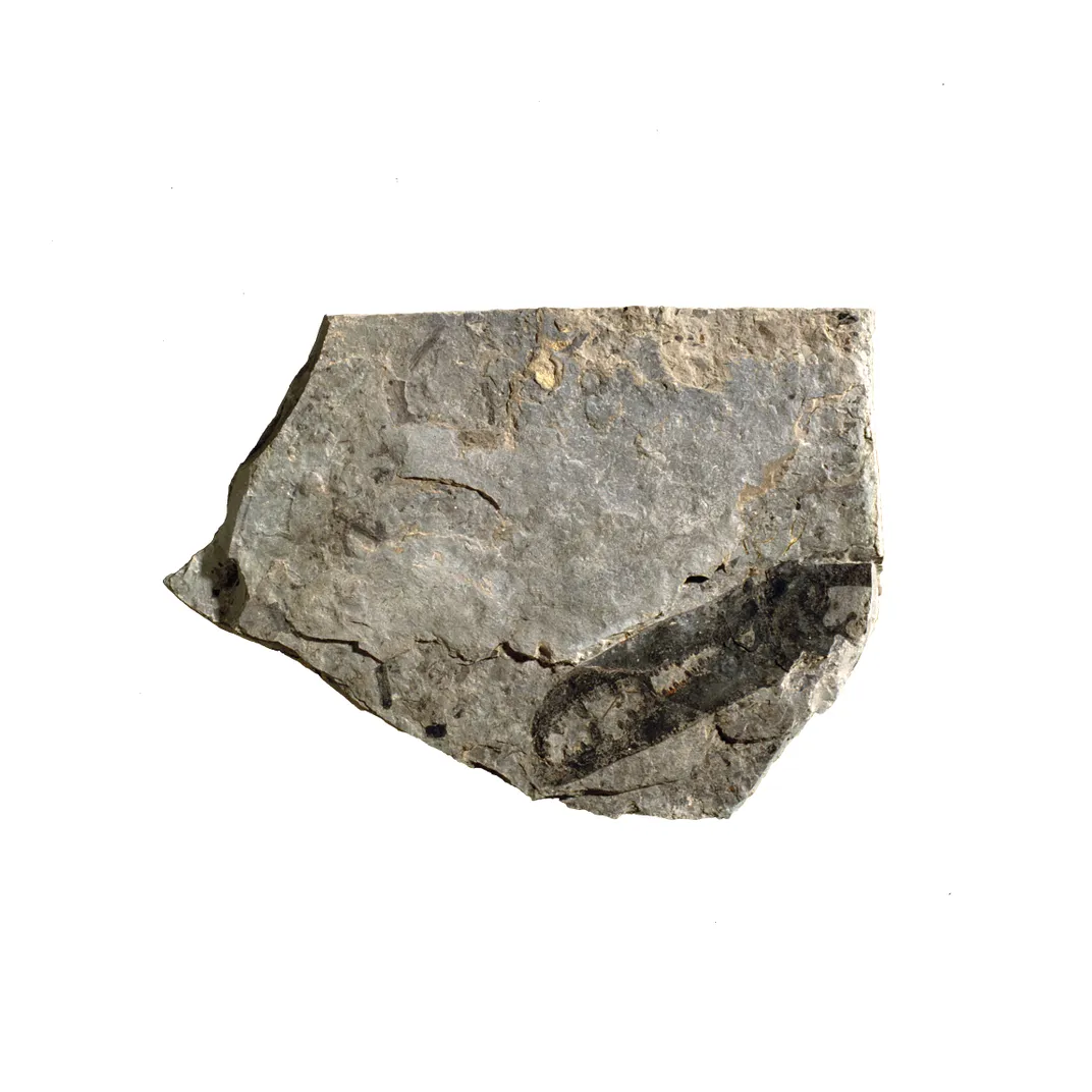
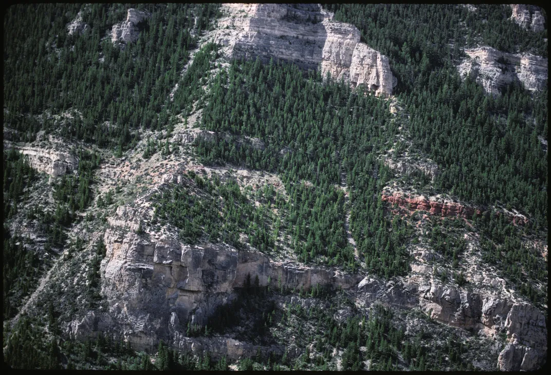
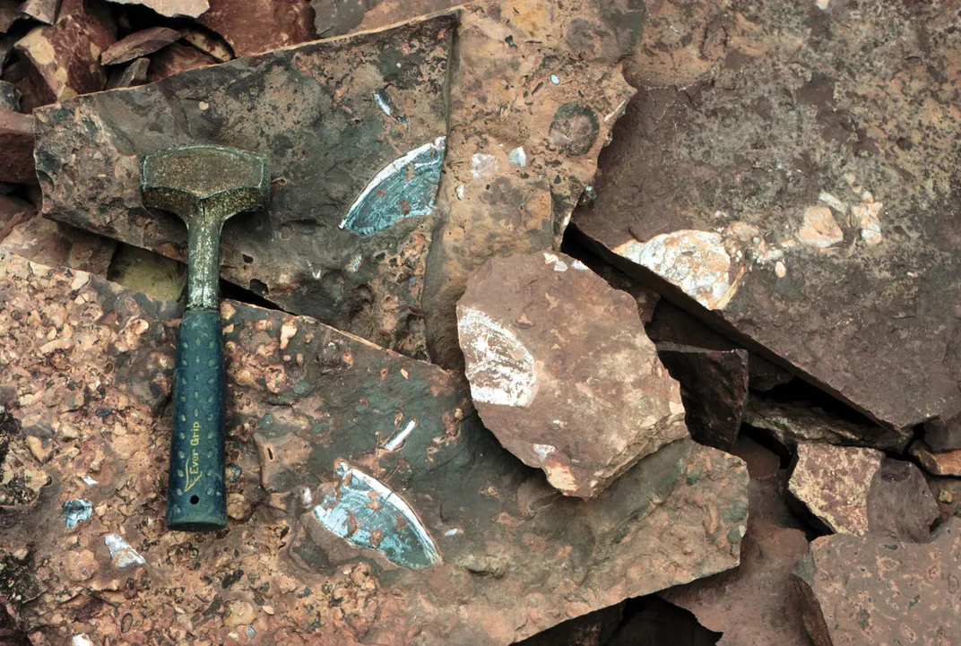
The layered rocks of the Bighorn Basin were once ancient landscapes, and the fossils in the rocks are clues to what these landscapes looked like, what the ancient vegetation was, and what kinds of animals lived here. Because the Bighorn Basin is a dry place, not many plants grow here today, so it is easy to see the rocks. If you can see the rocks, you can find the fossils in the rocks. In this place, the history of the Earth lies on the ground as if it were an open book. And the goal of our little book is to give you the tools to read the big rock book of the Bighorn Basin.
Using layered rocks and fossils, geologists and paleontologists are able to envision what these lost worlds looked like. To share them with you, we studied the rocks; tracked down the fossils; reconstructed the plants, animals, and landscapes; and then employed an artist to paint them, choosing ancient worlds ranging in age from 520 million years to 18,000 years old. There are so many layers of rock in the basin that we could have painted hundreds of them. Here, we present five.
Scorpion Stream: 400 Million Years Ago, Devonian Period

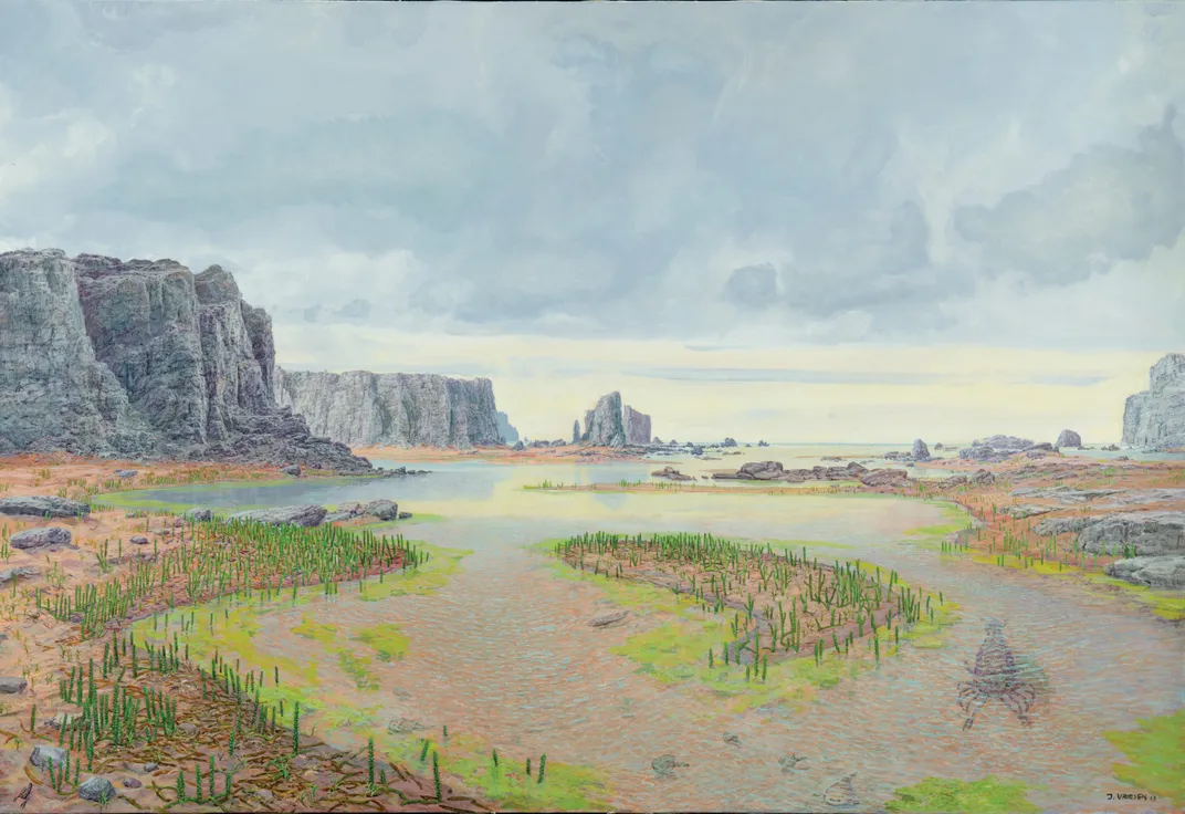
Past
Streams are entering a coastal area and have cut into the surrounding bedrock of Bighorn Dolomite. The channels are filling with sediment that has eroded from the surrounding hills. Lurking under the brackish water are armored fish, snails, and brachiopods. A five-foot-long predatory eurypterid is trolling the shallows in search of its next meal. These “scorpions of the water” are some of the largest predators of the Paleozoic and close evolutionary cousins to spiders and horseshoe crabs. They have legs for walking and paddles for swimming, so they can easily move in and out of the water. On land, life is now apparent. Thin, low-stemmed plants are sprouting from the muddy deposits on the edges of the streams. True land scorpions are scurrying among the plants, hunting for other critters that have evolved into this new, wide-open ecosystem outside of the water
What you see today
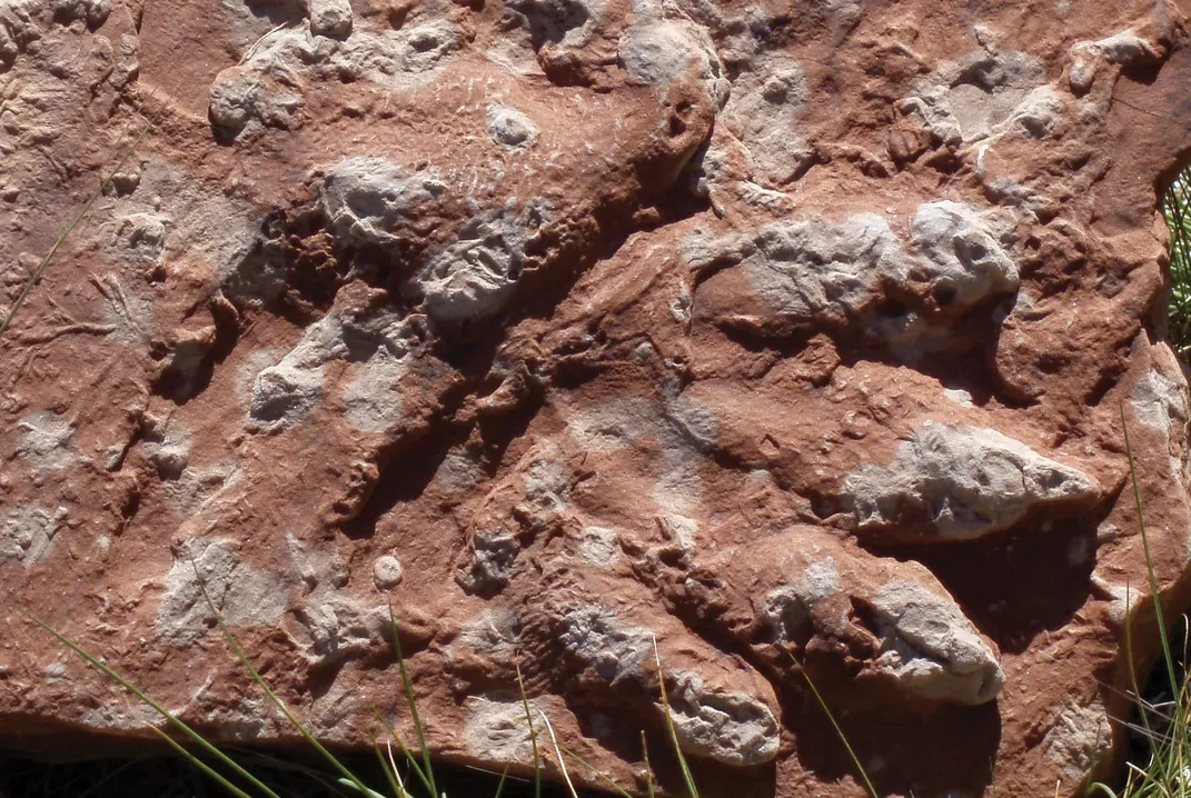
The most spectacular outcrop of the Beartooth Butte Formation is perched on the top of the Beartooth Plateau, more than 6,000 feet above the basin floor. This geological remnant is the only bit of post-Precambrian sedimentary rock left on top of the mountains in this area – the rest was eroded away during the rise of the Rockies. The butte preserves horizontal layers of Cambrian, Ordovician, and Devonian shale and limestone, with sediments of the Beartooth Butte Formation filling channels cut down into the Bighorn Dolomite. These channels formed when sea level dropped during the Early Devonian, creating a coastal environment where streams flowed in from the adjacent land. Sediment slowly filled these channels, entombing the pieces and parts of the organisms that were living in this thriving ecosystem.
Significance
The beginning of the Devonian was the time when organisms were just emerging onto land. The early land plants were small – no forests existed yet, just low stems and a few small leaves. Plant roots and dead plant debris mixed in with weathered rock to form soils that started to live and breathe like the ones we have today. Arthropods, the evolutionary group that includes crabs, insects, and trilobites, were the first animals to be preserved as fossils from this new land-based ecosystem, but other soft-bodied groups were likely there also, leaving behind evidence in the form of burrows and tracks. The Beartooth Butte Formation contains a mix of marine (brachiopods and snails) and land (scorpions and plants) organisms, providing a perfect window into the very environment where this remarkable water-to-land evolutionary transition was taking place.
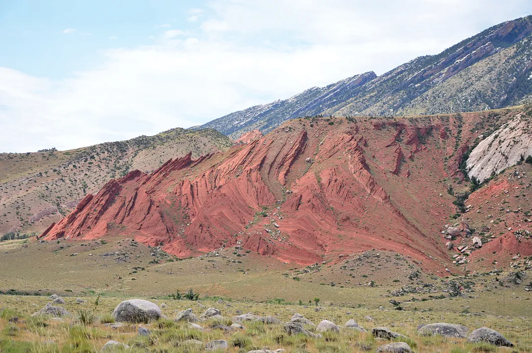
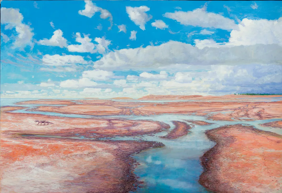
Red World: 220 Million Years, Triassic Period
Past
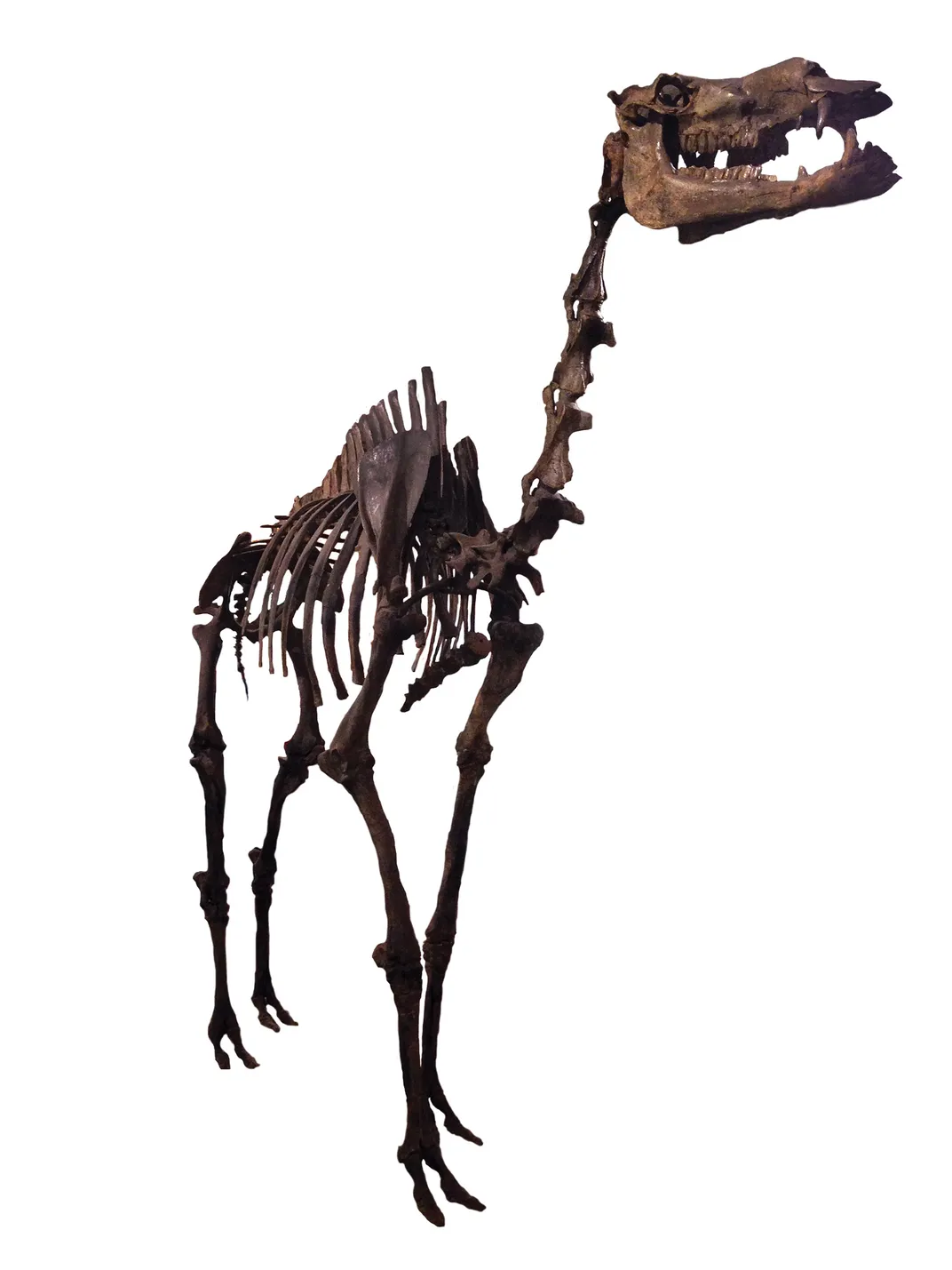
Deeply colored red mudflats can be seen far into the distance. Shallow channels drain the area, and little life is evident. Strong thunderstorms are booming away in the distance over a faraway forest. A lone rhynchosaur ambles across the plain, leaving a track in the soft mud underneath. This creature is like a vertebrate mash-up: a wide head with a short snout that resembles a hammerhead shark’s, a stout parrot-like beak, and plates of bumpy fish-like teeth lining its mouth so it can grind the plants that make up its diet. Sharp claws on its back feet could be used to dig up roots to eat or to protect it from the vast array of crocodile-like predators that roam the landscape.
What you see today
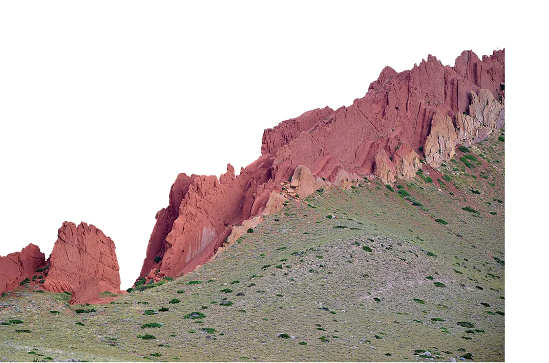
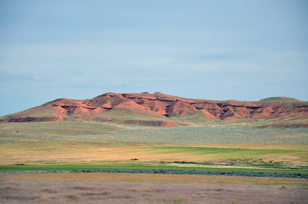
The Triassic Chugwater Formation is the most recognizable geological unit in the basin. Its bright-red color makes it stand out among the other more subdued colors of the adjacent formations. In fact, these red rocks can be seen clearly as you fly over the basin in an airplane and even in satellite imagery from space. During the Triassic, Wyoming was in the northern tropics, and North America was starting to grow to the west by colliding with smaller landmasses. The Chugwater, like the other Paleozoic and older Mesozoic units in the basin, is usually found along the basin margin, folded up during the subsequent rise of the Rockies. Because of this, the Chugwater forms a red ring around most of the basin when seen from above.
Significance
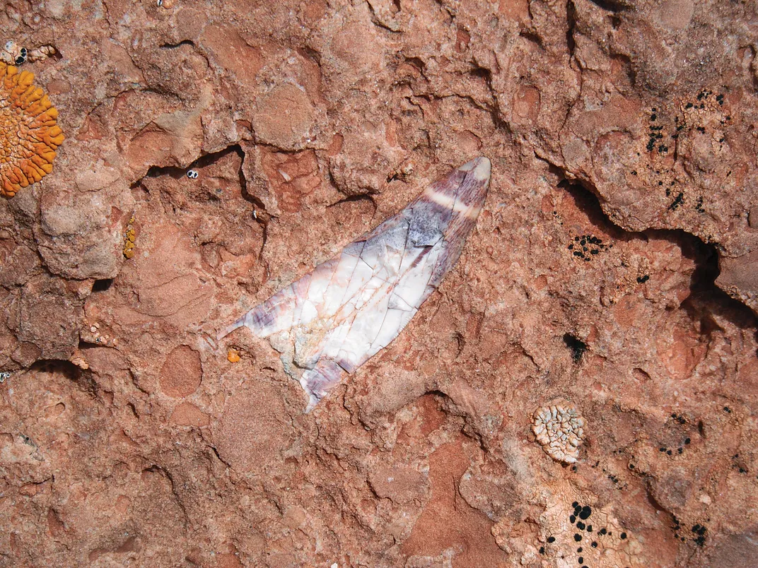
The Chugwater’s red color is very common for rocks of this age all over the world. It is rust, an oxidized form of iron that is also known as the mineral hematite. Just like a nail rusts when it is exposed to moisture and allowed to dry, sediments rust, and get red, when they experience cycles of wetting and drying. Red sediments are common today in places that have strong seasonal changes in rainfall, like the tropical and continental interior areas that experience monsoons. Why so much rust in the Triassic? This is when all of the world’s continents had come together into the great supercontinent called Pangaea. Today, the largest monsoons occur on the largest continents, which means a supercontinent like Pangaea likely had a “mega-monsoon.” These extreme wet and dry seasons during the Triassic caused massive rusting of the sediments, leaving behind a geological red ribbon that can be seen on all of the continents. The rusting process in the sediments often destroys the remains of plants and animals that would otherwise become fossilized, so very few fossils have been discovered in the Chugwater over the years.
Longneck Lineup: 150 Million Years, Jurassic Period
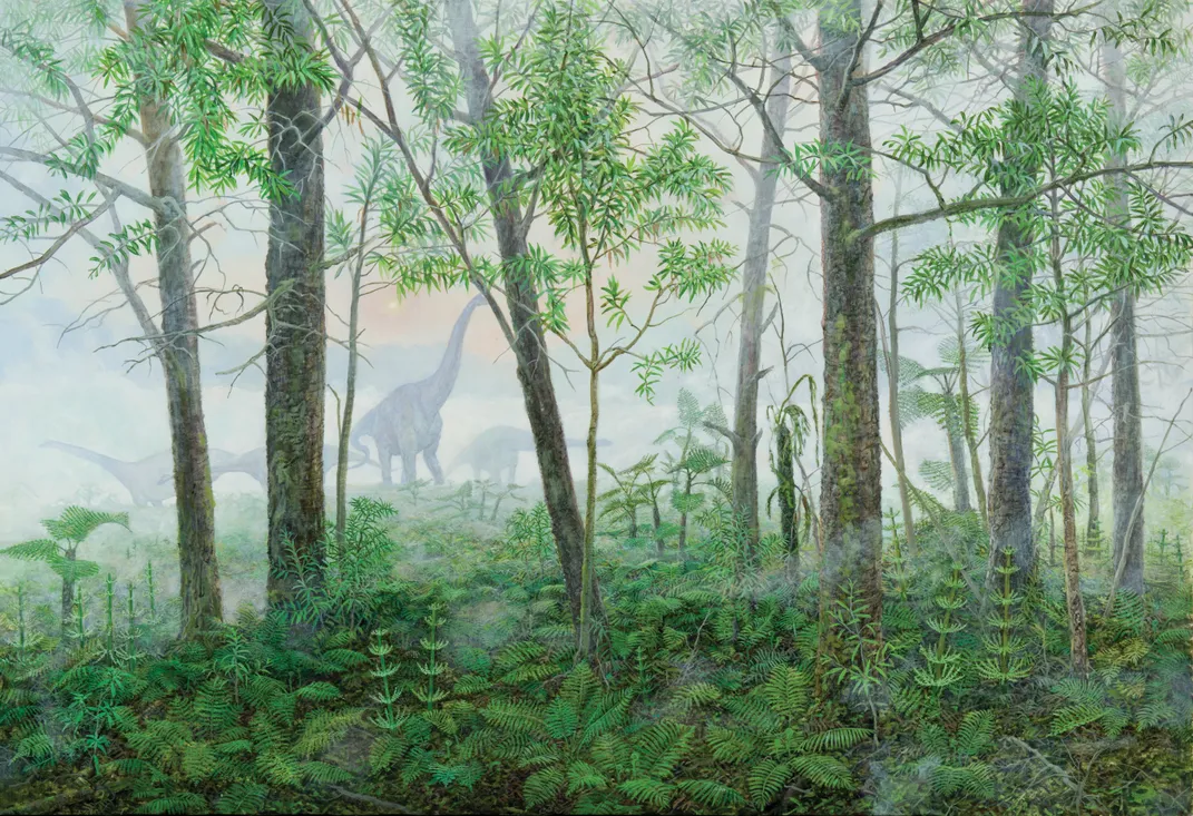
Past
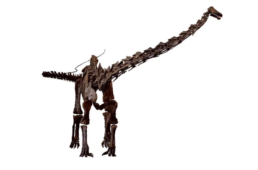
It is a foggy, quiet morning at the edge of a dense forest. The trees look vaguely familiar but on second glance are clearly not. In the distance, barely visible is a group of huge dinosaurs with long necks and tiny heads. They are moving very slowly and deliberately as they feed their way across a meadow of ferns and horsetails. There is no menace, only the muffled footfalls of massive herbivores.
What you see today
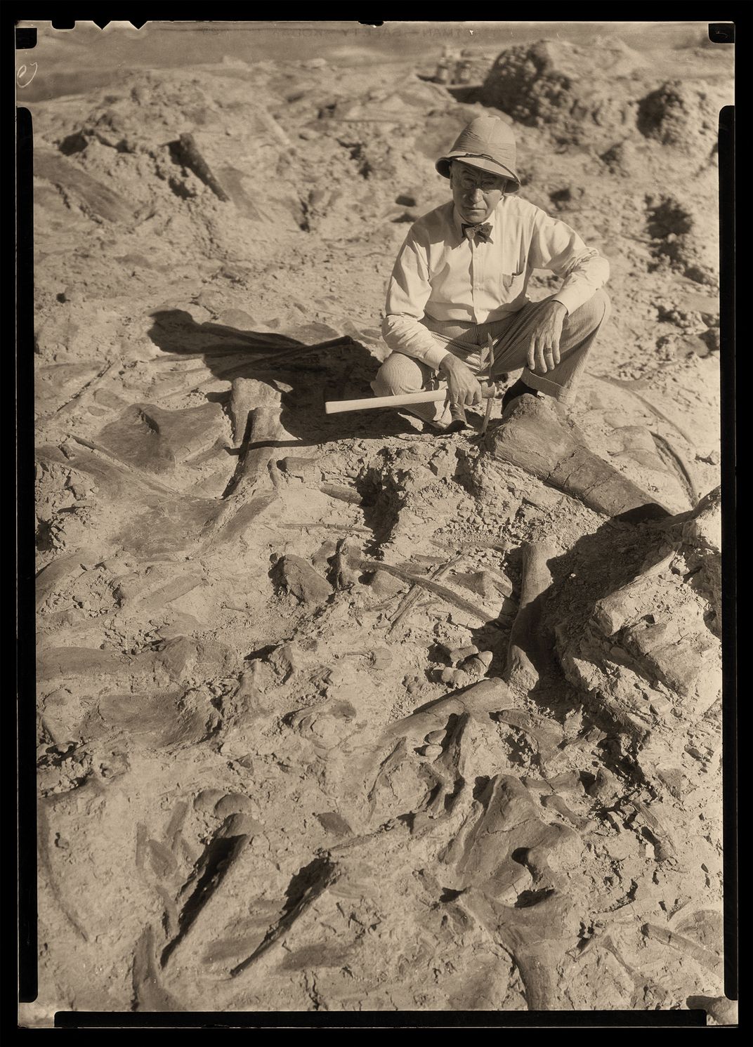
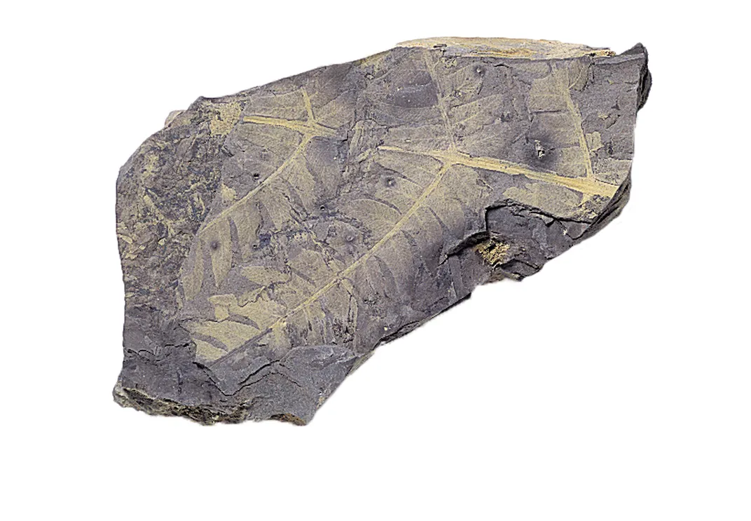
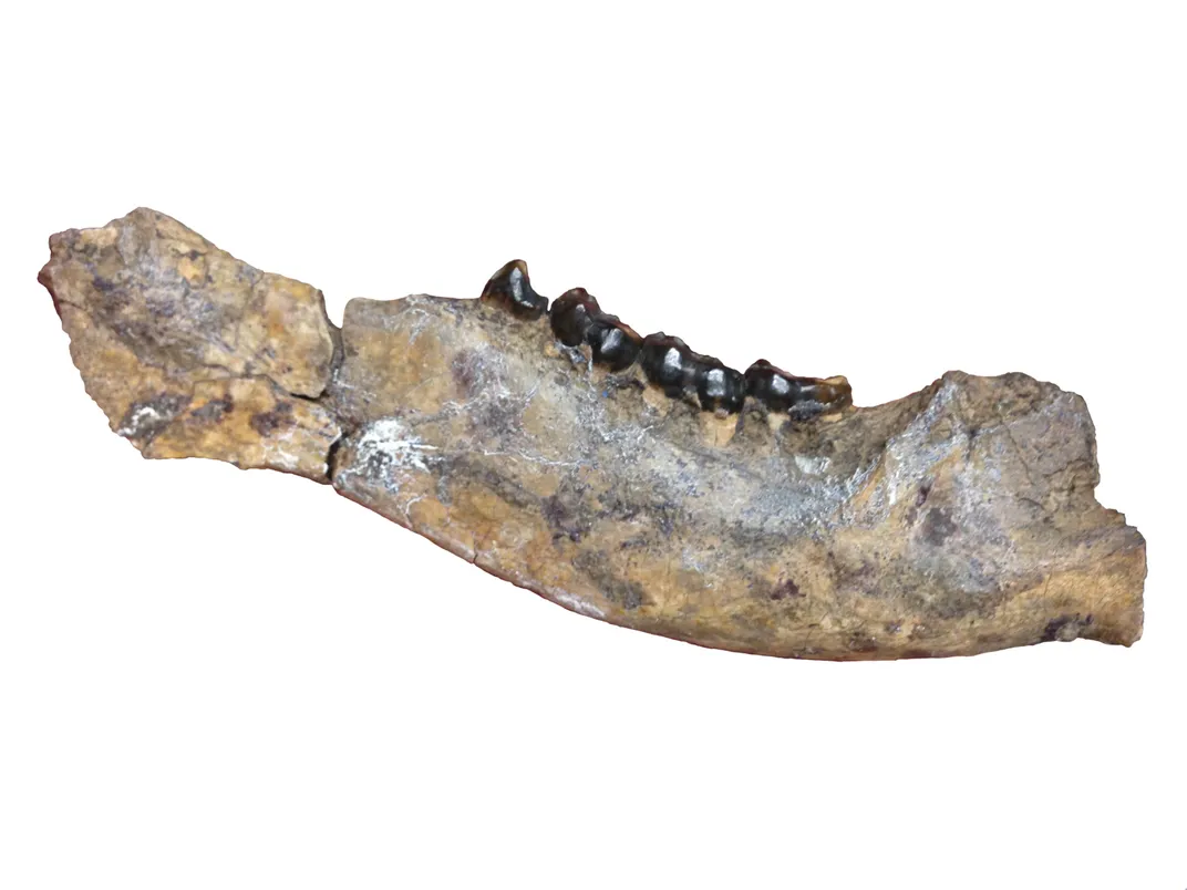
The Morrison Formation was first described in Colorado, and rocks of this name stretch across Utah and up through Wyoming. In the Bighorn Basin, the formation is very colorful with hues of blue, red, orange, and brown, but it is famous for its immense and diverse dinosaurs. Because of its high clay content, the formation does not make prominent outcrops, and it is often covered by geological debris or vegetation. Like all of the Paleozoic and Mesozoic formations in the basin, the Morrison crops out around the basin’s rim. Most of the best dinosaur fossils have come from the eastern edge, and active dinosaur quarries occur from Thermopolis to Shell.
In 1934, Barnum Brown from the American Museum of Natural History (AMNH) in New York opened the Howe Quarry east of Greybull, Wyoming. This expedition was funded by Sinclair Oil and resulted in the company’s green dinosaur symbol. The Howe Quarry yielded a remarkable dinosaur bone bed, including the Barosaurus skeleton that now stands on its hind legs in the Theodore Roosevelt atrium of the AMNH. In 1991, a 95 percent complete Allosaurus skeleton, now at the Museum of the Rockies in Bozeman, Montana, was collected at the Howe Quarry. The quarry also preserves carbonized remains of large trees and cones of extinct conifers.
Significance
The Morrison Formation is perhaps the best window into the world of giant Jurassic dinosaurs, but the picture is cloudy because bones are much more frequently preserved than are plants. The result is a world where we know the animals but are only now beginning to understand the nature of the vegetation. This is all the more important because the long-necked sauropods, who were clearly herbivores, are the largest animals ever to walk the Earth, yet we have little real understanding about what they ate. Sites like the Howe Quarry are beginning to change that.
Greenhouse Bird: 54 Million Years, Eocene Period
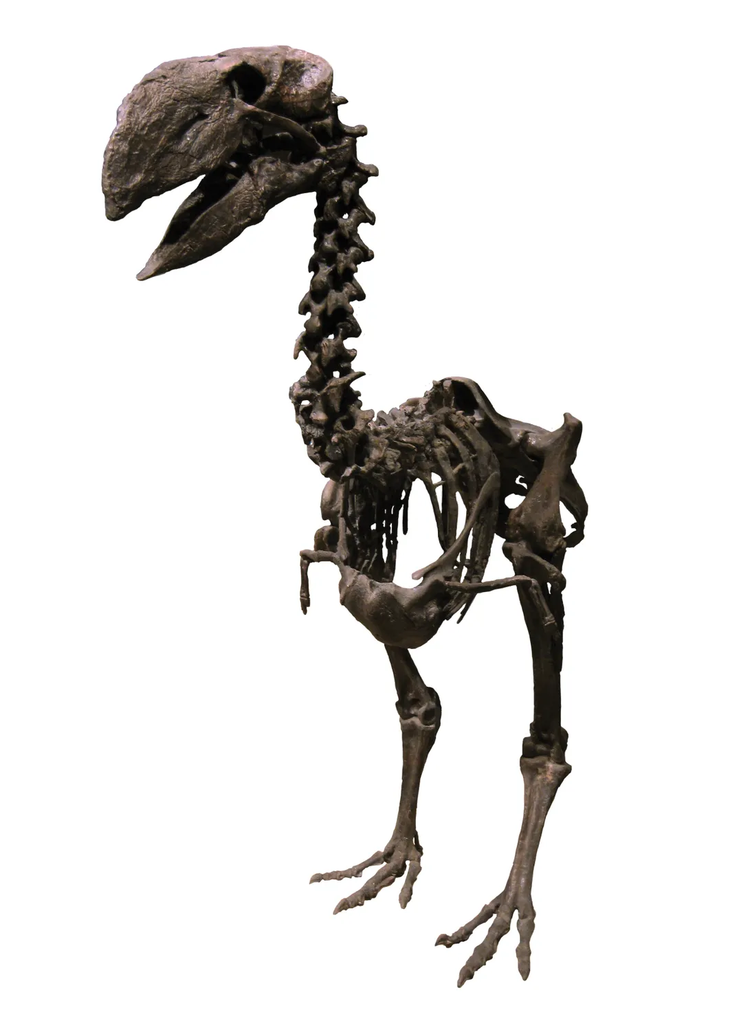
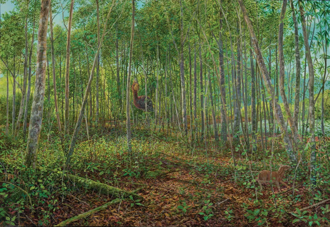
Past
The large, flightless bird Diatryma quietly moves through the lush floodplain forest, stalking a cocker spaniel-sized horse. The horse is startled by the rustling leaves and starts to run over to the fast-flowing stream cutting across the forest floor. Rainfall in the adjacent mountains feeds the streams here, and the temperature is much warmer than in today’s Wyoming. This forest harbors an abundance of species – primates, tapirs, rodents, and crocodiles living amid laurels, legumes, and palms. It looks and feels like a subtropical ecosystem, yet Wyoming sits at just about the same latitude as it does today.
What you see today
The Eocene Willwood Formation is exposed as red-and-beige-striped badlands throughout the middle of the basin. It formed as the large Rocky Mountain ranges that encircle the basin – the Bighorns, Beartooths, Owl Creeks, and Pryors – continued to rise. With the rising and eroding mountains delivering a steady supply of sediment into the actively sinking basin, a great thickness of sediment accumulated during the Eocene epoch. Mud settled on the floodplains and sand filled the channels, burying the remains of the animals and plants that lived there. The Willwood Formation is one of the thickest geological units in the Bighorn Basin – as thick as 5,000 feet – and it preserves one of the most abundant and diverse suites of fossil land animals and plants known anywhere in the world. The most common mammals in the Bighorn Basin today (pronghorn antelope, horses, and even people!) can trace their ancestry back to fossils found in the Willwood.
Significance
The early Eocene, when the Willwood Formation was deposited, was a period of extreme global warming. Crocodiles lived above the Arctic Circle at this time, and the Willwood shows us that Wyoming hosted a whole array of animals and plants that are more typical of a tropical environment than the mid-latitude, continental interior that it actually was. How could the world get so warm so far away from the equator? Mainly because the concentration of atmospheric greenhouse gases such as carbon dioxide was much higher than it is now. It is also likely that large, powerful storm systems carried heat from the equator to the poles, bringing with them volatile weather conditions. Many scientists wonder if we are heading back to a greenhouse world like the Eocene as we continue to burn fossil fuels (like Fort Union coal) and release long-buried carbon back into the atmosphere.
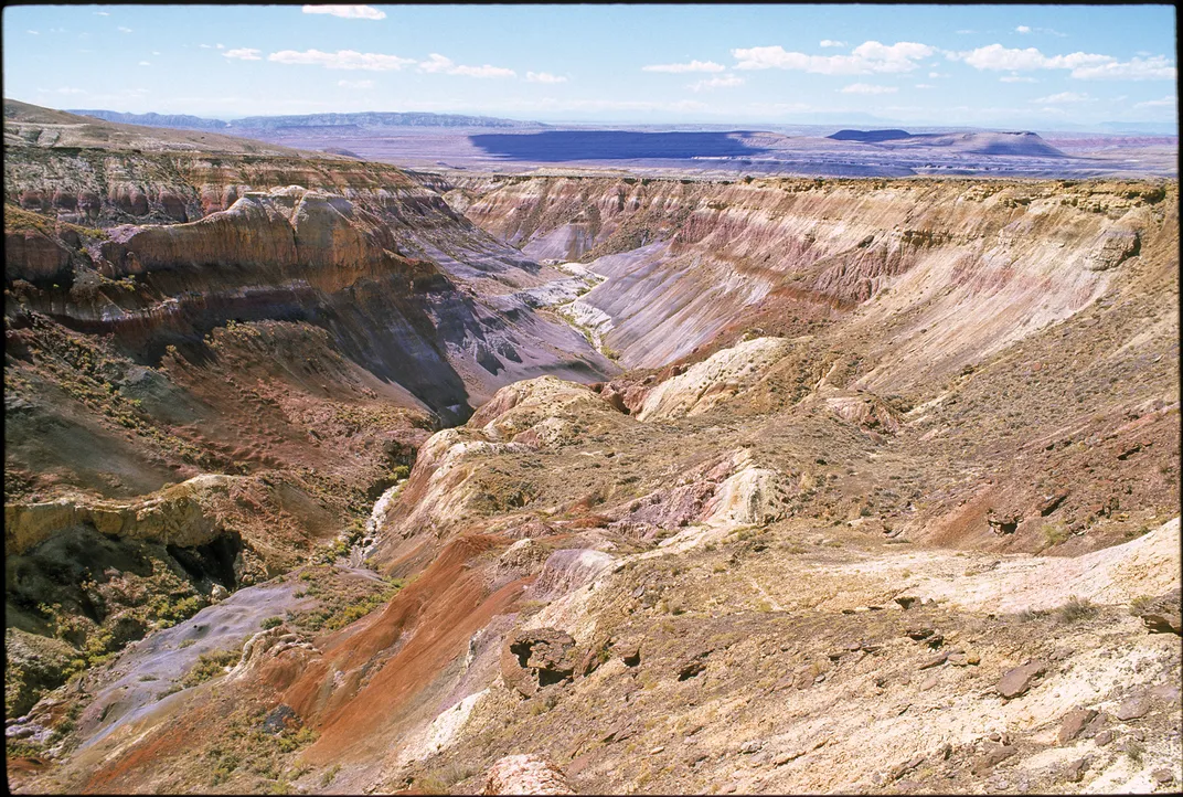
A Bad Day: 640,000 Years, Pleistoncene Period
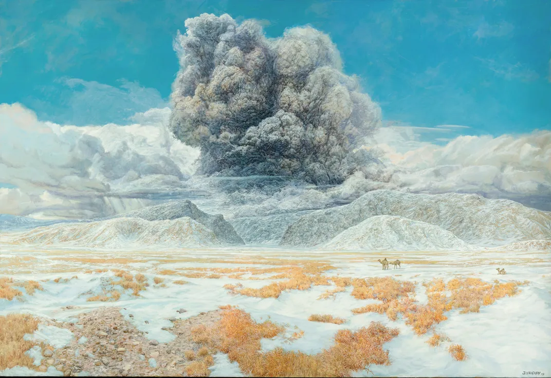
Past
The three camels at the mouth of the Clarks Fork Canyon probably don’t notice the strange cloud rising from the area of Yellowstone Lake some 100 miles to the west, although they certainly would have heard the loud explosion that preceded it. Within minutes the cloud will collapse under its own weight and roll eastward at speeds in excess of 100 miles an hour. The camels will have less than an hour to live. But the cloud will not stop there. It will continue to the east for several hundred miles, burning a path of death and destruction as it travels. Airborne ash will go farther still, covering most of the eastern half of the continent and smothering any life in its way.
What you see today
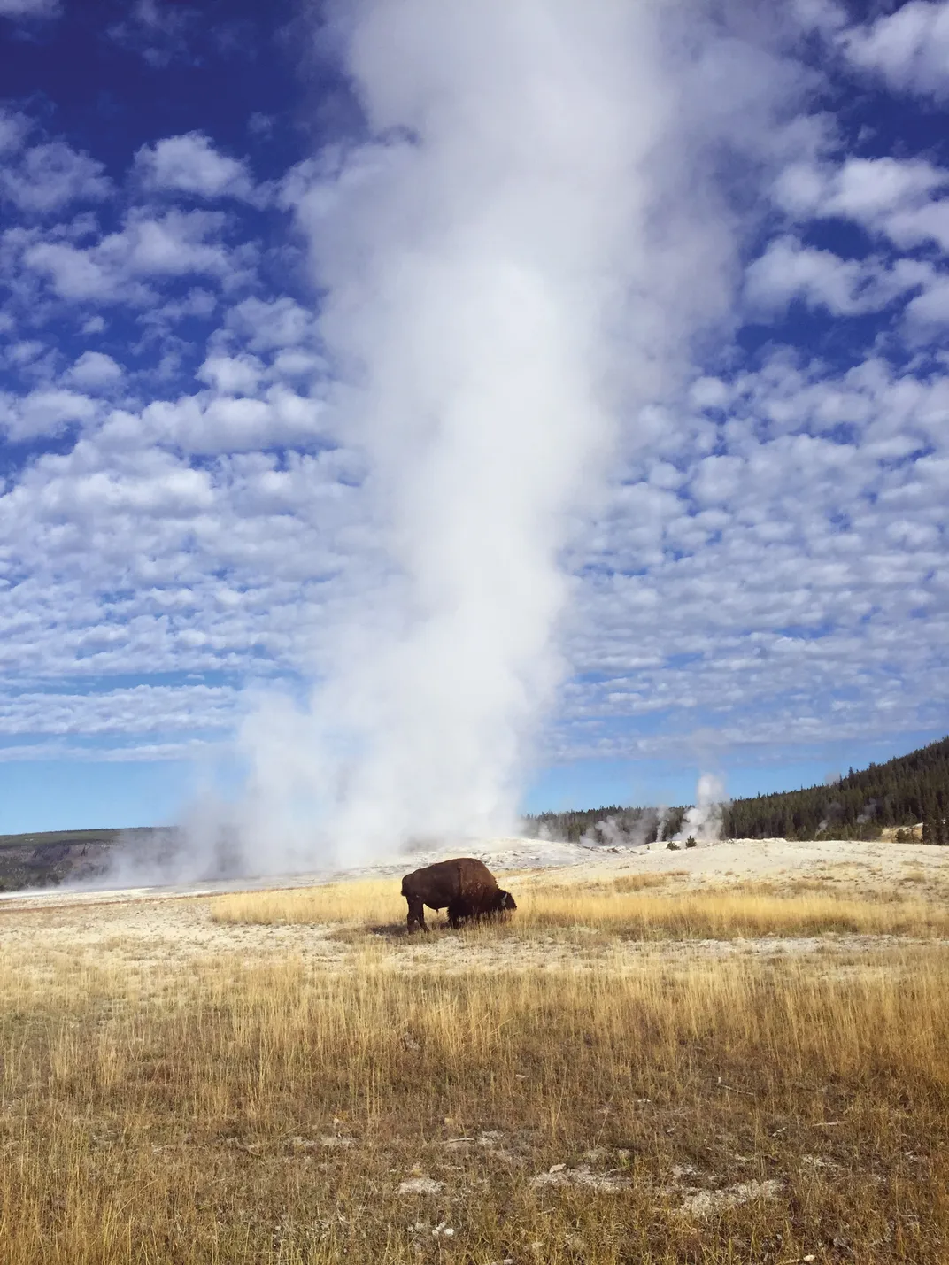
Today, Yellowstone National Park is one of the best-known natural sites in the world. More than 3 million people visit every year to vacation in its scenery, observe wildlife, and visit the geysers, boiling mud pots, and other thermal features that make this place so unusual – Yellowstone is home to more than half of the world’s geysers. Geologists are growing more interested in Yellowstone as well. The thermal features suggest that there is great warmth in the ground beneath the park, and a series of seismic monitoring devices are now showing that hundreds to thousands of small earthquakes shake it each year. In 1959, a magnitude 7.5 earth- quake on the western side of the park caused an 80-million-ton landslide that dammed Hebgen Lake and killed twenty-eight people who were camping along its shore. The devices that measure earthquakes form a network that lets geologists diagnose what is going on beneath Yellowstone, just like a surgeon uses a CT scan to look into a human body. Based on this data, it is clear that Yellowstone sits on top of a large cavity full of partially molten rock known as a magma chamber. The chamber begins about six miles below the surface and extends down at least 11 miles and is about 25 miles wide and 45 miles long. The last major eruption of this chamber occurred 639,000 years ago, and when it blew up, it released more than 250 cubic miles of molten gaseous magma and ash – more than 1,000 times larger than the 1980 Mount St. Helens eruption. The ash plume blew eastward and landed in measurable thickness as far east as Kansas City.
Significance
Evidence of ancient massive eruptions clearly has relevance for people who live within range of these volcanoes. An event that happened 639,000 years ago is not necessarily something we need to worry about, but it does make us think about geologic time.
Great Visitor Centers and Museums in the Bighorn Basin
- The Wyoming Dinosaur Center, Thermopolis. This museum runs an active nearby dinosaur quarry in the Morrison Formation where it is possible to pay to dig.
-
Washakie Museum, Worland. Recently renovated, this museum has an excellent overview of the geology of the Bighorn Basin, a full-size bronze mammoth, and exhibits of the paleontology and archaeology of the region.
-
Greybull Museum, Greybull. A small local museum with a long history and excellent samples of local fossils and minerals.
-
Bighorn Basin Research Institute, Greybull. A storefront in downtown Greybull with some local fossils and interpretations of local geology.
- Draper Museum, Cody. A full-blown natural history museum that interprets the biology and geology of the Yellowstone Plateau and the Bighorn Basin and pays tribute to the basin’s rich cultural history.
- Bighorn Canyon Visitor Center, Lovell. This gateway to the Bighorn Canyon has an excellent movie and a three-dimensional model of the northern portion of the Bighorn Basin.
-
Cody Dam Visitor Center. Located at the western margin of the basin and at the edge of Rattlesnake Mountain, this visitor center provides great views of the Paleozoic part of the area.
Excerpt from Ancient Wyoming: A Dozen Lost Worlds Based on the Geology of the Bighorn Basin by Kirk Johnson & Will Clyde. Copyright © 2016, Denver Museum of Nature and Science. Reprinted with permission.