Carving Out the Condor Trail
Cartographer Bryan Conant leads the quest to link Big Sur to southern California in the West Coast’s answer to the Appalachian Trail
/https://tf-cmsv2-smithsonianmag-media.s3.amazonaws.com/filer/hiking-Los-Padres-National-Forest-631.jpg)
Upon reaching the grassy meadow known as Bear Camp, there was no mistaking the loud and clumsy clamor coming from the conifer groves just off the the trail. A few steps into the bush later, we found ourselves a football’s throw away from a black bear nervously pacing the base of a cedar tree. Despite our less-than-subtle presence, which included two rambunctious dogs being held at bay, the bear didn’t flee, so Bryan Conant knew something was amiss. His expert eyes — honed from 15 years of exploring and, more recently, mapping this rugged backcountry terrain of the Los Padres National Forest — quickly scanned up the tree’s trunk settling on movement some 75 or so feet above. One, no two, no three cubs were hanging on for their lives, slowly creeping to even more nerve-racking heights. While our cameras clicked, they traded alarmed looks at us for reassuring glances at their mother, who glared and grunted in our general direction.
This was, almost certainly, the first time these cubs had ever seen humans, for we were dozens of miles from the nearest paved road, about a two-day walk from anything approaching civilization, and in a section of the Los Padres visited by fewer than 20 people per year. But it was also the first time that Conant — a professional cartographer with Maps.com and volunteer wilderness ranger for this second largest of California’s national forests, whicha spans nearly from the Monterey Bay south to almost Los Angeles — had witnessed bears in Bear Camp, despite repeated visits. “Well,” he laughed once back on the trail, “I guess now we know why they call it Bear.”
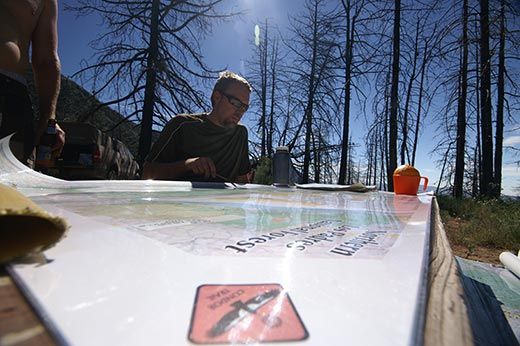
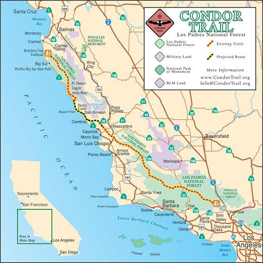
These sorts of discoveries are what keep Conant returning to this deep wilderness in the mountains north of Santa Barbara, where he’s self-published two must-have maps — one detailing the forest’s San Rafael Wilderness, the other on the Dick Smith and Matilija wildernesses. Today, Conant faces what just might be his most daunting endeavor ever: the establishment of the Condor Trail, a hiking thoroughfare that would link the redwoods of Big Sur to the gorges of the Sespe Wilderness near Lake Piru, close to where Interstate 5 emerges from the L.A. Basin.
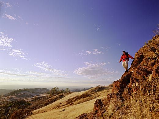
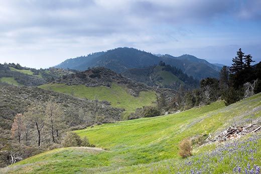
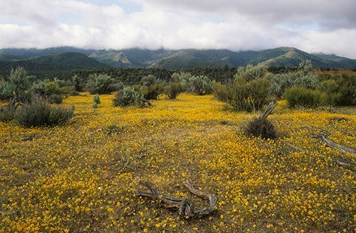
The ambitious 400-mile route through the Los Padres — which was originally envisioned in the mid-1990s as a Central Californian version of the popular but much longer Appalachian and Pacific Crest thru-trails — would trace the endangered California condor’s historic flyways, jumping from the rock art-covered boulders and wildflower prairies of the mountain porteros down to the hidden hot springs and waterfall-lined canyons in forgotten corners of Monterey, San Luis Obispo, Santa Barbara and Ventura counties. “It’s just a fantastic forest,” said Conant. “The Condor Trail will be a highlight show. Eventually, it could be the crowning jewel of the Los Padres.”
A Slow Go
The original idea for the trail was first put on paper in 1996 by Irvine, California-based software engineer Alan Coles. “I wouldn’t claim to be the only one with the idea,” admitted Coles, but he’s long been a fan of the forest, having enjoyed its wide-ranging biodiversity for 40-plus years. One day, while admiring the volunteers who worked on sections of the Pacific Crest Trail, which stretches from Mexico to Canada, Coles explained. “It just occurred to me that we could use something like that.” Though his initial trail only included the lower portion of the Los Padres — which is split into two parts near San Luis Obispo because of private property, much of it owned by the Hearst family — the idea quickly grew to encompass the entire forest. As to the route being tentatively proposed today, Coles happily claimed, “There’s just not a bad mile on the whole thing, quite honestly.”
A lawyer named Chris Danch eventually fell in love with the idea, and ran with it for a few years. “He really got a lot of publicity. He got it in the newspaper. He got a lot of people out,” said Coles. “Chris raised the consciousness level of this so much that it had really gotten out into the hiking community.” Danch moved on from the project by 2001, but not before a younger Bryan Conant saw him speak at the Santa Barbara Public Library and had his own trail fire sparked.
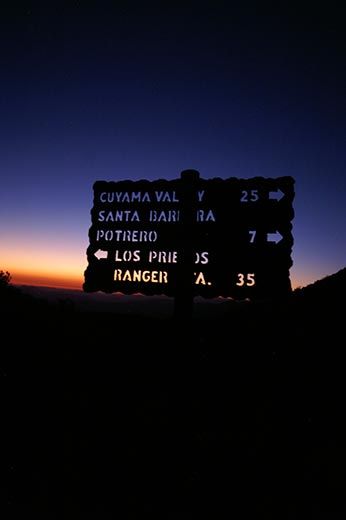
At that time, Conant had been hiking the Los Padres for less than a decade. His first trip was in 1995 as a student at the University of California at Santa Barbara, right around the time he ditched political science for a degree in geography. It took him only a few trips to realize that both the trail signs and the available maps were off. “Trail signs would say 15 miles. The map would say seven. Then you hike it and it feels like 10,” recalled Conant. “I knew that it was time to put my skills together.”
So in 2003, using a mop handle, a children’s bicycle tire and a $20 mileage tracker, Conant constructed his own trundle wheel and took to mapping the forest’s San Rafael Wilderness step by step. “I just dove in and started mapping,” he explained, taking 2- to 17-day trips with his dog Bean and then “hunkering down in the front of the computer” for a couple of months afterward to finish the job. He did the same in 2008 for the Dick Smith and Matilija, and has since updated the San Raf map to account for the forest’s recent wildfires.
The Los Padres’ old guard — including both U.S. Forest Service employees and longtime backpacking naturalists like Carol Day, who helped craft the Condor Trail idea with Coles — took notice and anointed Conant the Condor Trail’s new ambassador. In 2008, Conant officially accepted the Condor Trail challenge, and has been taking a crash course on politics, bureaucracy, fundraising and outreach ever since.
Like the first visionaries, Conant’s eyes are fixed on the Pacific Crest, Appalachian and Continental Divide trails as models. “Like those trails, the ultimate plan is to have trail signs out there, maybe even kiosks, and have a community of hikers,” he said, explaining that the 400 or so miles would probably take anywhere from one to three months to complete. “Unlike those others, you can do the Condor Trail in the wintertime. That’s actually the preferred time to do it.”
Winter, spring, summer or fall, though, no one expects the Condor Trail to unleash a flood of visitors to the Los Padres, largely because it’s deep, extremely rugged backcountry. “It’s not warm and welcoming; it’s wilderness,” explained Coles. “You really don’t have much real wilderness left in this state. You don’t see people. Everything is wild. . . but that’s really the charm of it.” Conant agrees. “I don’t expect this to be attracting thousands of hikers a year. Twenty miles on the PCT is like 10 miles here.”
Travails of the Trail
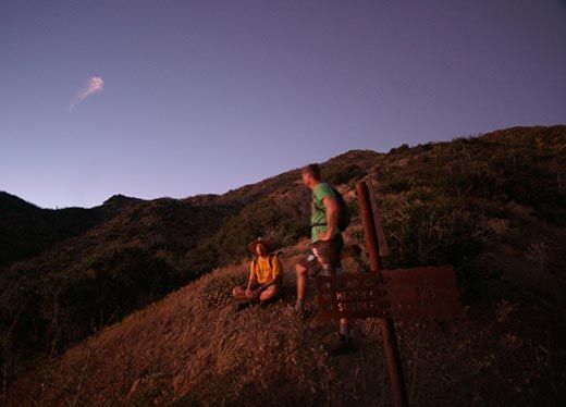
After the afternoon of bear-spotting and a night of shooting stars, Bryan, his cousin Will and I awake the next morning in our camp at Alamar Saddle, located at the juncture between the San Raf and Dick Smith wildernesses. This is where the Alamar Trail turns into the Sisquoc River Trail, but both will fall under the Condor Trail umbrella when Conant and his supporters have their way.
Set on getting some trail work done before the hot August sun starts scorching, we head down Alamar Trail at 7 a.m. with handsaws and pulaskis, a tool usually used by firefighters that combines an adze edge with an ax head. It’s my first time really working a trail, and I quickly learn that even the easiest of tasks — sawing down six-inch-wide tree trunks that cross the path and uprooting young plants that threaten to choke the way — is exhausting. We work for nearly three hours before climbing back out, but only manage to tackle about a mile stretch of trail.
This is the grueling hands-on work that will be required to make the Condor Trail a reality, and the strongest argument that Conant can make to the Forest Service is that it will be done by volunteers. Much like the Pacific Crest Trail, Conant hopes to develop a system of trail volunteers that would adopt sections of the trail and maintain them, as well as separate councils in each of the four counties to direct the work. “If we had a real backbone trail like that, what it would do is create potential for a system-wide set of volunteers that could be tied into other things as well,” argued Ray Ford, an author, backpacking expert and integral adviser to the trail. “I don’t see it as an additional burden on the Forest Service. I see it as a something that has the potential to make their jobs easier.”
But promises like that are where the Forest Service starts to get a little leery. “We’re in favor of anything that improves the trails and improves visitor use, but we’re having real struggles with today’s budget and economy in keeping the trails that we have open,” said Kerry Kellogg, wilderness trail manager for the Santa Barbara district of the Los Padres National Forest. Kellogg explains that it takes, on average, about $25,000 and 90 days of manpower just to restore three miles of existing trail, of which there are more than 800 miles in the forest. “Adding new trails is something that we would have to do with lots of thought. If we were going to add new trails, we might have to eliminate some in order to stay at no net gain.”
There is some hope for the Condor Trail as it is not officially seeking to create any new trails and the route can currently follow the existing network, at least through the southern end of the Los Padres. “All of them exist, technically,” said Conant, but admitting in the same breath that some of the historic trails are the least maintained and others travel along jeepways or dirt roads rather than wilderness. “I want to keep as much a wilderness feel as we can,” said Conan, “and avoid roads as much as possible.” Ideally, Conant would like to craft a brand-new nine-mile segment from Pine Mountain to Madulce Peak in order to avoid dirt roads, but he’s not planning on pushing that anytime soon, for new trail creation also requires costly environmental and archaeological review.
As a lifelong backcountry explorer, Kellogg is personally excited by the idea, knows that the emerging Condor Trail association will be able to attract grants and other funding that the Forest Service cannot, and hopes that it comes forth with a professionally laid out proposal that identifies priorities, lists alternatives and shows long-range thinking. But when his “weary bureaucrat” side arises, Kellogg has plenty of worries, including whether the new Condor Trail volunteer system would pull away from the entire forest’s volunteer pool and whether the forest would be creating an unrealistic expectation for visitors who come expecting to find a perfect trail only to encounter serious brush. “I don’t want to give a guy a T-shirt and a map and send him out on trails that are completely overgrown,” laughed Kellogg. “That T-shirt would turn to garbage immediately.”
As someone who’s had plenty of shirts shredded by the Los Padres, Conant appreciates the government’s concerns and plans to address them in the years to come. “I’m usually pretty impatient, but things like this aren’t built overnight,” said Conant, who’s working on a ten-year plan for the Condor Trail. “It’s a concept better presented slowly.”