See the Gulf of Mexico’s Seafloor Like Never Before With This 1.4-Billion-Pixel Map
Made from data collected from 200 proprietary maps from oil and gas companies, the new image has a resolution 16 times greater than the next best map
In the age of satellite imagery, cartographers have gotten great at creating detailed maps of the surface of the Earth, producing incredible data on remote regions that humans have probably never visited. We even have pretty good maps of the surface of Mars. But when it comes to the floor of Earth’s oceans, mapping is woefully behind. Ryan F. Mandelbaum at Gizmodo reports that we’ve only charted about five percent of the ocean floor, and many of the maps we have are pretty low resolution. Which is why a new dataset published by the Bureau of Ocean Energy Management is so exiting: they’ve released the first high-resolution bathymetry—or underwater topographic—maps of the Gulf of Mexico’s deepwater regions.
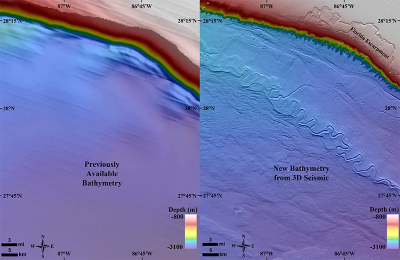
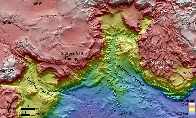
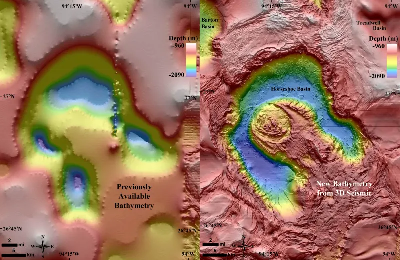
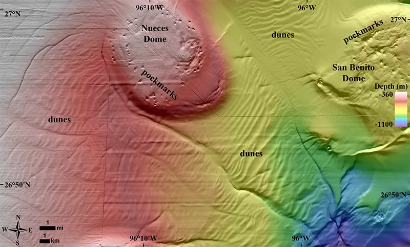
K.V. Kramer and W. W. Shedd at EOS.org report that the 1.4-billion-pixel map was created from more than 200 maps developed by seven companies in the oil and gas industry that have explored the region since the 1980s. Those companies agreed to allow the BOEM to release the data to the public. The new map covers 90,000 square miles covering depths from 130 feet to 11,000 feet underwater and has a resolution 16 times higher than the map now most commonly used to study the Gulf of Mexico, created in the 1990s by NOAA. Each pixel in the new data represents about 1,600 square feet, roughly the average footprint of an American house, and shows 34,000 seafloor features like pockmarks, channels, hard grounds, mud volcanoes and natural seeps.
“We know more about some other planets than about a lot of the areas of our own planet’s sea floor,” BOEM geologist Kody Kramer tells Mandelbaum. “Scientists were eager to get this high resolution data. It’s so much better than what’s out here already for the region.”
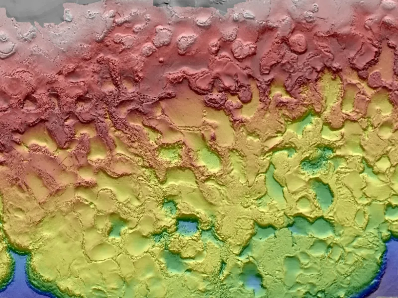
The images reveal a surprisingly complex seafloor. Kramer and Shedd report that the geology of the Gulf of Mexico is not driven by plate tectonics, but is governed by thousands of meters of subsurface salt, the legacy of an ocean that covered the area 200 million years ago. The “salt tectonics” create a unique underwater landscape that is in constant flux as it interacts with a thousand meters of heavy sediment that has accumulated on top of the salt over the millennia. The result is an region constantly in flux, full of faults in the salt, fractures, basins and other interesting geologic features.
The origin of the new map, however, is a little sad. Kramer and Shedd report that after the 2010 Deep Water Horizon oil spill, marine biologists wanted a detailed map of the Gulf to help locate ecological communities that might have been impacted. Most of the detailed maps, however, are considered proprietary by oil and gas companies. But the BOEM does keep copies of every survey conducted, and realized they could find a way to overlap all of that 3D seismic data into one highly detailed super map. After doing that, they realized they could produce a similar map for the broader region, though it took some negotiating to get permission to release the data.
While the map probably doesn’t boost the amount of seafloor mapped much past the five percent level, it is a sign that researchers are starting to get a better grip on the bottom of the ocean. Just last month, researchers released an atlas of more than 200 images from the Arctic and Antarctic seafloor showing the tracks of ancient glaciers. And at least one organization, the General Bathymetric Chart of the Oceans, is advocating for a $3 billion project to completely map the seabed, a job they say they can complete by 2030.