Massive Royal Atlas Gets Digitized
The magnificent Klencke Atlas is now available online courtesy of the British Library
/https://tf-cmsv2-smithsonianmag-media.s3.amazonaws.com/filer/e2/92/e292823e-e192-4ef0-b609-2e4e368ac5b2/klencke.jpg)
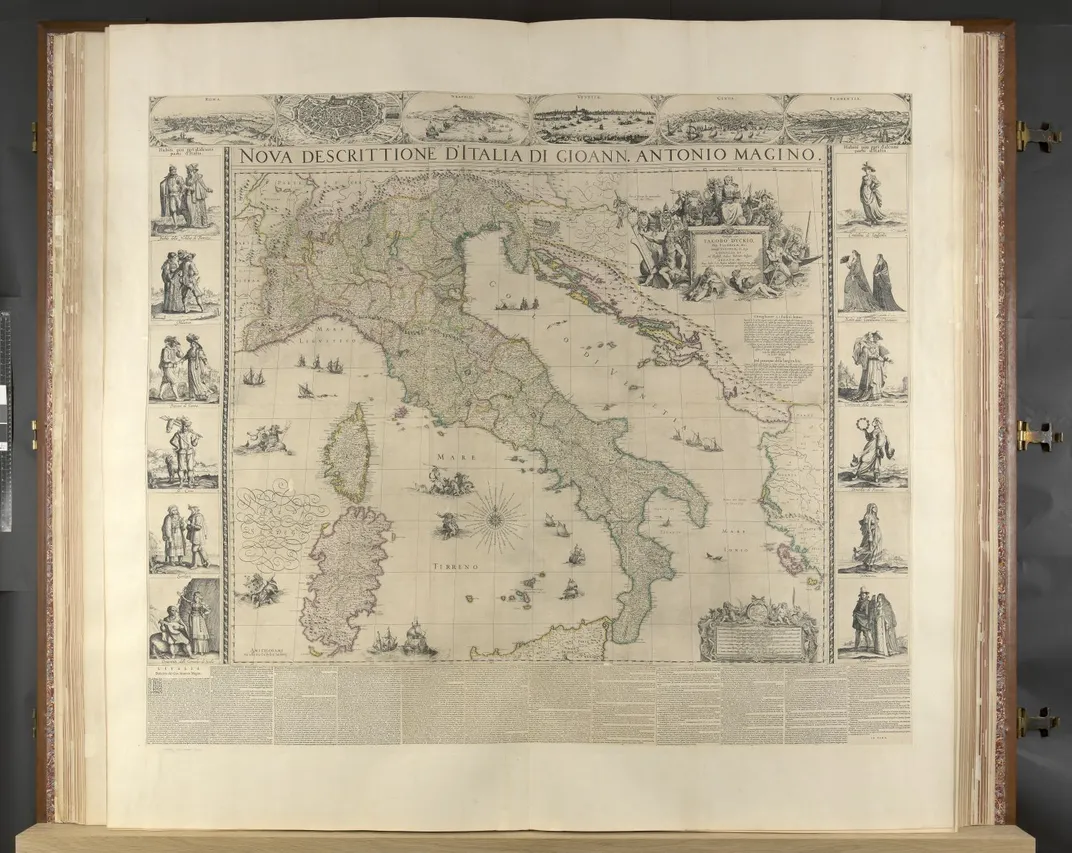
Digitizing books is pretty run-of-the-mill job these days—Google alone has scanned over 25 million titles. But some books need special treatment to make it into the digital world, and the Klencke Atlas held at the British Library took a lot of extra effort, Allison Meier at Hyperallergic reports. That's because the volume is six feet tall by seven feet wide when open.
In a time-lapse video, the Library shows how the staff had to build a special platform for the massive book, which was wrestled into place by several curators so the maps could be photographed by a high-resolution camera.
So why go to all the trouble to digitize this book? The idea is to give researchers better access to the Dutch cartography, Tom Harper, lead curator of antiquarian maps at the library, tells Meier. “We digitized the atlas in order to increase access to the 41 maps which are contained in it, which are extremely rare — some known in only three surviving copies — but not terribly well known," he says.
According to Emily Sharpe at the Art Newspaper, the Klencke Atlas was given to King Charles II in 1660 by Dutch sugar merchant Johannes Klencke. Most of the maps were designed to hang on walls, but Klencke had them bound together into the massive book. For the effort he earned a knightship and several lucrative trade concessions for his plantations in Brazil. The atlas was wasn’t very useful but it was impressive. “It is completely impractical, completely overblown and totally over the top,” Harper tells Sharpe.
The digitization is part of an effort to digitize all the volumes in the British Library’s George III map collection. That king began building a massive map library in the 1760s, eventually amassing a huge collection. Many of the maps, he simply “borrowed” from surveyors and others and never returned, and others he claimed he “captured” in war.
While the Klencke Atlas has been on view to the public before, it was not displayed with its pages open until 2010. Now the public can peruse the entire contents online.
The Klencke’s reign as the world’s largest atlas lasted about 350 years, but it was finally surpassed in 2012 with the publication of the Earth Platinum Atlas, a six-foot by nine-foot behemoth that includes incredibly detailed satellite images of the surface of the earth.