The Many Roads That Lead to Rome, Visualized
Caveat: not all cities named Rome are in Italy
/https://tf-cmsv2-smithsonianmag-media.s3.amazonaws.com/filer/cd/b1/cdb12458-0385-463b-894f-bb2f179e4408/0_roads_to_rome_-_photo.jpg)
The English language is liberally sprinkled with idioms, many of which don’t make much literal sense. But occasionally one does hold up under scrutiny. Take the phrase "all roads lead to Rome." Turns out, many roads really do lead to Rome, especially if the Rome in question is not always the one that most people intuitively think of.
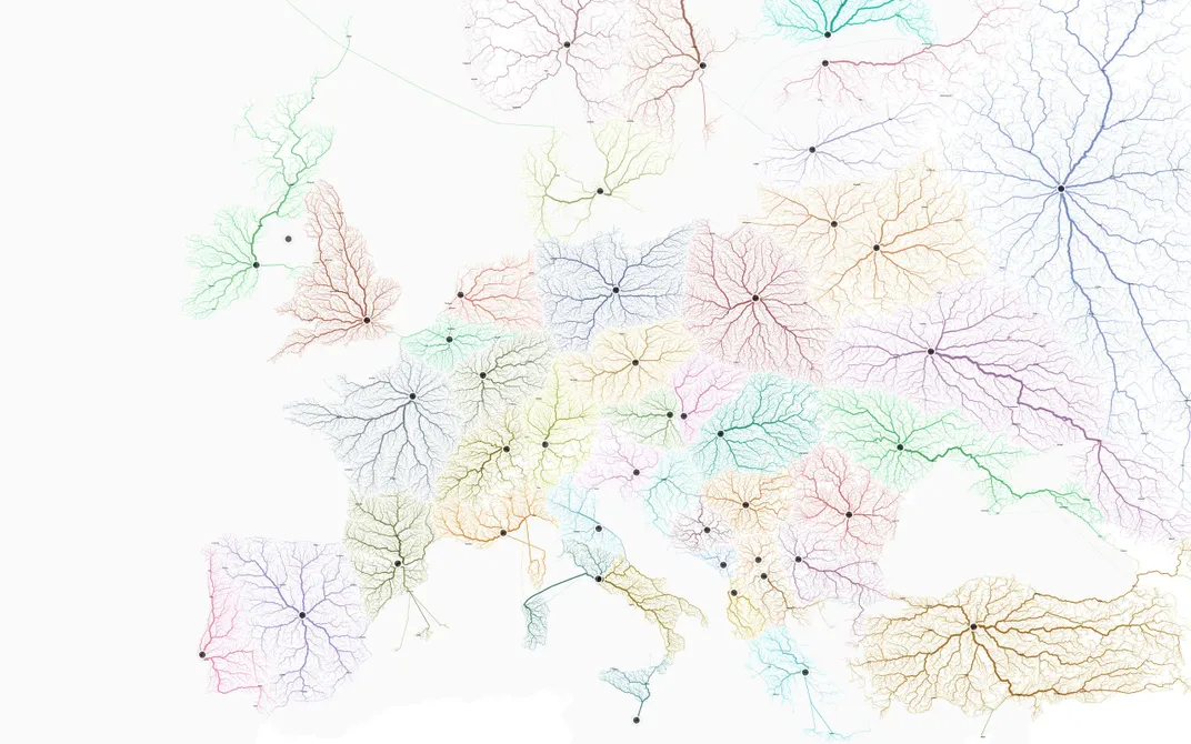
Designers Benedikt Groß, Philipp Schmitt and Raphael Reimann decided to use their skills to create maps showing all the roads that lead to Rome, writes Liz Stinson for Wired. They found nearly 500,000 different routes in Europe that ended in the Eternal City and assembled them in a new infographic.
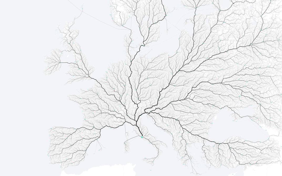
The results are reminiscent of rivers or blood vessels branching from a single point. The group added more weight to highways that were traced by more than one route, so the thoroughfares closest to Rome are etched the darkest.
To make the map, the team - which is part of the a mobility technology group called moovel lab - explains on their site that they first divided Europe into a grid and picked a starting point in each square. An algorithm they built calculates a route from each point, drawing from the open source software GraphHopper, which in turn uses Open Street Map data.
The beautiful results inspired the computer scientists to branch out to other continents. Ancient Rome’s imprint on the culture of the world is deep enough that there is a city called Rome or Roma on every continent; indeed, the U.S. has 10 cities named after the Italian capital. A second map shows the fastest way to the closest Rome from any point in the U.S.
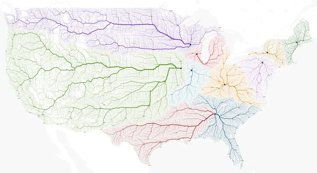
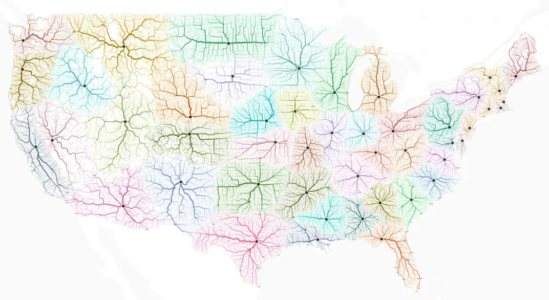
Since the roads that lead to Rome were actually built to connect the far reaches of the Empire to the capital, the researchers decided that another map should show the fastest routes to the nearest state capital, an approach that suggests some slightly different state shapes than the ones that currently exist. The same holds true for a map depicting the routes to the capitals of European countries.
In addition to thier beauty and visual intrigue, the maps can tell a story about the political and social decisions that build a country. They also offer clues to the strengths and weaknesses of current road infrastructure. An interactive version of the data lets people explore the time it takes to journey from one European city to another and reveals how accessible different areas are.