Watch 32 Years of Our Changing Planet Unfold With Google Timelapse
A satellite-eye’s-view of growing cities and climate change

A lot has changed in the past 32 years: average yearly temperatures increased, glacier have retreated and nearly three billion more people wander the planet’s surface. Now, Google Earth's latest update to "Timelapse" gives viewers a glimpse into the past, allowing them to watch landscapes evolve from 1984 to 2016.
Google first rolled out Timelapse in 2013, which allowed users to scroll back through satellite images to see what the world looked like at any point between 1984 and the present. But those initial pictures were rough compared to the updated high-resolution imagery now used with the tool, giving people a much sharper look at the world as it changed, Peter Hess reports for Popular Science.
“Using Google Earth Engine, we sifted through about three quadrillion pixels—that's 3 followed by 15 zeroes—from more than 5,000,000 satellite images,” Chris Herwig, Google Earth’s program manager, writes in a blog post. “For this latest update, we had access to more images from the past, thanks to the Landsat Global Archive Consolidation Program, and fresh images from two new satellites, Landsat 8 and Sentinel-2.”
Processing that much data, however, is easier said than done. The satellite images that Google’s engineers worked with were extremely high resolution, and in order to get the best pictures, they had to give some of them touch ups. Jeffrey Kluger reports for TIME:
In some, cloud cover had to be scrubbed away; in others missing pixels had to be filled in. In all of the images, there were plenty of those pixels to attend to. The average high-definition TV image is made of about 300,000 individual points of light. The Google time-lapse images pack 3.95 trillion pixels into a single frame.
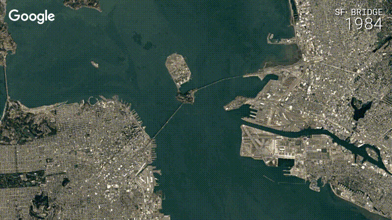
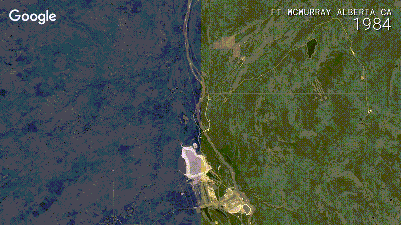
In the end, all that work and data crunching resulted in a much sharper and more detailed look at the way both nature and humans have reshaped the face of the planet over the last 30 years. While anyone can pick their own coordinates to examine, Google’s engineers isolated some particularly striking ones—the development of Fort McMurray in Alberta, Canada’s Tar Sands, is one example. There’s the creation of artificial islands off the coast of Dubai, for another. And of course, there’s the changes in the natural world such as meandering rivers, rising tides, shrinking glaciers, and dwindling forests, Bec Crew reports for ScienceAlert.
Some of the imagery is certainly sobering. But by giving people a good look at how our species has changed the world, it could also inspire new ways of thinking about how we go forward from here.