These Stunning Satellite Images Turn Earth Into Art
These images illustrate the brutal beauty geologic processes carve into our planet
Jane J. Lee
/
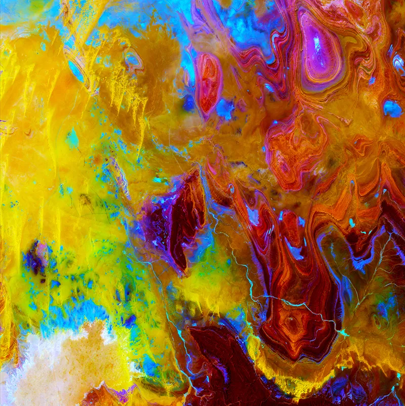
The psychedelic colors in this image serve to highlight the features of the Tanezrouft Basin in Algeria, one of the most desolate places in the Sahara Desert. Sand dunes (yellow) dribble down the left while weathered sandstone formations dot the right in concentric whorls.
U.S. Department of the Interior/U.S. Geological Survey
/
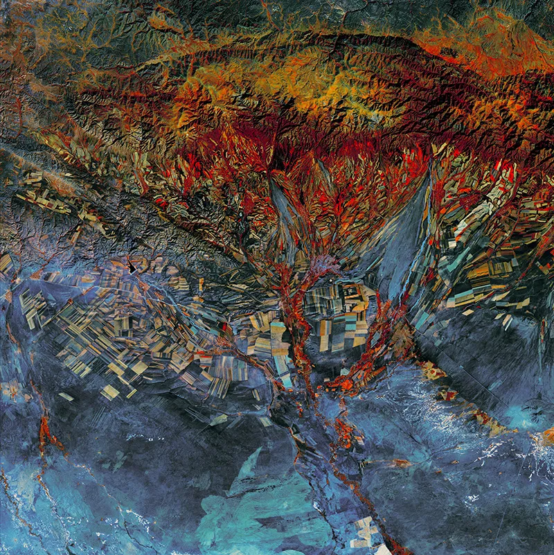
Eastern Kazakhstan is riddled with agricultural fields. But the farms follow the contours of the land; mountain valleys (near the top) dictate long and narrow fields while the plains (bottom) allow for larger, more rectangular plots.
U.S. Department of the Interior/U.S. Geological Survey
/
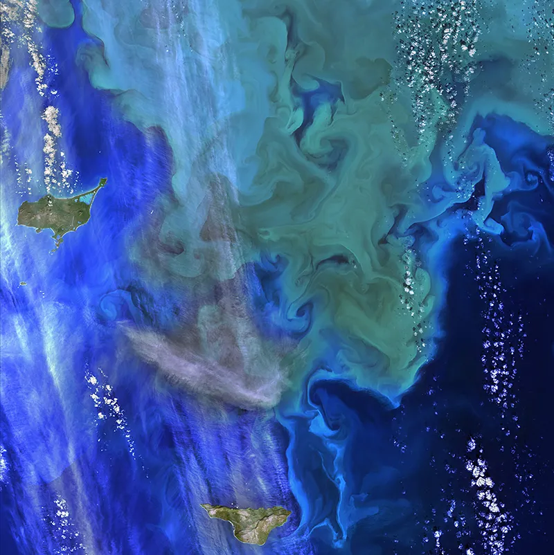
An algae bloom shows up as swirls of creamy olive green in this image of the Bering Sea between Alaska and Russia. Organisms, such as algae, can suck up huge amounts of carbon and send it to the bottom of the ocean once they die. Called sequestration, this can play a large role in regulating Earth's climate.
U.S. Department of the Interior/U.S. Geological Survey
/
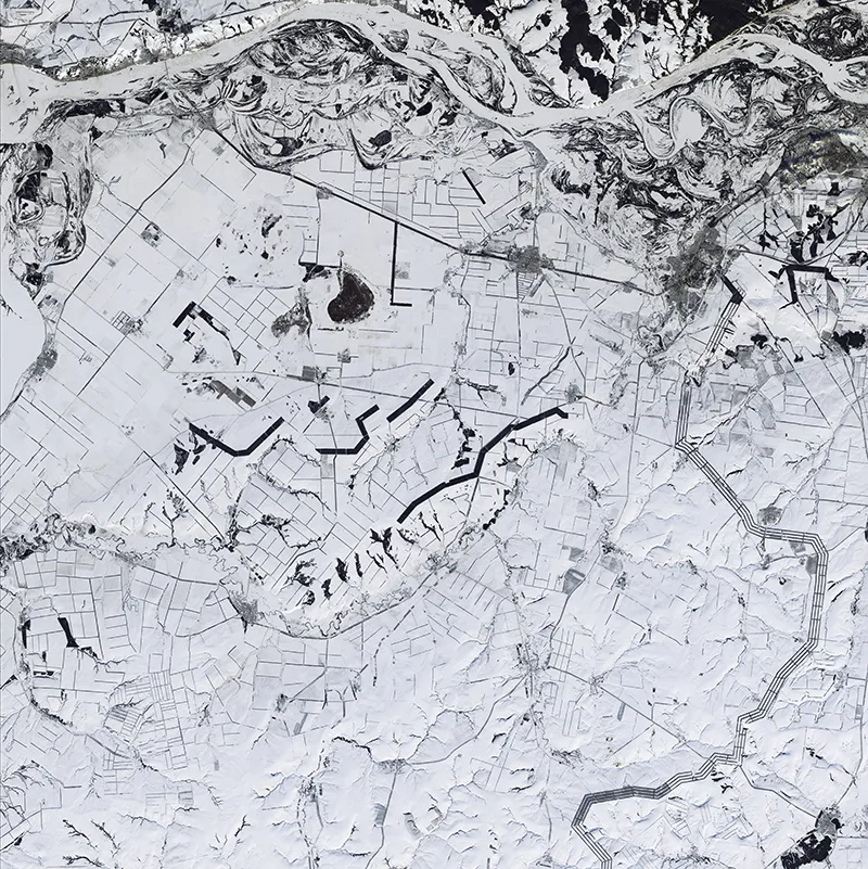
The Volga River snakes across the top of this image of southwestern Russia in the heart of winter. This natural color image shows a tangle of roads, fences and rows of trees that act as windbreaks. Not only do windbreaks protect crops from wind and erosion, they also hang on to snow, which allows more moisture to soak into the soil.
U.S. Department of the Interior/U.S. Geological Survey
/
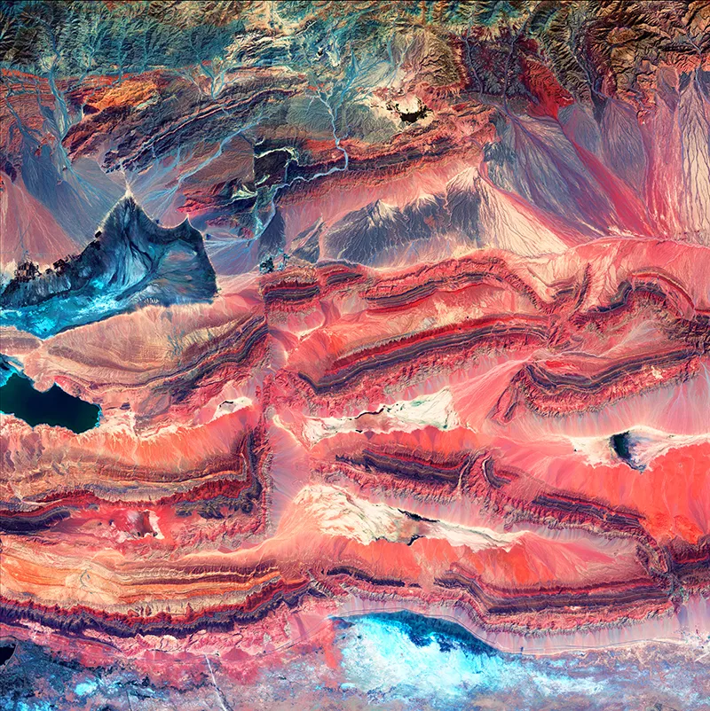
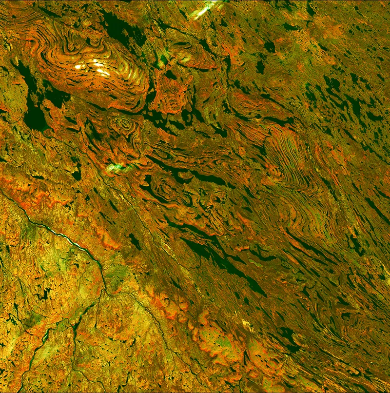
This image of western China highlights "faults," or areas where rock layers have broken apart thanks to the collision of landmasses. The different colors of rock in this picture represent layers that formed at different times and in different environments.
U.S. Department of the Interior/U.S. Geological Survey
/
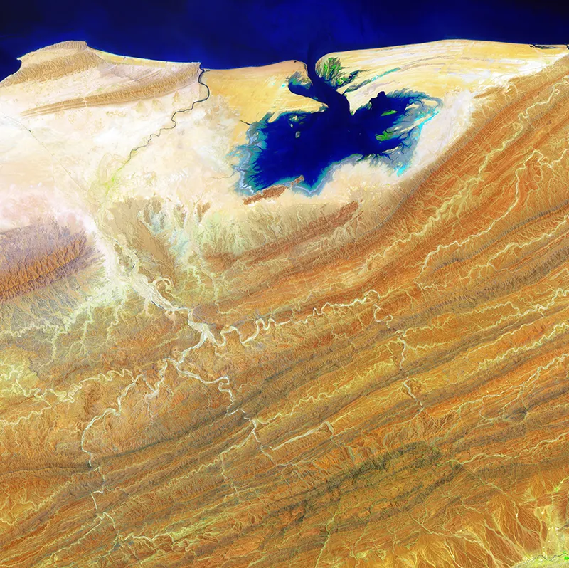
The Arabian Sea spills onto Pakistan's desert landscape like ink on a page. The deep blue splotch is the Khor Kalmat lagoon and it butts up against the Makran Coastal Range (lower right). The bright green near the top of the image is mangrove forests.
U.S. Department of the Interior/U.S. Geological Survey
/
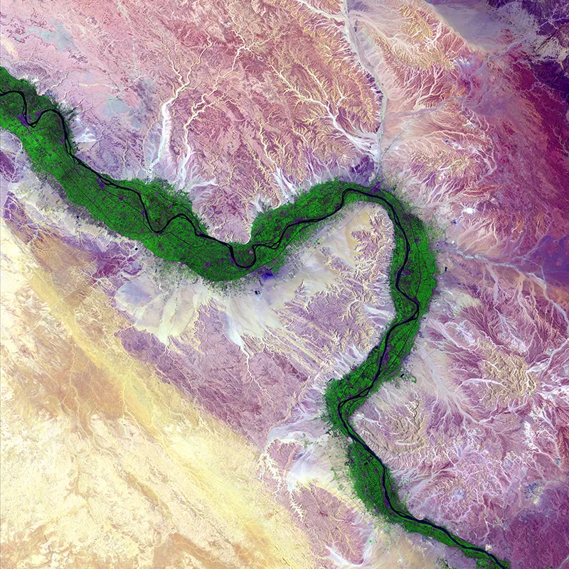
A lush green border outlines the Nile River as it snakes its way across Egypt. The country's desert lies outside of a relatively small ribbon of farmland that hugs the life-giving waterway.
U.S. Department of the Interior/U.S. Geological Survey
/
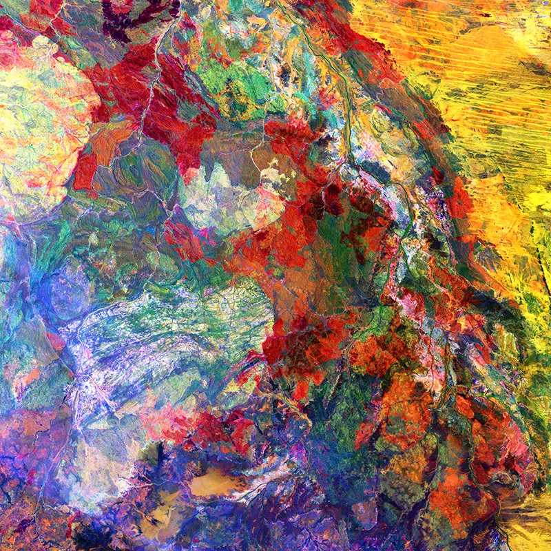
Western Australia's Great Sandy Desert blazes in bright yellow on the right side of this image while the red blotches highlight areas that burned during wildfires. The mélange of colors in the rest of the image captures various types of geologic formations.
U.S. Department of the Interior/U.S. Geological Survey
/
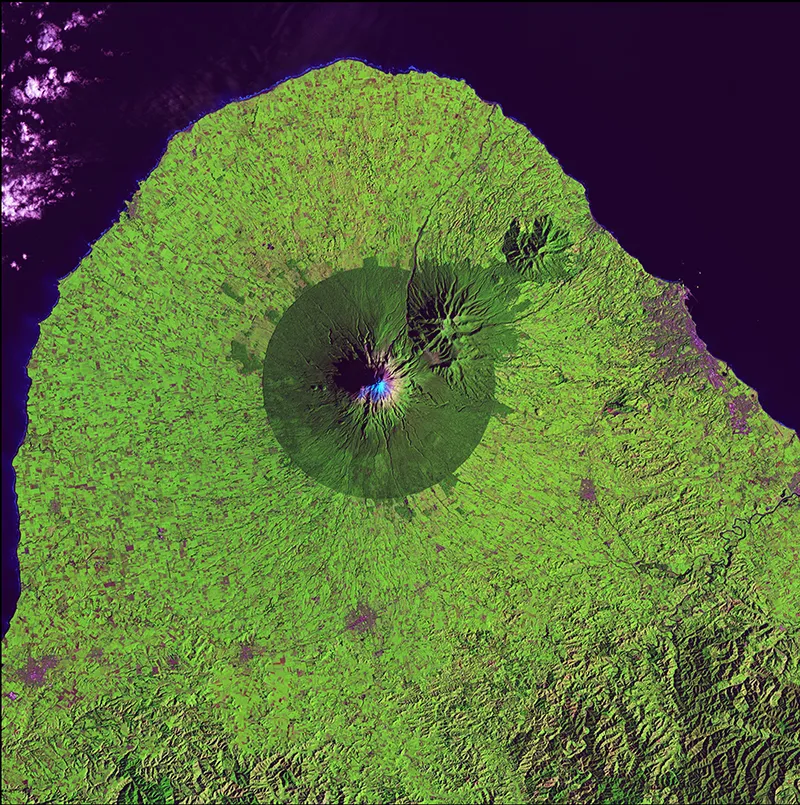
Mount Taranaki stands amidst a dark green circle of forest in this image of Egmont National Park in New Zealand. The lighter green outside the park's boundaries indicates farmland.
U.S. Department of the Interior/U.S. Geological Survey
/
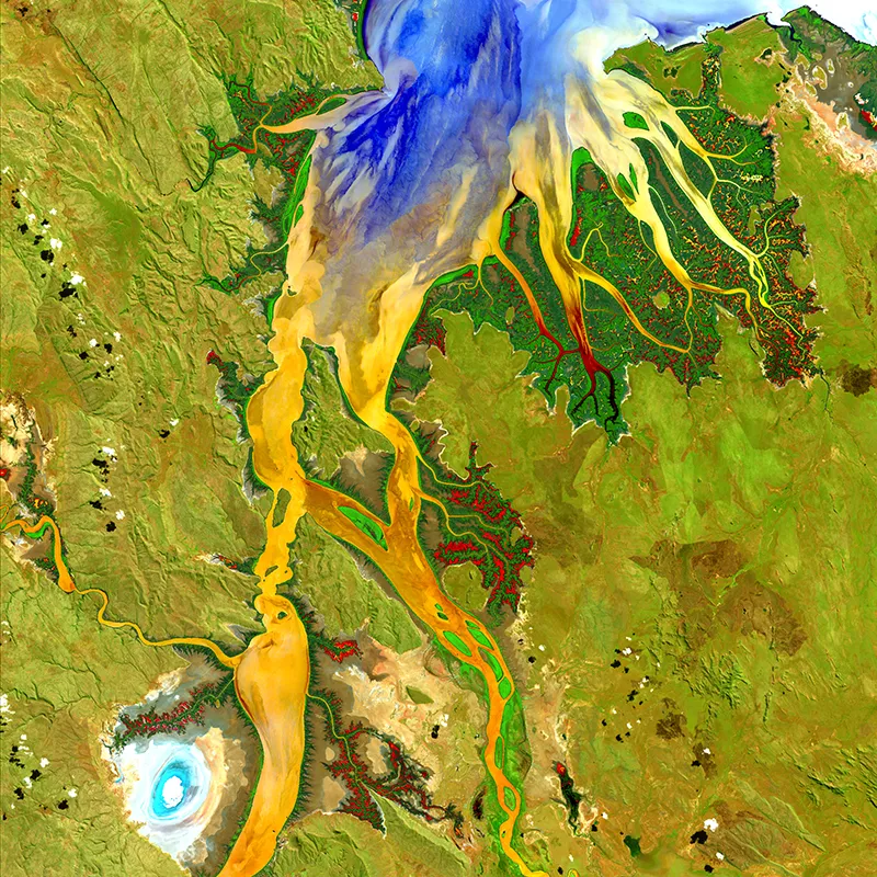
Water spreads like inky-blue fingers into mangrove forests along the shore of Australia's Ord River (top). The sediment load in the water shows up as yellow and orange while mudflats stick out like a light blue bull's-eye on the lower left.
U.S. Department of the Interior/U.S. Geological Survey
/
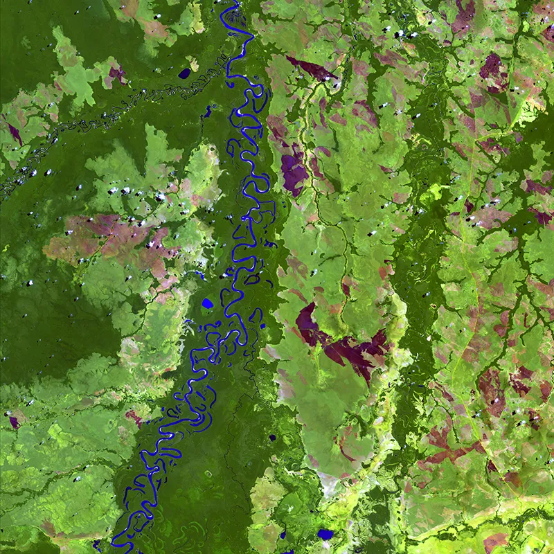
Bolivia's Beni River meanders through the Amazon jungle. Dark green delineates the forest while light green indicates grassland or more sparse stands of trees. The blue dots scattered along the river are oxbow lakes. They form when curves in the river's pathway eventually pinch off, forming a completely separate body of water.
U.S. Department of the Interior/U.S. Geological Survey
/
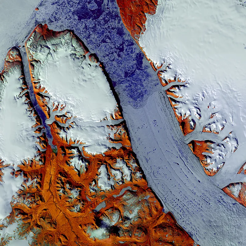
The Petermann glacier is currently cutting its way across Greenland to the sea, and this image showcases the floating portion of this glacier. It stretches 43 miles long from the bottom right to the top center of the picture, and it is the longest floating glacier in the Northern Hemisphere. Bare ground—recorded with infrared wavelengths of light—pops in a reddish-brown color.
U.S. Department of the Interior/U.S. Geological Survey
/
The dark green splotches in this image are lakes gouged out of the landscape by glaciers that cut near Quebec in Canada. The massive rivers of ice also scraped away the top layers of sediment to expose the folds and swirls of rock layers underneath.
U.S. Department of the Interior/U.S. Geological Survey
Nearly 500 miles above our heads, a series of satellites continues a silent vigil recording the changes that nature and people impose on planet Earth. Landsat 8 is the latest satellite specifically used to study the status of large swaths of vegetation, how urban development changes the landscape and how much influence natural disasters have on the surrounding area. Scientists display their data using a combination of natural color and infrared images.
While the images tell researchers what they need to know about how Earth changes over time, they also reveal the beauty of our planet. The lush vegetation along mighty rivers, farmland crowded into mountain valleys and windswept ice sheets look like dabs of paint or streaks of color from a satellite's point of view in space.
The U.S. Geological Survey (USGS) has compiled some of the more stunning examples into a traveling art exhibition called Earth as Art 4, the fourth in a series of shows since 2002. The collection, which can be viewed in full online, debuted at USGS headquarters in Reston, Virginia.