DIY Cartographers Are Putting Slums on the Literal Map
When a community makes its way onto a map, it’s that much harder to deny, say activists.
/https://tf-cmsv2-smithsonianmag-media.s3.amazonaws.com/accounts/headshot/erin.png)
/https://tf-cmsv2-smithsonianmag-media.s3.amazonaws.com/filer/b7/7b/b77be508-b1b8-4f7d-87c6-1215b087a942/1978559_848321891873417_3455105195331354283_o.jpeg)
By 2017, a majority of Earth’s population will live in urban areas. And an increasing number of those people will live in slums: According to the United Nations, the number of slum dwellers has grown by 55 million since 2000.
But don’t look for those slums and other ad-hoc and marginalized settlements on official maps. When it comes to the documents that reflect geographic reality and dictate public policy, many slum dwellers might as well not exist. Impoverished areas are regularly bypassed by official and commercial mapping initiatives—an oversight that reduces dynamic communities to vague blanks on otherwise comprehensive maps.
Primož Kovačič, an engineer who specializes in surveying and Geographic Information Systems (GIS), wants to do something about that. “These marginalized communities are missing from maps,” he tells Smithsonian.com. “The government doesn’t recognize the area, or it’s not economically interesting for companies to map it.”
But being on the map is important—and not just for symbolic reasons. Communities that are on maps can gain access to things like emergency services (after all, it’s hard for an ambulance or fire truck to reach a location that can’t be found). Neighborhoods that know how big and populous they are can agitate for better public services like electricity and streetlights, gain political representation, or keep other groups from encroaching on their territory. When a community makes its way onto the map, it becomes that much harder to deny.
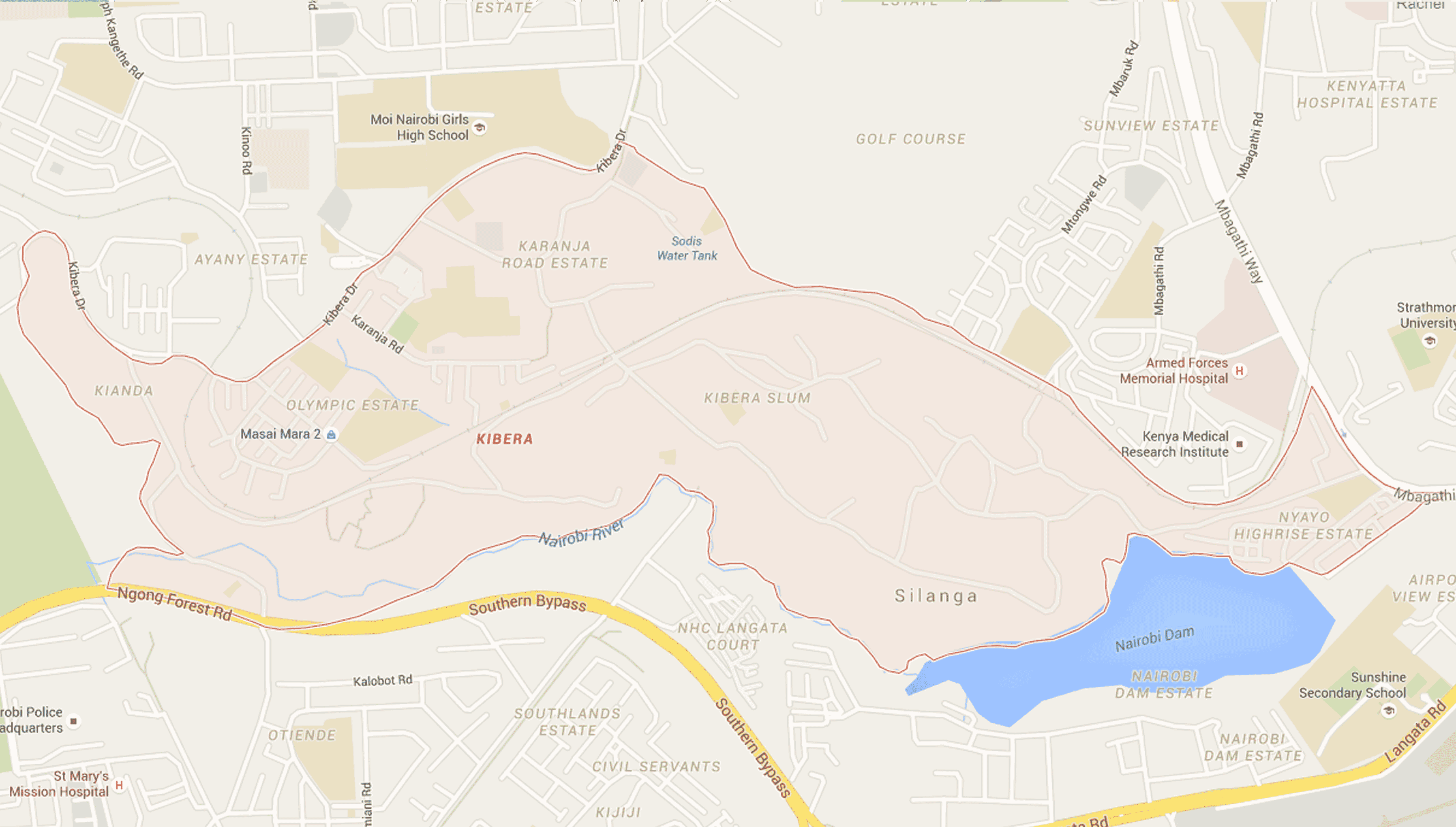
Kovačič has spent the last seven years teaching Kenyan citizens how to document their own worlds and make their way onto official maps, contributing to mapping projects in Kenya’s two largest informal settlements, Kibera and Mathare. A look at either Nairobi settlement on Google Maps reveals featureless patches threaded through by scant roads—but the combined communities house over three million Kenyans. Satellite imagery shows only part of the story: Because slums are ever changing, buildings can be constructed or torn down literally overnight. Property rights are confusing and contested, too.
On the ground, things are just as confusing: Nairobi’s slums are packed with villages with constantly morphing borders and omnipresent security threats for residents, not to mention outsiders. Meanwhile, the human beings who live there are forced to improvise things as basic as shelter, sanitation and education.
No wonder, then, that neither Nairobi community had maps—and that both took matters into their own hands.

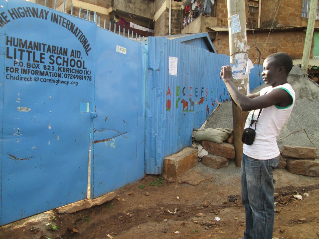
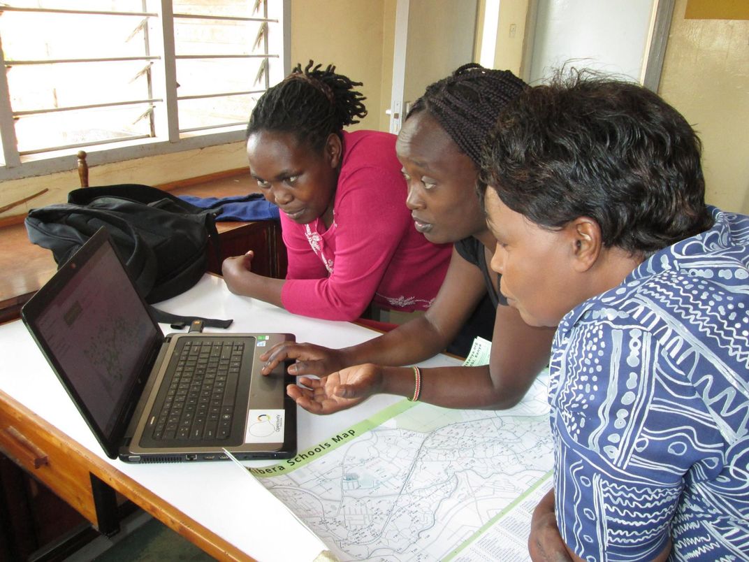
With the assistance of NGOs and mapping initiatives like Map Kibera and Spatial Collective, Kovačič’s consulting firm, residents of both Kibera and Mathare put their own communities on the map. Residents were trained by geographers and given GPS devices, then sent into their communities to log the landmarks that mattered in their lives. Teams representing different villages then edited and uploaded map information and worked with professional cartographers to perform data analysis on different features of the slum.
“We turn people into data scientists,” says Kovačič. But DIY mapping does something else—it turns amateur cartographers into activists, and vice-versa. Within underserved areas, maps can expose the lack of things like water and power services, trash collection and healthcare. Armed with information about what they don’t have, citizens gain the power to advocate for what they need. When demographic information is overlaid on new maps, it can help officials target the greatest need for services and provide them in a way that reflects the real makeup of formerly invisible communities. One such overlay in Kibera helped residents apply for clean water from the local water utility. Another in Mathare mapped out every public toilet in the neighborhood.
Citizen cartographers and the agencies that assist them have a powerful ally in their quest to make the invisible visible—OpenStreetMap, a citizen-created world map generated by locals and available to one and all. Anyone can enter GPS data or aerial photography into OpenStreetMap, which the project supplements with publicly available data.
Humanitarian groups use OpenStreetMap data to figure out how to get services to people in need, as when the Humanitarian OpenStreetMap Team coordinated damage assessments of an earthquake-ravaged area near the Afghanistan - Pakistan border in late 2015.
Spatial Collective and OpenStreetMap aren’t the only groups who believe in the power of DIY mapping. Mapillary, a community-based photomapping platform, just raised $8 million in funds to continue creating a Google StreetView alternative that stitches together individual photographs into a crowdsourced, 3D view of the world.
“The top-down approach has failed to scale,” Mapillary’s founder, Jan Erik Solem, tells Smithsonian.com. “If you want something that covers the rest of the world—the entire developing world—you have to let anyone contribute.” So far, Mapillary has collected over 50 million photos in more than 170 countries. Users license their images to Mapillary, who sells the data to governments for infrastructure insight and gives it to NGOs for free in the hopes that they’ll use it to better pinpoint things like disaster response and charitable outreach. “People should be given control over what is captured and when, instead of waiting for institutions,” says Solem.
Or should they? Sterling Quinn, who is earning his Ph.D. in geography at Penn State, notes that there are downsides to user-generated maps. Just because an underserved community makes its way onto the map doesn’t mean it becomes less vulnerable, says Sterling. “Putting yourself on the map may make you more vulnerable to people who want to exploit the area,” he tells Smithsonian.com.
In 2006, a University of Kansas project called México Indígena met with the ire of Mexican indigenous organizations. The project’s goal was to use participatory mapping to understand public land ownership within native communities, but questions over the true purpose of the data collection and objections to its partial funding by the U.S. military turned the project into a lightning rod. Accusations of “geopiracy” indicated just how sensitive mapping—which can disrupt the balance of power and expose groups to legal proceedings and scrutiny—can be.
And then there’s the issue of bias and accuracy. When humans initiate mapping projects, says Sterling, they superimpose their personal agendas onto those maps—whether or not they are professional cartographers. Citizen-driven mapping projects might miss data points that would be considered in larger, more comprehensive initiatives with access to more expensive equipment and more professional resources. Then again, he adds, it’s a way for people to say, “Hey, we’re here. We have livelihoods. We have needs.”
Professional cartographers may still have their doubts about the accuracy of DIY maps, but Kovačič is confident in citizen-driven projects. “People don’t take us seriously,” he says. “They think that if it’s not some kind of academic institution or the World Bank or some kind of Ph.D. people, it’s not worthy. But I can assure you that we can collect much better data than all of those institutions.”
After all, says Kovačič, the best way to prove the power of DIY mapping is to do it well. “We can’t make mistakes,” he says, his voice intensifying over the crackling Skype line from a Kenya he’s helping put on the map, one GPS point at a time. “The worst thing we can do is f--k something up.”
/https://tf-cmsv2-smithsonianmag-media.s3.amazonaws.com/accounts/headshot/erin.png)