Caves Can Now Help Scientists Trace Ancient Wildfires
But the chemical clues for fire add an unexpected snarl for researchers using those same caves to track climate change
/https://tf-cmsv2-smithsonianmag-media.s3.amazonaws.com/filer/ce/9a/ce9a00b3-649f-4654-ae43-d2da20a845fd/42-33074787.jpg)
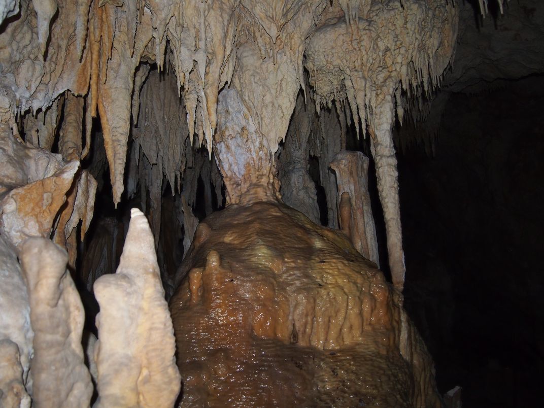
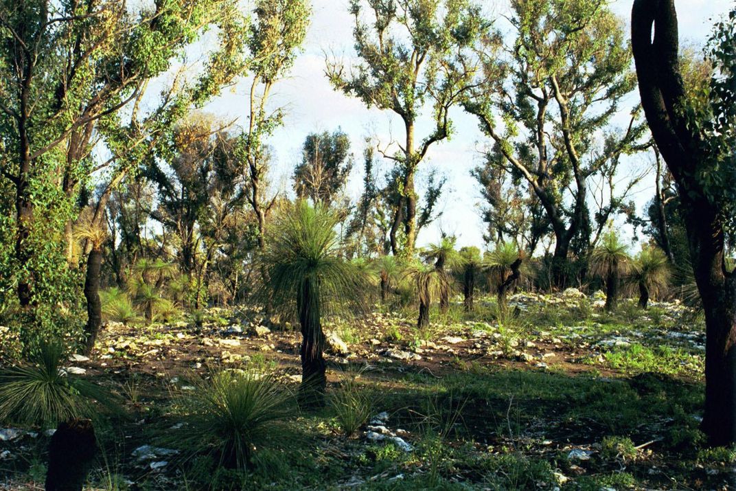
Inside Yonderup cave, 12 miles north of Perth, Australia, Pauline Treble is travelling through time. Rather than bending the laws of physics, the researcher is examining records of Earth's past locked inside stalagmites and stalactites—the latter from the ceiling and the former from the ground—together called speleothems.
These iconic parts of caves form when water drips into the subterranean maw, carrying minerals with it. The liquid leaves the minerals behind, just as water from your shower leaves deposits on the tile, and some of the water stays trapped between mineral crystals. Over centuries, this pretty plaque becomes a time capsule: Each mineral layer holds chemical clues, or proxies, to tell what was going on above ground during a particular era. The closer to the middle of the speleothem you look, the farther back in time you’re seeing.
Scientists like Treble, of the Australian Nuclear Science and Technology Organisation, are learning how to use these cave-cones’ compositions to trace ancient ebbs and flows in climate and weather patterns. The hope is to not only understand the past but also to get possible glimpses of our future.
Now Treble and her colleagues have found that cave formations also capture records of ancient wildfires—and that presents a problem. The signal for fire looks a lot like a major proxy for changes in climate conditions, which means scientists may be mistaking local disruptions like fires for more global effects.
“It really needs to be brought to people’s attention,” says Treble. “Otherwise there’s plenty of potential for people to be misinterpreting those proxies.”
Treble didn't set out to find ancient fires. She traveled to Yonderup hoping to extract the cave's rainfall information and add to the paleoclimate record. “There should have been a clear signal,” says Treble, a signal like the ones other scientific spelunkers had seen in other caves. But, mysteriously, there was not.
The problem was that those other caves were located in temperate parts of the Northern Hemisphere. In Western Australia, the climate leaned drier, more Mediterranean. With the strange lack of signal in her cave, she began to think that perhaps the proxies that temperate scientists used just didn’t translate down under.
But then she considered the wildfire that she remembered had blazed above the cave in February. How would that have changed the speleothems? What would an encoded fire look like? And could its speleothem signals mask the one from rainfall?
She turned that project over to University of New South Wales undergraduate Gurinder Nagra. He worked with Treble and her colleague Andy Baker to expose how fires affect the land they burn and how those effects drip into caves.
Oxygen is one of the key proxies scientists use to reconstruct the past—specifically, the changing ratio between the isotopes oxygen-18 and oxygen-16. In the broad sense, rainwater has more oxygen-16 than seawater because that isotope is lighter, so it evaporates more easily from the ocean, finds its way into clouds and then falls back down to Earth. The warmer the temperature, the more oxygen-18 can evaporate, too—and the more water evaporates period, meaning the amount of precipitation rises globally.
But reading into the ratios that show up in caves and in different climate zones isn’t simple, and their exact meaning varies around the world.
“In Southwest Australia, the [oxygen] ratio of rainfall is related to two things: the intensity of rainfall events and changes in atmospheric circulation,” says Treble, a finding she has verified by looking at known 20th-century rainfall events and a modern stalagmite record. For that part of Australia, Treble has found that a higher ratio—more heavy oxygen compared to light—means less heavy rainfall, or a shift in the Southern Hemisphere’s westerly winds.
Adding to the intricacies, it seems that the oxygen ratio can be as sensitive to conflagrations as it is to climate. Messages from the two are mixed up in the speleothems, and no one knew it until now.
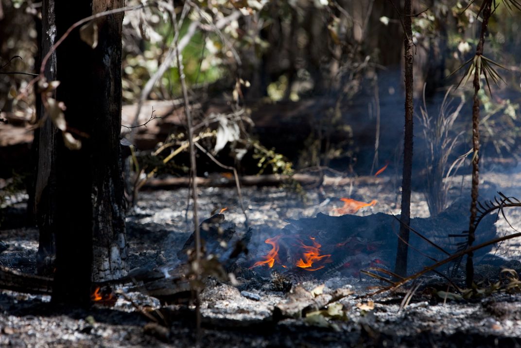
When a fire rips through a dry region, it chars or kills vegetation. Those casualties change the rates of transpiration and evaporation—how water runs up through the roots of plants to their leaves and then leaps into the air as vapor. Because of flora fluctuations and ash, the soil microbes also shift, as do the levels of elements like magnesium, calcium, potassium and sodium. The ground becomes blacker than it was before, which causes it to absorb more radiation from the sun.
When water flows through the blackened, lifeless ground, it gathers evidence of the altered environment, and that signal gets deposited in caves. The question then became, could the signs of fire be disentangled from signs of changing climate? Nagra dug deep into the cave data to find out, using bimonthly measurements of the sites from August 2005 to March 2011, an analysis that revealed the fingerprints of fire pressed onto speleothems.
The post-fire water was more chlorinated and richer in potassium and sulfate, the team reports in results presented at the American Geophysical Union conference in December, and now under review at Hydrology and Earth Systems Sciences. Most importantly, they saw that the fire also increased the oxygen isotope ratio—that traditional standard of past climate studies—by as much as 2 parts per thousand.
Such a seemingly small change is actually on par with the largest climate fluctuations from about 2.6 million years ago to the present. Scientists, the team discovered, might be misreading oxygen ratios as big swings in climate when they are actually seeing big flames.
Correctly interpreted climate reconstruction helps scientists put present-day changes into context, such as comparing today's rate of change to the planet's natural variability in the past, says Frank McDermott of University College Dublin. And scientists use paleoclimate data to make more accurate models of the past and present, and better projections for the future.
“If we know how climate changed in the past—let’s say in the past few thousand years—we can run a climate model backwards from the present-day … and then check if the model manages to reproduce the known past climatic conditions,” he says.
The team’s study shows how important it is to understand a cave as an individual system before using it to make such generalizations about the world — a good tactic whether you’re studying people or underground chambers.
“In essence, the scientist must try to understand the cave system and even the drip-water system from which his or her stalagmite has been sampled to properly interpret the more subtle changes,” says McDermott.
A project led by Greg Hakim of the University of Washington in Seattle is currently incorporating the National Oceanic and Atmospheric Administration’s (NOAA) database of oxygen-isotope measurements into those models, to perform exactly those checks. And that's where the new findings can help.
“Ones that are affected by local factors get kicked out,” says Baker. Now, scientists can perhaps kick out caves that have been burned.
Using that same NOAA database and Nagra’s new results, paleoclimatologists might also be able to reconstruct the fire history of a region. “You probably can’t do it with [the oxygen isotope measurement] by itself, but with other things that would be more isolated in terms of how they’re affected,” cautions Nagra.
That means such work needs a true fingerprint of fire—one that is actually unique. Treble says that the solution may be trace metals. Combined with the oxygen data, they could build a strong fire-history timeline. That record, especially in dry areas like the ones in this study, is often a subplot in the story of climate. We see that now, with wildfires increasing in the American West because of drought, higher temperatures, longer hot seasons and bigger storms.
With the Australian caves, “we are trying to narrow down how those processes are coupled in the longer term, and what sort of impact we can expect to see with further drying of that region,” says Treble.
The scientists also hope to see how future fires will affect the local ecology and the caves themselves, which is why the Australian Research Council funded this study. Nagra and his advisors teamed up with the Office of Environment and Heritage, which manages Australia’s national parks.
“In New South Wales, we have a state policy where they have not had any controlled or prescribed burning of caves or karst in national preserves, because they didn’t know what impact it would have,” says Baker. “To be precautionary, they have not had a fire. Maybe we can give them enough evidence that they can change the policy if it’s in the best interest.”