Storm Warnings
Is global warming to blame for the intensity of recent Atlantic hurricanes? While experts debate that question, they agree that tempests are headed our way
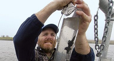


Plunging through a stand of poison ivy, Jeffrey Donnelly wades into Oyster Pond and begins assembling a crude raft. He and two colleagues lash a piece of plywood on top of two aluminum canoes and push off, paddling their makeshift catamaran toward a fringe of scrub bordering this brackish pond in Woods Hole, Massachusetts. Donnelly whips out a hand-held GPS receiver and takes a reading. "This is the place," he says. After setting out a web of anchors, the team settles into hours of monotonous labor. They push long pipes through nearly 25 feet of tea-colored water into thick layers of sediment below. The moans of foghorns drift in from Vineyard Sound, and mist rises and falls like a scrim.
"One, two, three!" Donnelly brings up a five-foot-long core of sediment encased in transparent plastic. "Look!" he whoops, pointing to a thick deposit of yellowish sand bracketed by black-brown pond muck. "That’s a hurricane!"
Donnelly, a geologist and paleoclimatologist at the Woods Hole Oceanographic Institution, has been prowling the lakes and marshes that dot the New England coastline for nearly a decade, assembling a record of hurricanes going back hundreds of years. The record takes the form of sand washed inland by monstrous storm surges.
What Donnelly is staring at now may be the gritty calling card of the Great New England Hurricane of 1938, which lifted up a dome of water 20 feet high as it slashed its way from Long Island to Cape Cod with Katrina-class force, leaving at least 680 people dead and tens of thousands homeless. Or perhaps the sand is from the Great Colonial Hurricane of 1635, which ravaged the fledgling Plymouth and Massachusetts Bay colonies, or the Great September Gale of 1815, which put Providence, Rhode Island, under more than ten feet of water.
Hurricanes that intense may not threaten Northeastern states as often as they do Louisiana, Florida or the Carolinas, but they aren't as rare as the people living along the coastline from Virginia to Maine might like to think. The sediment cores Donnelly has collected indicate that devastating hurricanes have slammed into the Northeastern seaboard at least nine times in the past seven centuries.
Understanding hurricane history takes on new urgency in the wake of the worst hurricane season on record. In 2005, the Atlantic basin produced more tropical storms, 28, and more full-blown hurricanes, 15, than any year in at least the past half century. Last year, memorable for its four major hurricanes, could also lay claim to three of the six strongest storms on record. And as bad as it was, the 2005 season was just an exclamation point in a decade-long hurricane onslaught, which will end—well, scientists can't agree on when, or even whether, it will end.
That's because late last year, around the time Hurricane Katrina stormed ashore in Mississippi, climate scientists were engaged in an urgent debate. According to one group, the increasing intensity of Atlantic storms comes from a natural climate cycle that causes sea surface temperatures to rise and fall every 20 to 40 years. According to another group, it comes from human emissions of carbon dioxide and other greenhouse gases. (So far, no one has linked the number of hurricanes to global warming.) In the first scenario, the fever in the Atlantic might not break for another decade or more; in the second, it might last for the rest of this century and beyond.
Evidence from sediment cores collected by Donnelly and others hints that long before industrial activity began pumping the air full of heat-trapping gases, particularly carbon dioxide, naturally occurring climate shifts influenced hurricane activity, either by changing wind patterns that steer hurricanes toward or away from land, or by altering the frequency and intensity of the storms themselves. Cores collected by Louisiana State University geographer Kam-biu Liu from four Gulf Coast lakes and marshes, for example, show that major hurricanes struck that region three to five times more often between 3,500 and 1,000 years ago than in the ten centuries since. Donnelly, for his part, has pieced together a similar record in Vieques, Puerto Rico; there, the active hurricane pattern starts 2,500 years ago and ends 1,500 years later. But, Donnelly cautions, these are just a few scattered jigsaw pieces. "We have to collect a lot more pieces in order to put the puzzle together." And that is why he’s out in the middle of Oyster Pond, coring his way through time.
I am to meet Donnelly the next morning at his lab. As a strong thunderstorm rolls through, Donnelly pedals in on a mountain bike looking like a sopping wet Power Ranger. Inside a cavernous room, chockablock with tools, the first core is standing on end, giving the slurry in the topmost foot or so a chance to settle. On the floor lie two long cores in aluminum pipes.
Using a hacksaw, Donnelly cuts the cores into shorter lengths, then uses a table saw to slice them in half lengthwise. Water puddles onto the floor, and we smell rotten eggs—hydrogen sulfide produced by microbes that live within the pond's deep, dark pockets of organic debris. Donnelly opens one of the cores, and I can see a sequence of sandy strips, the spoor of ancient hurricanes.
Later Donnelly takes me into a walk-in refrigerator filled with core samples from some 60 sites stretching from the Yucatán Peninsula to the Lesser Antilles and from the Chesapeake Bay to Cape Cod. In a few years, he says, he hopes to have enough data to put the present—and the future—into broader perspective. But he can't do that yet.
The control box for the earth's climate machine, he muses, has many knobs, and scientists are only beginning to identify the ones that dial the awesome power of hurricanes up and down. "The point is, we know the knobs are there," Donnelly says, and if the natural system can tweak them, so can human beings. It's a thought I hold onto as I prepare to dive into the maelstrom of the debate over hurricanes and global warming.
When Christopher Columbus arrived in the New World, he heard its native inhabitants speak fearfully of the storm god they called Jurakan. On his fourth voyage, in 1502, the Italian explorer and his ships weathered a hurricane that destroyed much of the settlement his brother Bartolomeo had founded six years earlier at Nueva Isabela, later rechristened Santo Domingo. "The storm was terrible," Christopher Columbus wrote, "and on that night the ships were parted from me." His ships reassembled afterward, but some 25 other ships in a fleet launched by the governor of Hispaniola foundered in wind-frenzied seas.
The scientific study of hurricanes leapt forward in 1831, when William Redfield, a self-taught meteorologist trained as a saddler, finally grasped their nature. In an article published in the American Journal of Science, Redfield described patterns of damage wrought by a powerful storm that had swept through New England ten years earlier, after passing directly over the New York metropolitan area. In one part of Connecticut, he noted, trees appeared to have been blown down by southwesterly winds; in another part, by winds from nearly the opposite direction. Redfield nailed down the rotary nature of a hurricane's eye wall, a churning cylinder of wind circling a calm center.
A systematic effort to understand these storms dates to 1898, when President William McKinley directed what was then the U.S. Weather Bureau to expand its rudimentary network for hurricane warnings. The impetus was the outbreak of the Spanish-American War. "I am more afraid of a...hurricane than I am of the entire Spanish Navy," McKinley reportedly said. In 1886, a record seven hurricanes hit the U.S. coast; one completely destroyed the thriving port city of Indianola, Texas. The year 1893 was almost as bad; six hurricanes hit the United States. One came ashore near Savannah, Georgia, overwhelming the low-lying Sea Islands off the South Carolina coast; another devastated the island of Cheniere Caminanda off the Louisiana coast. In those two storms alone, 4,500 lives were lost.
Over the next half century, forecasters relying on observations of winds and pressure taken by an expanding network of ship and ground-based weather stations struggled to provide hurricane warnings to vulnerable populations. They often failed. In 1900, a hurricane burst upon the unsuspecting citizens of Galveston, Texas, killing 8,000 to 12,000. In 1938, people stood along Long Island's Westhampton Beach marveling at what they thought was an approaching fog bank, only to realize, too late, that it was the storm-seized ocean heaving up. Twenty-nine people died.
World War II propelled hurricane science into the modern era. In July 1943, Army Air Forces pilot Joseph B. Duckworth—on a dare, it is said—flew through the eye of a hurricane as it neared the Texas coast; he did it again a couple of hours later as weather officer First Lt. William Jones-Burdick took measurements at 7,000 feet, inside the storm's eye. In February 1944, the Joint Chiefs of Staff approved the first of a series of hurricane missions by Army and Navy aircraft. Later that year, military planes gave chase to a storm that came to be known as the Great Atlantic Hurricane, following it as it roared up the East Coast, taking aim at New England. All along the storm's path, radio newscasters blared out warnings. Of 390 deaths, all but 46 occurred at sea.
After the war, the U.S. Weather Bureau—renamed the National Weather Service in 1970—established a formal program of hurricane research. To study these formidable whirlwinds, flights continued to transport scientists through turbulent eye walls and the eerie stillness of the eye itself. In the 1960s, earth-orbiting satellites began providing even higher observational platforms. Since then, forecasters have progressively narrowed "the cone of uncertainty," the teardrop-shaped blob that surrounds their best predictions of where a hurricane is likely to go. At 48 hours, track forecasts are now "off" on average by just 118 miles; at 24 hours, by less than 65 miles, both significant improvements over 15 years ago. Despite these advances, hurricanes undergo sudden surges in power that are easy to spot once they start but dauntingly hard to predict.
Like a giant bumblebee, the P-3 Orion buzzes in from Biscayne Bay, dipping a wing as it passes the compact concrete building that houses the National Oceanic and Atmospheric Administration's Miami-based Hurricane Research Division. The plane, a modification of the submarine hunters built in the 1960s for the U.S. Navy, is one of two that fly scientists in and out of some of the planet's mightiest storms, including Hurricane Katrina as its engorged eye neared landfall.
Among those on that flight was research meteorologist Stanley Goldenberg, whose third-floor office looks, appropriately enough, as if a hurricane just blew through it. Goldenberg is well acquainted with hurricanes blowing though. In 1992 Hurricane Andrew demolished his family's rented house in Perrine, Florida. A computer-enhanced satellite image of the hurricane, with its monstrous circular eye wall, now hangs on his wall. "The bagel that ate Miami," he quips.
Hurricanes belong to a broad class of storms known as tropical cyclones, which also occur in the Indian and Pacific oceans. They do not develop spontaneously but grow out of other disturbances. In the Atlantic, most evolve out of "African waves," unstable kinks in the atmosphere that spiral off the West African coast and head toward Central America. Along the way, these atmospheric waves generate ephemeral clusters of thunderstorm-producing clouds that can seed hurricanes.
At the same time, hurricanes are much more than collections of thunderstorms writ large; they stand out amid the general chaos of the atmosphere as coherent, long-lasting structures, with cloud towers that soar up to the stratosphere, ten miles above the earth's surface. The rise of warm, moist air through the chimney-like eye pumps energy into the developing storm.
Ocean warmth is essential—hurricanes do not readily form over waters cooler than about 79 degrees Fahrenheit—but the right temperature is not enough. Atmospheric conditions, such as dry air wafting off the Sahara, can cause hurricanes—along with their weaker cousins, tropical storms and depressions—to falter, weaken and die. Vertical wind shear—the difference between wind speed and direction near the ocean's surface and at 40,000 feet—is another formidable foe. Among the known regulators of vertical wind shear is El Niño, the climate upheaval that alters weather patterns around the globe every two to seven years. During El Niño years, as Colorado State University tropical meteorologist William Gray was first to appreciate, high-level westerlies over the tropical North Atlantic increase in strength, ripping developing storms apart. In 1992 and 1997, both El Niño years, only six and seven tropical storms formed, respectively, or a quarter of the number in 2005. (Then again, Goldenberg observes, the devastating Hurricane Andrew was one of the 1992 storms.)
For years, Goldenberg notes, scientists have been pondering why the number of Atlantic hurricanes varies from year to year, even though roughly the same number of African waves move out over the ocean each year. What accounts for the difference? El Niño explains some, but not all, of the variance. By combing through the historical record and more recent recordings from scientific instruments, Gray, along with Goldenberg's colleague Christopher Landsea, has found another pattern: hurricanes in the Atlantic march to a slowly alternating rhythm, with the 1880s and 1890s very active, the early 1900s comparatively quiescent, the 1930s through 1960s again active, 1970 through 1994 quiescent again.
Five years ago, a possible explanation for this pattern emerged. Goldenberg shows me a graph that plots the number of major hurricanes—Category 3 or higher—that spin up each year in the Atlantic’s main hurricane development region, a 3,500-mile-long band of balmy water between the coast of Senegal and the Caribbean basin. Between 1970 and 1994, this region produced, on average, less than half the number of major hurricanes that it did in the decades before and after. Goldenberg then hands me a second graph. It shows a series of jagged humps representing the Atlantic multi-decadal oscillation, a swing of sea surface temperatures in the North Atlantic that occurs every 20 to 40 years. The two graphs seem to coincide, with the number of major hurricanes falling as waters cooled around 1970 and rising as they began warming about 1995.
Scientists have yet to nail down the cause of the multi-decadal oscillation, but these striking ups and downs in surface temperatures appear to correlate—somehow—with hurricane activity. "You can't just heat up the ocean by 1 degree Celsius and Pow! Pow! Pow! get more hurricanes," says Goldenberg. More critical, he thinks, are atmospheric changes—more or less wind shear, for example—that accompany these temperature shifts, but what comes first? "We still don't know which is the chicken and which is the egg," he says. "The ocean tends to warm when the trade winds get weaker, and the trade winds can get weaker if the ocean warms. Will we lock it down? Maybe someday."
After leaving Goldenberg's office, I drive across town to the National Hurricane Center, a low-lying bunker whose roof bristles with satellite dishes and antennae. Inside, as computer monitors rerun satellite images of Katrina's savage waltz toward the Gulf Coast, top National Oceanic and Atmospheric Administration officials have gathered to announce the agency's best estimate of how many tropical storms and hurricanes are likely to form in 2006. It's not an encouraging forecast: eight to ten hurricanes, fewer than last year, but four to six of them Category 3s or higher. (Last year there were seven.) The predictions are based, in large part, on the multi-decadal oscillation. "The researchers are telling us that we're in a very active period for major hurricanes," says Max Mayfield, the center's director, "one that will probably last at least 10 to 20 more years."
From his 16th-floor office on the Massachusetts Institute of Technology campus, meteorologist Kerry Emanuel commands a crow's-nest view of the esplanade along the Charles River, the dividing line between Boston and Cambridge. In 1985, he remembers, the windows wept with spray blown up from the river by Hurricane Gloria, a moderately strong storm that, nonetheless, made a mess of the Northeast. A painting by a Haitian artist that shows people and animals drowning in a storm surge hangs on a wall near his desk.
Last year, right after Katrina hit, Emanuel found himself in the media spotlight. A few weeks earlier he had published evidence in the journal Nature that hurricanes in both the North Atlantic and the western basin of the North Pacific had undergone a startling increase in power over the past half century. The increase showed up in both the duration of the storms and their peak wind speeds. The cause, Emanuel suggested, was a rise in tropical sea surface temperatures due, at least in part, to the atmospheric buildup of carbon dioxide and other heat-trapping gases caused by the burning of fossil fuels.
Even scientists who would expect hurricanes to intensify in response to greenhouse warming were stunned by Emanuel's suggestion that global warming has already had a profound effect. Computer simulations of a warming world, notes climate modeler Thomas Knutson of the Geophysical Fluid Dynamics Laboratory in Princeton, New Jersey, suggest that by the end of this century, peak sustained wind speeds could increase by around 7 percent, enough to push some Category 4 hurricanes into Category 5 territory. But Knutson, along with many others, did not think that the intensity rise would be detectable so soon—or that it might be five or more times larger than he and his colleagues anticipated. "These are huge changes," Knutson says of Emanuel’s results. "If true, they may have serious implications. First we need to find out if they’re true."
Emanuel’s paper raised the ante in what has grown into an extremely intense debate over the sensitivity of the earth's most violent storms to gases spewed into the atmosphere by human beings. In the months since the dispute began, dozens of other studies have been reported, some of which support Emanuel's conclusions, others of which call them into question. The debate has grown so impassioned that some former colleagues now scarcely speak to one another.
As Emanuel sees it, sea surface temperatures are important because they tweak a fundamental dynamic that controls hurricane intensity. After all, storm clouds form because the ocean's heat warms the overlying air and pumps it full of moisture. And the warmer the air is, the more vigorous its rise. For their part, Emanuel's critics, Goldenberg and Landsea among them, don't utterly discount ocean warmth. They just put far more emphasis on other factors like wind shear as the main determinants of storm intensity.
Sorting out the differences between the two camps is not easy. Goldenberg and Landsea, for example, grant that greenhouse gases may be contributing to a slight long-term rise in sea surface temperatures. They just don't think the effect is significant enough to trump the natural swings of the Atlantic multi-decadal oscillation. "It's not simply, yes or no, is global warming having an effect?" says Landsea, the science and operations officer for the National Hurricane Center. "It's how much of an effect is it having?"
Emanuel, while respectful of Landsea, is not backing down. In fact, he has now stirred up a second storm. "If you'd asked me a year ago," Emanuel says, "I would have probably told you that a lot of the variability in hurricane activity was due to the Atlantic multi-decadal oscillation. I've now come to the conclusion that the oscillation either doesn't exist at all or, if it does, has no perceptible influence on the temperature of the tropical Atlantic in the late summer and fall"—that is, in hurricane season.
Emanuel says that much of the cooling in the tropical North Atlantic in the 1970s can be traced to atmospheric pollutants, specifically to a haze of sulfurous droplets spewed out by volcanoes and industrial smokestacks. Global climate modelers have recognized for years that this haze in the atmosphere acts as a sunshade that cools the earth's surface below. Emanuel says that now that this form of air pollution is on the wane (and this is a good thing for all sorts of reasons having nothing to do with hurricanes), the warming influence of greenhouse gas pollution, and its effect on hurricanes, is growing ever more pronounced. "We will have some quiet [hurricane] years," he says. "But unless we have a really big volcanic eruption, we'll never see another quiet decade in the Atlantic in our lifetime or that of our children."
Is such a grim prediction warranted? Scientists on the periphery of the debate aren't yet sure. For now, says meteorologist Hugh Willoughby of Florida International University, the points of agreement among experts are more important than the differences. Whether a natural oscillation or greenhouse warming is to blame, the odds of a major hurricane striking the U.S. coastline are higher than they have been for more than a generation. And the dangers such storms pose are higher than ever.
I drive down Brickell Avenue, the heart of Miami's financial district, past bank buildings with windows still boarded up, then wend through residential neighborhoods where a smattering of rooftops remain covered with blue tarps, a reminder that even a glancing blow from a hurricane like Wilma, which slammed into Miami last October as a Category 1 storm, can pack a wicked punch.
I continue south 65 miles to the Florida Key called Islamorada, crossing over a series of bridges that connect one low-lying coral islet to another. It's the route along which automobiles crawled in the opposite direction last year as some 40,000 people fled the Lower Keys in advance of Hurricane Dennis in July. It's also the route on which an 11-car train was washed off its tracks in the 1935 Labor Day Hurricane.
The train was en route from Miami to rescue a Depression-era work crew composed largely of World War I veterans, many of whom had participated in the Bonus March on Washington in 1932. Encamped in flimsy Civilian Conservation Corps housing, the men had been working on a bridge-building project. The train got to the Islamorada station shortly after 8 p.m., just in time to confront an 18-foot-high storm surge that washed over the Upper Keys like a tsunami and knocked the train off its tracks. In all, more than 400 people died, among them at least 259 of the veterans. In a magazine piece, an enraged Ernest Hemingway, then living in Key West, lambasted Washington politicians for the loss of so many lives. "Who sent nearly a thousand war veterans...to live in frame shacks on the Florida Keys in hurricane months?" he asked.
Hemingway's veterans are long gone from the Keys. In their place are 75,000 permanent residents, supplemented during the year by more than 2.5 million visitors. The Labor Day storm, it is worth remembering, didn't look like much just a day before it hit; it exploded from a Category 1 to a Category 5 hurricane in 40 hours, about the amount of time an evacuation of the Keys might take today. As the storm bore down, sustained winds in the eye wall reached 160 miles per hour, with gusts that exceeded 200 miles per hour. The winds lifted up sheet metal roofs and wooden planks, hurling them through the air with lethal force; in some cases, as one writer described, "pounding sheets of sand sheared clothes and even the skin off victims, leaving them clad only in belts and shoes, often with their faces literally sandblasted beyond identification."
In an era overshadowed by the specter of large-scale climate change, the past may appear an inadequate guide to the future, but it’s the only one we have. Certainly, there is no reason to think that major hurricanes, some as powerful as the 1935 Labor Day storm, won't continue to strike the U.S. coastline at least as often as before. And that fact alone—independent of any increase in hurricane intensity—affords ample reason for concern. The destructive potential of hurricanes, it's important to keep in mind, does not stem solely from their intrinsic power. No less important is America's love affair with waterfront living. From Texas to Maine, the coastal population now stands at 52 million, versus less than 10 million a century ago. On average, there are 160 people per square mile in hurricane belt states versus 61 per square mile in the rest of the country.
Adjusted for inflation, the 1938 New England hurricane destroyed or damaged some $3.5 billion worth of property. Today, estimates Roger Pielke Jr., a professor of environmental studies at the University of Colorado at Boulder, the same hurricane would leave behind a tab of up to $50 billion. The 1900 Galveston hurricane would cause property losses as high as $120 billion. And at the very top of Pielke's list of catastrophic disasters is a replay of the Category 4 hurricane that slashed into Miami in 1926, eighty years ago this September. Were the same hurricane to hit the Miami area in 2006, Pielke estimates, the bill could approach $180 billion. "And," he adds, "if you want to compare apples to apples, Katrina was an $80 billion storm."
In 1926, Miami was just coming off a growth spurt; the city bustled with transplants from the north who had never experienced a hurricane before. As the eye passed overhead, hundreds of these innocents spilled into the streets to gawk, prompting Richard Gray, the horrified chief of the city's Weather Bureau, to run out of his office, screaming at people to take cover. By the time the storm ended, at least 300 people had died and property damage was estimated at $76 million, around $700 million in today's dollars. "The intensity of the storm and the wreckage that it left cannot be adequately described," Gray later recalled. "The continuous roar of the wind; the crash of falling buildings, flying debris and plate glass; the shriek of fire apparatus and ambulances that rendered assistance until the streets became impassable."
Before leaving Miami, I take a last drive through the downtown area, which is in the midst of yet another building boom, its skyline spiky with cranes that loom over streets and sidewalks like mechanical dinosaurs. Showcase buildings designed by famous architects—including Cesar Pelli's Performing Arts Center and Frank Gehry's concert hall for the New World Symphony—are rising toward the sky. Today Miami-Dade County has a population approaching 2.5 million, 25 times its 1926 number. Neighboring Broward County, which had not quite 15,000 residents 80 years ago, is fast approaching the 2 million mark. The air is hot, steamy, swelling with clouds.