The War on Potholes Has a New Weapon
Researchers at Northeastern University have outfitted a van with sensors, microphones and cameras that can spot the early stages of potholes
/https://tf-cmsv2-smithsonianmag-media.s3.amazonaws.com/accounts/headshot/randy-rieland-240.png)
/https://tf-cmsv2-smithsonianmag-media.s3.amazonaws.com/filer/d0/85/d085880c-e13e-45ca-a840-bd7e7171599f/pothole.jpg)
If you’ve driven a car the past few weeks, you’ve hit a pothole or ten. Every year, we know they’re coming, and yet we’re still dumbfounded by their sheer number and capacity for destruction.
And, we wonder, why does this go on? I mean, we have driverless cars, but every spring our roads still crumble like stale cake. The best we can manage, it seems, is a mad scramble of patching, little more than a blitz of damage control.
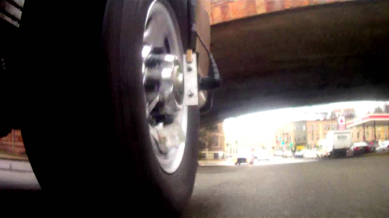
But there may be hope for a more proactive pothole strategy. A team of scientists at Northeastern University in Boston has created a special van with sensors, microphones and cameras that not only can detect every crack in a street, but also has ground-penetrating radar to pinpoint where holes are likely to form in the future.
The idea is to use this technology, called Versatile Onboard Traffic Embedded Roaming Sensors (VOTERS), to map every inch of a city’s roads, identifying places where water is likely to pool and weaken the surface, and also to analyze what’s happening to the soil underneath the pavement. Plus, cameras on the van can take photos of current trouble spots and prioritize which ones most need attention.
VOTERS has done all of the above in Beverly, Massachusetts, a town of about 40,000 people northeast of Boston, with impressive results. In just four days, the Northeastern van evaluated 150 miles of roads in the city. Human inspectors last assessed Beverly’s streets in 2010. That took more than a year. It also ended up costing the town about $50,000. The VOTERS approach cost half as much.
“This is absolutely the way of the future,” Michael Collins, Beverly’s commissioner of public services and engineering, told the Boston Globe.
Mean streets
Here’s how it works: As the van rolls over the road surface, a sensor records changes in air pressure inside the tire caused by bumps. A microphone senses any jostling sounds, and the radar system scans the surface between the wheels, checking for problems missed by the tires, and for pockets of air or pools of water beneath the pavement—likely signs of future problems. A video camera trained on the ground behind the van provides a picture of crack density and helps corroborate information gathered by the other devices.
The person who heads up the project, a Northeastern civil engineering professor named Ming Wang, says that the van can collect up to 50,000 data points per second. The system then rates each road using the Pavement Condition Index, the measure used by human highway inspectors.
The team can overlay those results on an aerial map of a city, creating a color-coded image—green lines for good pavement quality, yellow for adequate and red for trouble ahead. Zoom in on a red street and the image changes into a photo of that stretch of rough road taken by the van. The system’s software can then estimate how much that repair would cost, according to Wang.
Nearby, in Boston, officials say they want to test the VOTERS van and compare it to assessments done by the city’s street inspectors. And that may only be the beginning. Wang said that the university has plans to turn the project into a for-profit business this spring by contracting the road-scanning service to communities around the United States.
The engineer points out that, ultimately, checking the condition of our roads could be done by crowd-sourcing cars. Sensors could be embedded in the tires of new cars that could provide cities with a continuously updated supply of data on the quality of their roads.
Says Wang: “This is not a crazy idea. It could be cheap. Every car could have it—it would be that easy.”
Meanwhile, in England…
Researchers at Nottingham Trent University have devised a similar road-scanning process. They’ve developed algorithms that can take data gathered by 2D and 3D scanners and sensors on the front of a van and identify early signs of what’s known as “raveling”—the breakdown of asphalt that leads to cracks and holes.
Lead researcher Senthan Mathavan says that in a test the sensors—the same ones robots use to perceive their surroundings—were able to correctly detect raveling in 900 different spots. The thinking is that the sooner potential problems can be spotted, the more efficiently and less expensively they can be repaired—which is critical because in times of tight budgets most communities can’t afford to rebuild deteriorating roads.
The device with the scanners, unfortunately, is too large and bulky to be used on public roads, but the goal is to develop a smaller version that could be attached to city vehicles, meaning more street inspections and, hopefully, fewer flat tires.
/https://tf-cmsv2-smithsonianmag-media.s3.amazonaws.com/accounts/headshot/randy-rieland-240.png)