New Mapping Technology Helps Arctic Communities “Keep on Top” of Sea Ice Changes
Buoys are being deployed in the bays of Labrador, Canada, with sensors that track ice thickness, to stop Inuit from breaking through
/https://tf-cmsv2-smithsonianmag-media.s3.amazonaws.com/accounts/headshot/joshua-learn_copy.jpg)
/https://tf-cmsv2-smithsonianmag-media.s3.amazonaws.com/filer/20/1d/201df8c7-a0e2-492c-8551-725a5fc965b0/smartice1.jpg)
Like a winter highway, the yearly freeze-up of the fjords and bays that dot the northern coast of Labrador in Canada makes for quicker travel. It opens up hunting possibilities, and it gives people in Nain and other communities a fast track to collect firewood to warm houses and fire stoves.
“We look forward to ice forming every year,” says Ronald Webb, a 57-year old Inuk (Inuk is the singular form of Inuit) business owner and hunter. “You get a certain freedom when you get out on the ice.”
Webb learned to check the ice from an early age by watching his father and older brother. But the freezing patterns he’s followed since he was young are changing drastically—a terrible thing when your life often depends on the support of a few feet of solid ice over a freezing ocean.
Luckily for Webb and other people in the Inuit-controlled region of Nunatsiavut in the north of Labrador, a new system is in the works that combines traditional ice knowledge with the latest technology in satellite tracking and ice sensing equipment.
Sea-ice Monitoring and Real-Time Information for Coastal Environments, or SmartICE, is being developed by Canadian universities, the Nunatsiavut and federal governments and private research companies.
“It’s for Inuit, by Inuit,” says Trevor Bell, the lead investigator of the project and a geography professor at Memorial University in St. Johns, Newfoundland and Labrador. “It’s doing something about climate change, not talking about it.”
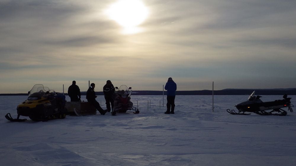
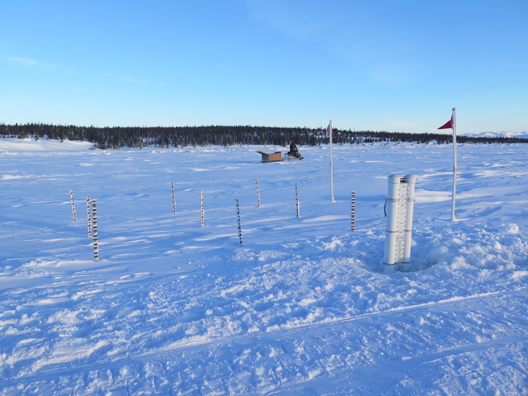
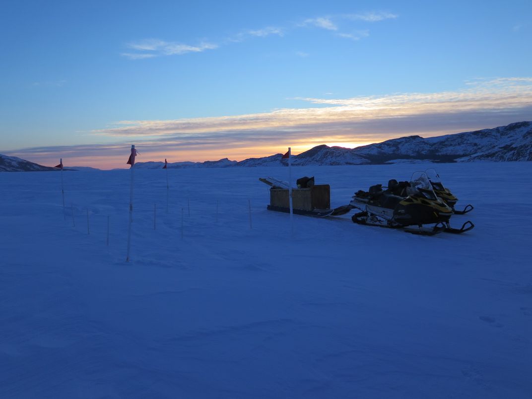
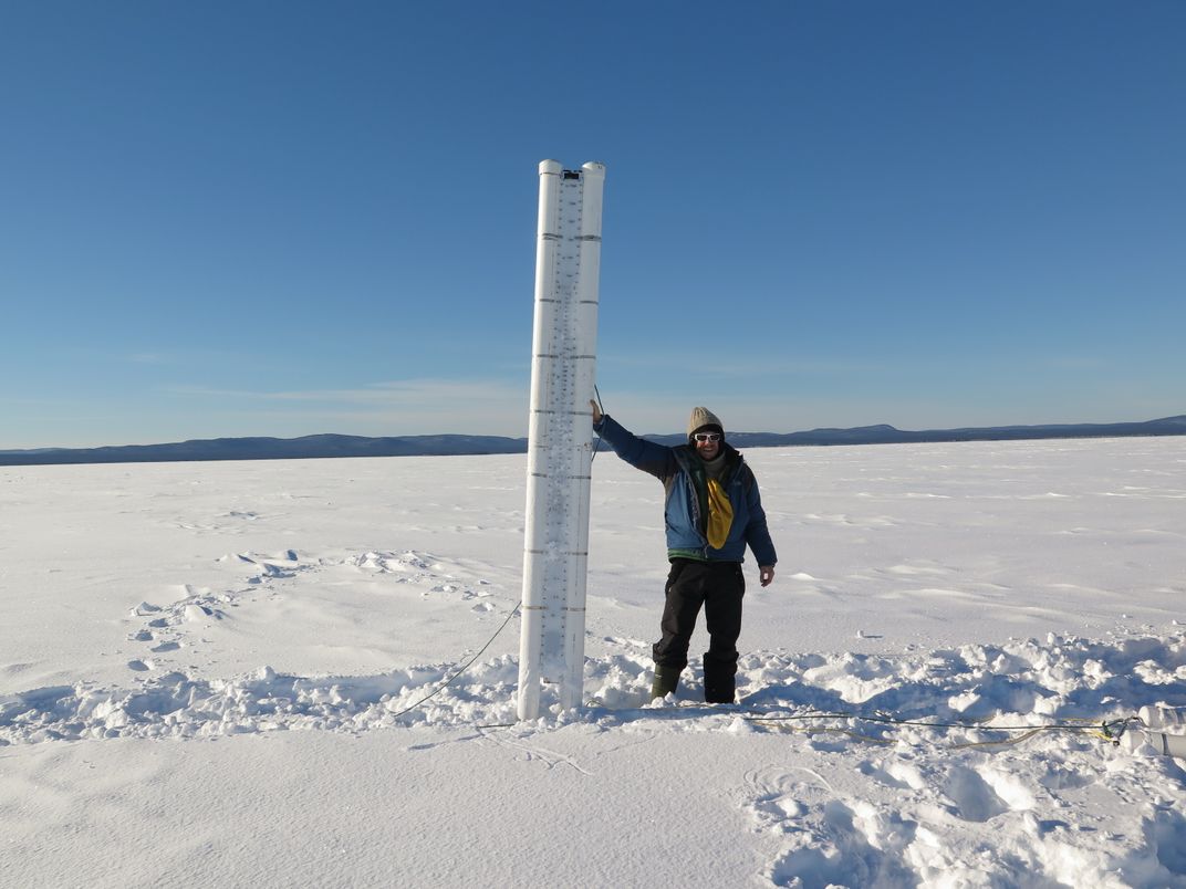
The system basically works like this: before the ice freezes at the end of November, technicians will deploy buoys more than six feet tall into the sea with anchors to keep them roughly in place until the ice freezes around them. Sensors installed in each device will relay important information about ice thickness, the amount of snow cover on top of the ice and location to a database via satellite.
This data will be combined with other satellite information to create thematic maps colored in different ways to represent types of ice important to Inuit. Categories like rough ice (what happens when wind blows thin levels of ice on top of each other early in the season, creating a curtain-like effect), double ice (what happens when a thin layer of ice freezes over a pond of meltwater on top of a lower, thicker ice layer) and smooth ice (the optimal rink-like surface) can all have huge effects on the safety of ice travel. These maps, accessible online and eventually through apps or social media, will give people real-time information about routes, particularly during the most dangerous times in the shoulder seasons of freezing and melting.
Meanwhile, other devices will be attached to traditional Inuit ice sleds pulled by snowmobiles to sense ice thickness along a traveled route.
The program started in the winter of 2013-2014 when consultation was done and last winter the team installed buoys in holes cut in the ice pack after it formed. But this coming year will be the first time the SmartICE buoys will be deployed into the sea before freeze-up, with devices in Nunatsiavut’s administrative capital Nain as well as Rigolet and North West River, two other coastal settlements accessible only by sea or airplane.
***
Six years ago, two snowmobiles with about a half dozen people hit a 30-foot-wide pond of freezing water that sat on top of the ice. Everyone got wet, and though it was only a few miles from Nain, Webb notes “in cold temperatures a mile is far.”
They were lucky enough to get picked up by someone passing by from the community, but the event illustrates a kind of new reality of formerly safe routes turning “scary,” Webb says. That winter was a particularly warm one, with parts of the sea not freezing until January. One out of 12 people went through the ice.
“People were really weary of traveling that winter,” Webb says.
“You’ve got to keep on top of it,” Webb says of conditions on the ice. “There are quite a lot of changes with the ice formations.”
Some of these changes include less predictable periods during freeze up and melt down periods, which are the most treacherous times, and bigger patches of thin ice, rough ice, double ice and open water in the middle of the winter that all make travel more hazardous. Six years ago some areas didn’t freeze up at all.
***
In many ways it’s more than just danger—there’s a whole lifestyle at stake.
“Ice allows you to collect firewood. It allows you to go collect meat rather than having to pay $20 for a chicken breast. The food is so expensive up there that getting access to fresh protein is so much better than getting it flown from St. John’s,” says Rob Briggs, a research scientist with C-CORE, a private research and development corporation partnering in the SmartICE program. “Ice is not just a thing that comes and goes—it’s a part of the culture. The more I work with the people the more I appreciate that.”
While Webb doesn’t work with the SmartICE project, he said that he believes the technology will help his community. “Any little thing like that can give us a little more help with the way things are changing so much with the weather conditions,” he says. “Hopefully, it’ll work out.”
Briggs is optimistic on this front. While Google Earth and other maps focus on macroscale depictions of the region, SmartICE will have much more detail.
This was illustrated perfectly one day when Briggs was out on the ice around Nain in a snowmobile with Joey Angnatok, an Inuk community leader and ice expert involved with the project. Angnatok wanted to show Briggs a transition point where smooth ice turned into rough ice, a dangerous condition that can occur when wind storms blow folds of half-formed ice on top of each other early in the season. When they freeze, the ice looks something like a portable staircase lying on the ground and can prove treacherous for travelers like a pothole hidden by snow. It was a chipper -4 degrees Fahrenheit with wind and blue skies, but the area had been recently covered by a fresh snowfall, rending the hazard invisible.
“I’m telling you it was here,” Angnatok told Briggs, kicking the snow in the area in an effort to find the hidden danger.
They took a GPS reading to mark their location and left in frustration, but luckily for them, another unseen force was working in their favor. A satellite used for the SmartICE program was passing over the area around the time Angnatok and Briggs were out on the ice and a map was delivered to Briggs’ desk by the time he got home.
“Right at that location you can visually see smooth moving over to rough,” Briggs said about the ice on the map, excited to illustrate how Inuit knowledge comes together with the new technology. “Joey couldn’t see it, but he knew it was there.”
***
Once the program has been running for a few years, the researchers will be able to release studies on how the changing climate might be affecting the ice. If everything goes well there is no reason that the program couldn’t be expanded to other parts of the Arctic. Bell says they will install two new buoys in Pond Inlet off the coast of Baffin Island in Nunavut this year. He hopes that this technology can be used to work around potential conflicts between future shipping routes through the Northwest Passage and caribou migration routes. If the researchers can map where caribou are going, then perhaps they can stop ships from cutting off their travel routes between islands during the winter.
Right now ships don’t cut through the ice very often around Nain. Webb is one of the partners that received a contract to follow a ship that comes into a nearby mine four times a year, though. As the boat cuts a solid line through the ice sheet that literally severs the transportation routes between northern communities, Webb follows with temporary floating bridges that people can use to cross the open water left in the ship’s wake until it freezes again.
But if traffic starts to pick up in the area, an active concern for Nain, the SmartICE program can help coordinate the various ice use treaties that exist in the area, allowing Inuit communities and shipping companies to make safe, real-time decisions. Briggs and Bell even talk about integrating the information they gather from their satellites in the future with observations from local ice experts, like Webb, in some kind of social media format accessible on people’s phones or computers.
“Any information that you can put into the hands of the people traveling over the ice allows them to make better decisions about what’s safe and what’s not safe,” Briggs says.
/https://tf-cmsv2-smithsonianmag-media.s3.amazonaws.com/accounts/headshot/joshua-learn_copy.jpg)